Sarcoxie, Missouri facts for kids
Quick facts for kids
Sarcoxie, Missouri
|
|
|---|---|
| Nickname(s):
Scratchy
|
|

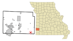
Location of Sarcoxie, Missouri
|
|
| Country | United States |
| State | Missouri |
| County | Jasper |
| Area | |
| • Total | 1.42 sq mi (3.66 km2) |
| • Land | 1.40 sq mi (3.63 km2) |
| • Water | 0.01 sq mi (0.04 km2) |
| Elevation | 1,171 ft (357 m) |
| Population
(2020)
|
|
| • Total | 1,406 |
| • Density | 1,003.57/sq mi (387.39/km2) |
| Time zone | UTC-6 (Central (CST)) |
| • Summer (DST) | UTC-5 (CDT) |
| ZIP code |
64862
|
| Area code(s) | 417 |
| FIPS code | 29-65990 |
| GNIS feature ID | 2396536 |
| Website | City Website |
Sarcoxie is a city located in Jasper County, Missouri, in the United States. In 2020, about 1,406 people lived there. It is part of the larger Joplin area.
Contents
History of Sarcoxie
Sarcoxie was planned out in the early 1830s. It was first called Centerville because of its location on Center Creek. In 1839, the town was renamed. It was named after Sarcoxie, a chief of the Delaware Native American tribe. He had settled near a spring within the town's current borders.
Sarcoxie was once known as the "strawberry capital of the world." Today, it is still known as the "peony capital of the world." It is home to Gilbert H. Wild, a large grower of flowers like daylilies, iris, and peonies. Sarcoxie even had its own money at one time, which featured a picture of a strawberry.
During the start of the Civil War in 1861, a military group led by Franz Sigel passed through Sarcoxie on June 28. They were trying to attack separate groups of soldiers led by Sterling Price and Missouri Governor Claiborne Fox Jackson. It was thought that Price was at Pool's Prairie, moving to join other Confederate forces.
Two important places in Sarcoxie are listed on the National Register of Historic Places listings in Jasper County, Missouri. These are the Cave Spring School and Cave Spring Cemetery and the Sarcoxie Public Square Historic District.
Geography and Location
According to the United States Census Bureau, the city covers a total area of about 1.08 square miles (2.80 square kilometers). All of this area is land.
Population and People
| Historical population | |||
|---|---|---|---|
| Census | Pop. | %± | |
| 1880 | 341 | — | |
| 1890 | 1,172 | 243.7% | |
| 1900 | 1,126 | −3.9% | |
| 1910 | 1,311 | 16.4% | |
| 1920 | 1,023 | −22.0% | |
| 1930 | 1,017 | −0.6% | |
| 1940 | 1,057 | 3.9% | |
| 1950 | 1,042 | −1.4% | |
| 1960 | 1,056 | 1.3% | |
| 1970 | 1,175 | 11.3% | |
| 1980 | 1,381 | 17.5% | |
| 1990 | 1,330 | −3.7% | |
| 2000 | 1,354 | 1.8% | |
| 2010 | 1,341 | −1.0% | |
| 2020 | 1,406 | 4.8% | |
| U.S. Decennial Census | |||
Sarcoxie Population in 2010
In 2010, about 1,330 people lived in Sarcoxie. There were 526 households and 350 families. The city had about 1,231.5 people per square mile (475.5 per square kilometer). There were 615 homes, with an average of 569.4 homes per square mile (219.8 per square kilometer).
Most people in the city were White (95.3%). Other groups included Native American (1.4%), Asian (0.5%), and African American (0.2%). About 1.4% of the population was Hispanic or Latino.
About 34.0% of households had children under 18 living with them. Nearly half (47.1%) were married couples. About 29.7% of all households were individuals living alone. Around 12.6% of households had someone aged 65 or older living by themselves. The average household had 2.48 people.
The average age in Sarcoxie was 38.9 years. About 26.9% of residents were under 18. About 17.3% were 65 years or older. The city's population was 47.2% male and 52.8% female.
Education in Sarcoxie
The Sarcoxie R-II School District manages public schools in Sarcoxie. The city also has a public library, called the Sarcoxie Public Library.
Notable People from Sarcoxie
- G. Lloyd Spencer - A US Senator who represented Arkansas.
- Gene Taylor - A member of the US House of Representatives.
See also
 In Spanish: Sarcoxie (Misuri) para niños
 | Charles R. Drew |
 | Benjamin Banneker |
 | Jane C. Wright |
 | Roger Arliner Young |

