
Sativanorte facts for kids
Quick facts for kids
Sativanorte
|
||
|---|---|---|
|
Municipality and town
|
||

Church of Saint Joseph
|
||
|
||

Location of the municipality and town of Sativanorte in the Boyacá Department of Colombia
|
||
| Country | ||
| Department | Boyacá Department | |
| Province | Northern Boyacá Province | |
| Founded | 15 March 1934 | |
| Area | ||
| • Municipality and town | 184 km2 (71 sq mi) | |
| • Urban | 1 km2 (0.4 sq mi) | |
| Elevation | 2,600 m (8,500 ft) | |
| Population
(2015)
|
||
| • Municipality and town | 2,339 | |
| • Density | 12.71/km2 (32.92/sq mi) | |
| • Urban | 528 | |
| Time zone | UTC-5 (Colombia Standard Time) | |
| Website | Official website: http://www.sativanorte-boyaca.gov.co/ | |
.svg)
Sativanorte is a town and a municipality in Colombia. It is located in the Boyacá Department, which is like a state or province. Sativanorte is part of the Northern Boyacá area. It shares borders with other towns like Susacón to the north and Sativasur to the south. To the west, it borders Onzaga in the Santander Department, and to the east, it borders Jericó and Socotá.
Contents
What's in a Name?
The names Sativanorte and Sativasur come from an old leader called Sátiva. In the Chibcha language, which was spoken by the Muisca people, Sátiva means "Captain of the Sun." This shows how important the sun was to their culture.
A Look Back in Time
Before the Spanish arrived, the area of Sativanorte and Sativasur was known simply as Sátiva. People lived here during the Herrera Period, which was a long time ago. Later, it became part of the Muisca Confederation. This was a group of Muisca communities ruled by different leaders called caciques. Sátiva was under the rule of the cacique Tundama, whose main city is now known as Duitama.
In 1540, Spanish explorers like Gonzalo Suárez Rendón and Hernán Pérez de Quesada came to this area. They took control of the land from the Muisca people. The original town of Sátiva was officially founded in 1633. The modern town of Sativanorte, as we know it today, was founded much later, on March 15, 1934.
The Land and Its Rocks
The land around Sativanorte has many interesting rocks. You can find metamorphic rocks like quartzites, phyllites, and schists. These rocks are very old, from a time called the Paleozoic era. You can also see sandstones and siltstones in some places. The area also has several natural cracks in the Earth's crust called faults, such as the Chicamocha fault and the Soapága fault.
What People Do Here
The main ways people make a living in Sativanorte are through agriculture (farming), raising livestock (like cows and sheep), and ecotourism. Ecotourism means visiting natural places in a way that protects the environment.
To the north of Sativanorte, you can find the amazing Chicamocha Canyon. To the east, there are the tall mountains of the Sierra Nevada del Cocuy. These natural wonders make Sativanorte a great place for nature lovers.
Weather in Sativanorte
Sativanorte has a mild climate because it is high up in the mountains. The temperature stays pretty steady throughout the year. It gets a good amount of rain, especially during certain months.
| Climate data for Sativanorte, elevation 2,594 m (8,510 ft), (1981–2010) | |||||||||||||
|---|---|---|---|---|---|---|---|---|---|---|---|---|---|
| Month | Jan | Feb | Mar | Apr | May | Jun | Jul | Aug | Sep | Oct | Nov | Dec | Year |
| Mean daily maximum °C (°F) | 21.2 (70.2) |
21.5 (70.7) |
21.4 (70.5) |
20.7 (69.3) |
20.2 (68.4) |
19.8 (67.6) |
19.6 (67.3) |
19.7 (67.5) |
20.1 (68.2) |
20.0 (68.0) |
20.0 (68.0) |
20.5 (68.9) |
20.4 (68.7) |
| Daily mean °C (°F) | 15.5 (59.9) |
15.5 (59.9) |
15.5 (59.9) |
15.5 (59.9) |
15.4 (59.7) |
15.2 (59.4) |
15.0 (59.0) |
15.1 (59.2) |
15.2 (59.4) |
15.1 (59.2) |
15.1 (59.2) |
15.3 (59.5) |
15.3 (59.5) |
| Mean daily minimum °C (°F) | 9.4 (48.9) |
9.6 (49.3) |
10.0 (50.0) |
10.7 (51.3) |
10.7 (51.3) |
10.3 (50.5) |
10.0 (50.0) |
10.0 (50.0) |
9.9 (49.8) |
10.1 (50.2) |
10.2 (50.4) |
9.7 (49.5) |
10.0 (50.0) |
| Average precipitation mm (inches) | 38.9 (1.53) |
54.3 (2.14) |
91.3 (3.59) |
153.5 (6.04) |
122.8 (4.83) |
46.8 (1.84) |
44.8 (1.76) |
49.7 (1.96) |
81.6 (3.21) |
156.4 (6.16) |
148.9 (5.86) |
61.3 (2.41) |
1,050.2 (41.35) |
| Average precipitation days (≥ 1.0 mm) | 7 | 9 | 13 | 18 | 18 | 13 | 14 | 14 | 14 | 18 | 16 | 10 | 163 |
| Average relative humidity (%) | 64 | 65 | 67 | 70 | 70 | 68 | 66 | 66 | 67 | 69 | 70 | 67 | 68 |
| Source: Instituto de Hidrologia Meteorologia y Estudios Ambientales | |||||||||||||
Gallery
-
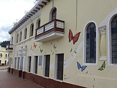
School
-
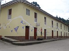
Street corner
-
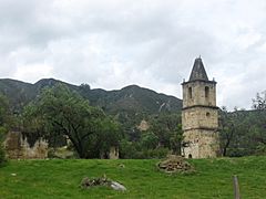
Church ruins
-
Church ruins
-
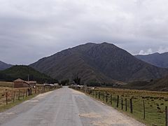
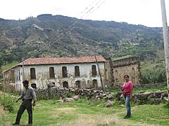
Rural area around Sativanorte


See also
 In Spanish: Sativanorte para niños
