Savognin facts for kids
Quick facts for kids
Savognin
|
||
|---|---|---|
 |
||
|
||
| Country | Switzerland | |
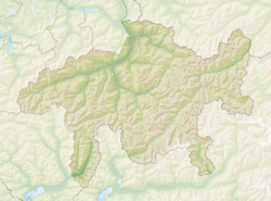
| Canton | Grisons | |
| District | Albula | |
| Area | ||
| • Total | 22.23 km2 (8.58 sq mi) | |
| Elevation | 1,207 m (3,960 ft) | |
| Population
(Dec 2014)
|
||
| • Total | 1,016 | |
| • Density | 45.70/km2 (118.37/sq mi) | |
| Postal code |
7460
|
|
| Surrounded by | Cunter, Filisur, Mulegns, Riom-Parsonz, Tiefencastel, Tinizong-Rona | |
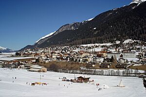
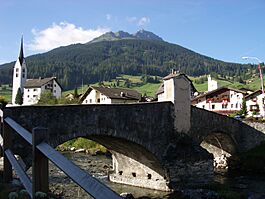
Savognin (called Suagnign in the local Romansh language) is a beautiful village in the Grisons canton of Switzerland. It used to be its own town, but on January 1, 2016, Savognin and several other towns joined together. They now form a new, larger area called Surses.
This village is the main hub of the Gelgia valley. It's a popular spot for tourists from other countries. People visit Savognin in both summer and winter. The main language spoken here is Romansh, specifically a type called Surmiran.
Contents
History of Savognin
Savognin was first mentioned way back in 1154. Back then, it was known as Sueningin.
Ancient Times and Important Routes
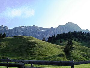
A very old settlement from the Bronze Age was found on Padnal hill. This is just south of the village. Digs there have uncovered many items from 1800 to 1000 B.C. This shows people lived here a very long time ago.
Since the time of the Romans, important travel paths have gone through this area. These paths crossed the Julier and Septimer mountains. In the 1200s, Savognin became part of the land owned by the Bishops of Chur. Later, it joined a group called the League of God's House. By 1552, the valley became fully independent. It was then part of the Free State of the Three Leagues.
Economy and Tourism Growth
For many centuries, the village's economy relied on raising cattle. It also depended on trade and travel through the mountain passes. Sometimes, things got better for the economy. For example, the Julier Road was improved between 1820 and 1840. But then, new competition arrived. When the Gotthardbahn railway opened in 1882, fewer people used the passes. Savognin became mostly a farming village again.
It took a while for Savognin to become a tourist spot. This change began in the 1960s. New hotels, vacation homes, and cable cars were built. These helped people reach the ski areas on Piz Martegnas. This development really changed the village.
Geography and Landscape
Savognin covers an area of about 22.2 square kilometers (8.6 square miles). A good part of this land, about 32.7%, is used for farming. Forests cover 36.2% of the area. About 3% of the land has buildings or roads. The rest, 28.2%, is made up of rivers, glaciers, or mountains.
The village sits in a wide, flat area called Sotgôt. This is the lower part of the Surses valley. The area includes part of the main valley. It stretches between Piz Arblatsch (3203 meters or 10,509 feet) in the southwest and Piz Mitgel (3159 meters or 10,364 feet) in the northeast.
Savognin used to be made up of five smaller villages. These were Son Mitgel, Naloz, Sot Curt, Sur Curt, and Sur Tocf. They were spread out along the Gelgia river. Between 1965 and 1975, a lot of building happened. This filled in the spaces between the old village parts. It also expanded the developed area on the right side of the valley.
Population and Language
As of 2014, Savognin had a population of 1016 people. About 14.3% of the people living there in 2008 were from other countries. The total number of people living in Savognin has gone down slightly over the last 10 years.
Age Groups in Savognin
In 2000, the population was 55% male and 45% female. Here's a look at the age groups:
- Kids aged 0-9 years: 15.9%
- Kids aged 10-14 years: 9.4%
- Teens aged 15-19 years: 4.5%
- Young adults aged 20-29 years: 7.8%
- Adults aged 30-39 years: 12.0%
- Adults aged 40-49 years: 12.7%
- Adults aged 50-59 years: 11.7%
- Seniors aged 60-69 years: 9.7%
- Seniors aged 70-79 years: 9.1%
- Seniors aged 80-89 years: 5.8%
- Seniors aged 90-99 years: 1.3%
Languages Spoken
The most common language in Savognin is Romansh. In 2000, about 53.1% of the people spoke Romansh. German was the second most common language, spoken by 36.6% of the population. Italian was spoken by 3.6%.
| Languages | Census 1980 | Census 1990 | Census 2000 | |||
|---|---|---|---|---|---|---|
| Number | Percent | Number | Percent | Number | Percent | |
| German | 212 | 24.88% | 274 | 31.24% | 323 | 36.62% |
| Romansh | 562 | 65.96% | 546 | 62.26% | 468 | 53.06% |
| Italian | 42 | 4.93% | 25 | 2.85% | 32 | 3.63% |
| Population | 852 | 100% | 877 | 100% | 882 | 100% |
Economy and Getting Around
Savognin is an important center for the valley. It has the district's main offices, a hospital, and a high school. The biggest part of its economy is tourism. Each year, about 200,000 rooms are rented out to visitors. The ski areas on Mounts Piz Martegnas and Val Nandro are easy to reach. You can get there using many cable cars and lifts.
Savognin is located on Highway 3. This road connects Chur to Engadin by going over the Julier pass. A public bus route also follows this highway. Most bus trips end in Bivio, but some continue to St. Moritz. Another bus route connects Savognin to nearby villages like Riom, Parsonz, and Salouf.
In 2005, Savognin had many businesses. There were 29 businesses in farming and related activities. There were 21 businesses in manufacturing and construction. And there were 64 businesses in services, like tourism and shops.
Important Historical Sites
Two places in Savognin are very important to Switzerland's history and culture. They are listed as heritage sites of national significance.
- The Son Martegn church
- The Padnal/Mot la Cresta (the Bronze Age settlement mentioned earlier)
Fun Places to Visit
Savognin has three beautiful Catholic churches built in the Baroque style.
- The Parish church Nossadonna was built in 1643. It also has some older Gothic parts.
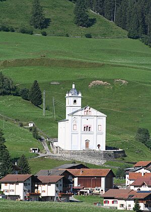
- The Church Son Martegn was built in 1677. It has a unique cross shape. Inside, you can see a huge painting from 1681 by Carlo Nuvolone from Milan.
- The Church Son Mitgel was built in 1663. It's an eight-sided building with an older bell tower.
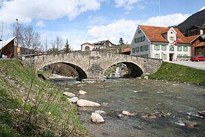
You can also see grand old houses in the village. The Peterelli House is on the main street. The Amilcar House is near the parish church. It has a special half-timbered style from southern Germany. The Gelgia bridge in Sot Curt was built in 1682. In 1982, a local museum opened in a farmhouse from the 1500s.
Famous People from Savognin
The famous Italian painter Giovanni Segantini lived in Savognin from 1886 to 1894. He developed his unique painting style here. He is well-known for his landscape paintings. Many of these show the mountains Piz Curver and Piz Tiossa in the background.
Weather in Savognin
Savognin gets rain about 104.3 days each year. On average, it receives about 917 millimeters (36 inches) of rain. The wettest month is August. During August, Savognin gets about 117 millimeters (4.6 inches) of rain. It rains for about 11.8 days in August. The driest month is February. In February, it gets about 42 millimeters (1.6 inches) of rain over 11.8 days.
See also
 In Spanish: Savognin para niños
 | William Lucy |
 | Charles Hayes |
 | Cleveland Robinson |


