Tinizong-Rona facts for kids
Quick facts for kids
Tinizong-Rona
|
||
|---|---|---|
 |
||
|
||
| Country | Switzerland | |
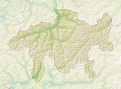
| Canton | Grisons | |
| District | Albula | |
| Area | ||
| • Total | 54.30 km2 (20.97 sq mi) | |
| Elevation | 1,232 m (4,042 ft) | |
| Population
(Dec 2014)
|
||
| • Total | 320 | |
| • Density | 5.89/km2 (15.26/sq mi) | |
| Postal code |
7453 Tinizong
7454 Rona |
|
| Surrounded by | Bergün/Bravuogn, Bever, Filisur, Mulegns, Savognin, Sur | |
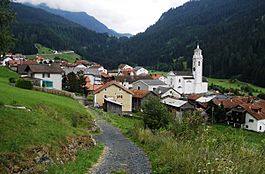
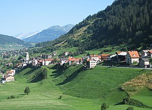
Tinizong-Rona was once a municipality in Switzerland. It was located in the Albula district, within the canton of Graubünden. This area is also known as Sursés.
The municipality was created in 1998. It brought together the two villages of Tinizong and Rona. The main office for the local government was in Tinizong. However, Tinizong-Rona is no longer a separate municipality. On January 1, 2016, it joined with several other nearby places. These included Bivio, Cunter, Marmorera, Mulegns, Riom-Parsonz, Salouf, Savognin, and Sur. Together, they formed a new, larger municipality called Surses.
Contents
A Look at Tinizong-Rona's Past
Tinizong has a very old history. It was first mentioned during the time of the Roman Empire, between the years 96 and 192 AD. Back then, it was known as Tinetione. It was an important stop along the Roman Septimer Pass route. This route was a mountain path used for travel and trade.
Rona is also quite old. It was first written about in the year 1330, when it was called Rouenam. Later, in 1377, it was known as Rouvena. By 1412, its name had changed again to Rofna.
Exploring the Geography of Tinizong-Rona
The area of Tinizong-Rona covered about 54.3 square kilometers (about 21 square miles). A good portion of this land, about 32.5%, was used for farming. Forests covered another 25.8% of the area.
Only a small part, about 1.1%, had buildings or roads. The largest part, 40.6%, was made up of natural features. These included rivers, glaciers, and mountains. This means much of the area was wild and untouched.
The former municipality was located in the Sursés sub-district. It was also along the road that leads to the Julier pass. The municipality included the two villages of Tinizong and Rona.
Rona itself had two parts:
- Ober-Rona: This part was on a higher, flat area, like a terrace. In the local Romansh language, it is called Ruegnas.
- Unter-Rona: This part was along the banks of the Gelgia River. In Romansh, it is called Rieven.
Interestingly, Unter-Rona (Rieven) used to be in a different spot. It was near a small settlement called Livizung. But in 1580, a rock slide destroyed Livizung. After that, the river often flooded. So, the people of Rieven moved to a safer location.
Understanding the Population of Tinizong-Rona
In 2014, Tinizong-Rona had a population of 320 people. Over the ten years before that, the number of people living there went down by about 9.1%.
In the year 2000, the population was almost evenly split between males and females. About 50.8% were male and 49.2% were female.
The age groups in 2000 were:
- Children (0-9 years old): 12.7%
- Pre-teens (10-14 years old): 7.9%
- Teenagers (15-19 years old): 2.2%
- Young adults (20-29 years old): 9.5%
- Adults (30-39 years old): 12.2%
- Adults (40-49 years old): 17.1%
- Adults (50-59 years old): 10.3%
- Seniors (60-69 years old): 11.4%
- Seniors (70-79 years old): 10.3%
- Seniors (80-89 years old): 5.1%
- Seniors (90-99 years old): 1.4%
Many people in Tinizong-Rona had a good education. About 54.8% of adults (aged 25-64) had finished higher education. This included either a university degree or a degree from a specialized college.
The unemployment rate in Tinizong-Rona was low, at 1.36%. In 2005, many people worked in farming. There were 40 people working in this area, across 15 businesses. Another 60 people worked in manufacturing and construction, with 9 businesses. Finally, 19 people worked in services, like shops or hotels, with 10 businesses.
Here is a table showing how the population of Tinizong-Rona changed over time:
| year | population |
|---|---|
| 1850 | 544 |
| 1900 | 496 |
| 1950 | 530 |
| 1960 | 470 |
| 1970 | 409 |
| 1980 | 332 |
| 1990 | 339 |
| 2000 | 369 |
Languages Spoken in Tinizong-Rona
In 2000, most people in Tinizong-Rona spoke Romansh. About 50.1% of the population used this language. German was the second most common language, spoken by 38.8% of people. Portuguese was third, spoken by 4.9%.
The official language of the municipality was the Surmiran dialect of Romansh.
Here is a table showing the languages spoken in Tinizong-Rona over different years:
| Languages | Census 1980 | Census 1990 | Census 2000 | |||
|---|---|---|---|---|---|---|
| Number | Percent | Number | Percent | Number | Percent | |
| German | 57 | 17.17% | 95 | 28.02% | 143 | 38.75% |
| Romansh | 264 | 79.52% | 227 | 66.96% | 185 | 50.14% |
| Italian | 7 | 2.11% | 6 | 1.77% | 12 | 3.25% |
| Population | 332 | 100% | 339 | 100% | 369 | 100% |
Important Buildings and Heritage Sites
Tinizong-Rona has two special places that are listed as heritage sites of national significance in Switzerland. These are very important historical buildings.
They are:
- The Church of S. Plasch (St. Blasius)
- The Chasa Cresta Nr. 5 (a house)
The Church of S. Plasch was first mentioned in records in 1180. In 1512, some parts of the church, like the side altars, were rebuilt. Later, in 1663, the church was changed from its original Gothic style. This work was done by the Capuchin friars.
See also
 In Spanish: Tinizong-Rona para niños
 | Aurelia Browder |
 | Nannie Helen Burroughs |
 | Michelle Alexander |


