
Chur facts for kids
Quick facts for kids
Chur
|
|||
|---|---|---|---|
|
Municipality
|
|||

Chur, looking upstream, to the west
|
|||
|
|||

Chur
Location in Switzerland

Chur
Location in Canton of Grisons
|
|||
| Country | Switzerland | ||
| Canton | Grisons | ||
| District | Plessur | ||
| Area
Lua error in Module:Wd at line 1575: attempt to index field 'wikibase' (a nil value).
|
|||
| • Total | Lua error in Module:Wd at line 1,575: attempt to index field 'wikibase' (a nil value). km2 (Formatting error: invalid input when rounding sq mi) | ||
| Elevation
(Postplatz)
|
592 m (1,942 ft) | ||
| Highest elevation
(Tschaggo)
|
2,223 m (7,293 ft) | ||
| Lowest elevation
(Rhein (Halbmil))
|
551 m (1,808 ft) | ||
| Population
(2018-12-31)Lua error in Module:Wd at line 1575: attempt to index field 'wikibase' (a nil value).
|
|||
| • Total | Lua error in Module:Wd at line 1,575: attempt to index field 'wikibase' (a nil value). | ||
| Demonym(s) | German: Churer(in) | ||
| Time zone | UTC+01:00 (Central European Time) | ||
| • Summer (DST) | UTC+02:00 (Central European Summer Time) | ||
| Postal code(s) | |||
| SFOS number | Lua error in Module:Wd at line 1575: attempt to index field 'wikibase' (a nil value). | ||
| Localities | Altstadt, Sand, Kasernenquartier, Industriegebiet, Loestrasse-Lürlibad, Haldenstein, Maladers, Masans, Rheinquartier | ||
| Surrounded by | Arosa, Churwalden, Tschiertschen-Praden, Domat/Ems, Felsberg, Malix, Trimmis, Untervaz, Pfäfers | ||
| Twin towns | Bad Homburg (Germany), Cabourg (France), Mayrhofen (Austria), Mondorf-les-Bains (Luxembourg), Terracina (Italy) | ||
| Website | SFSO statistics |
||


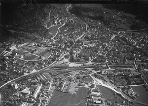
Chur is the capital and largest town in the Swiss canton of Grisons. It sits in the Grisonian Rhine Valley, where the Rhine river turns north. People believe Chur is the oldest town in Switzerland.
The main language spoken in Chur is German, especially a local dialect called Alemannic. However, because the canton has three official languages, you will also hear Romansh and Italian spoken here.
In recent years, some nearby villages have joined Chur. Maladers became part of Chur on January 1, 2020, and Haldenstein joined on January 1, 2021.
Contents
Chur's Long History

.jpg)

_via_Ranculier_en_Praden_naar_Tschiertschen_013.jpg)
Chur is one of the oldest settlements in Switzerland. Scientists have found signs of people living here as far back as 3900-3500 BC. They have also found items from the Bronze Age and Iron Age in the city center.
The Roman Empire took over this area in 15 BC. It became a Roman province called Raetia. Later, around the late 200s AD, the Roman settlement of Curia Raetorum (which became Chur) was made the capital of a new province.
In the 300s AD, Chur became home to the first Christian bishopric (a bishop's area of control) north of the Alps. The bishop gained a lot of power, especially after 831 AD.
Chur faced several attacks, including by the Magyars in 925–926, which destroyed the cathedral. It was also attacked by the Saracens. But the town grew strong because it was located where important trade routes through the Alps met. These routes were used by the Romans and became even more important later. In 952, Emperor Otto I gave Chur the right to collect tolls, which helped the city's economy.
By the 1200s, Chur had about 1,300 people and was surrounded by walls. In the 1300s, several fires damaged the city. In 1367, the League of God's House was formed in Chur. This group wanted to resist the growing power of the Bishop of Chur and the Habsburg family. Chur became the main town of this League.
A big fire in 1464 destroyed most of the town. Only the bishop's buildings and St Luzi monastery survived. The citizens asked Emperor Frederick III for help. The Emperor gave Chur new rights, which freed the city from the bishop's control. In 1465, the citizens created a new government where guilds (groups of skilled workers) had all the power.
In 1471, the Chur-led League of the House of God joined with two other leagues to form the Three Leagues. This group later allied with the Swiss Confederation in 1497–98. This led to the Swabian War in 1499 against Austria.
In 1523, a priest named Johannes Comander started teaching the new ideas of the Protestant Reformation. These ideas spread quickly. By 1525, the bishop had left the city, and Protestant services were held in the churches. By 1527, most of Chur had become Protestant.
During the 1500s, the German language became more common than Romansh. More fires also hit the city in 1479, 1574, and 1576, destroying many homes.
After the Napoleonic Wars, the Three Leagues became the canton of Graubünden in 1803. Chur was chosen as its capital.
In Chur's cemetery, there is a large stone monument. In 2023, a historian discovered that this monument, built in 1938, was originally created to promote a political movement that held extreme ideas.
Geography and Weather
Chur's Location

.jpg)
Chur covers an area of about 54 square kilometers (20.9 square miles). A large part of this area, about 52%, is covered by forests. Around 26% of the land has buildings or roads.
Chur is located about 592 meters (1,949 feet) above sea level. It sits on the right bank of the Plessur river, close to where it joins the Rhine river. The city is almost completely surrounded by the Swiss Alps. The mountains Mittenberg and Pizoggel stand guard at the entrance to the deep Schanfigg valley.
The highest point in the city area is about 1,800 meters (5,900 feet) above sea level. The local mountain, Brambrüesch, which you can reach from the Old Town, is 2,174 meters (7,133 feet) high.
Chur is also known for its spring water, which is bottled and sold as Passugger mineral water.
Chur's Climate
Chur has a climate that feels like an ocean climate, even though it's inland. Summers are warm, sometimes hot, usually around 25°C (77°F) during the day. Winters are cold, with temperatures around freezing, and daytime highs about 5°C (41°F).
Between 1981 and 2010, Chur had rain on about 105 days each year, with an average of 849 millimeters (33.4 inches) of rain. August was the wettest month, and February was the driest.
| Climate data for Chur (1991–2020) | |||||||||||||
|---|---|---|---|---|---|---|---|---|---|---|---|---|---|
| Month | Jan | Feb | Mar | Apr | May | Jun | Jul | Aug | Sep | Oct | Nov | Dec | Year |
| Mean daily maximum °C (°F) | 5.2 (41.4) |
7.0 (44.6) |
11.9 (53.4) |
16.1 (61.0) |
20.3 (68.5) |
23.6 (74.5) |
25.3 (77.5) |
24.8 (76.6) |
20.3 (68.5) |
16.1 (61.0) |
10.2 (50.4) |
5.7 (42.3) |
15.5 (59.9) |
| Daily mean °C (°F) | 1.0 (33.8) |
2.1 (35.8) |
6.3 (43.3) |
10.2 (50.4) |
14.4 (57.9) |
17.7 (63.9) |
19.3 (66.7) |
18.9 (66.0) |
14.9 (58.8) |
10.8 (51.4) |
5.6 (42.1) |
1.9 (35.4) |
10.3 (50.5) |
| Mean daily minimum °C (°F) | −2.1 (28.2) |
−1.4 (29.5) |
1.9 (35.4) |
5.1 (41.2) |
9.3 (48.7) |
12.6 (54.7) |
14.3 (57.7) |
14.3 (57.7) |
10.6 (51.1) |
6.8 (44.2) |
2.4 (36.3) |
−1.0 (30.2) |
6.1 (43.0) |
| Average precipitation mm (inches) | 54 (2.1) |
40 (1.6) |
53 (2.1) |
50 (2.0) |
70 (2.8) |
93 (3.7) |
101 (4.0) |
119 (4.7) |
77 (3.0) |
67 (2.6) |
69 (2.7) |
58 (2.3) |
852 (33.5) |
| Average snowfall cm (inches) | 20 (7.9) |
18 (7.1) |
6 (2.4) |
1 (0.4) |
0 (0) |
0 (0) |
0 (0) |
0 (0) |
0 (0) |
1 (0.4) |
6 (2.4) |
17 (6.7) |
69 (27) |
| Average precipitation days (≥ 1.0 mm) | 7.8 | 6.5 | 7.1 | 7.1 | 9.7 | 11.4 | 11.3 | 11.5 | 8.6 | 7.7 | 8.3 | 8.0 | 105.0 |
| Average snowy days (≥ 1.0 cm) | 4.1 | 3.2 | 1.9 | 0.3 | 0.0 | 0.0 | 0.0 | 0.0 | 0.0 | 0.1 | 1.2 | 3.3 | 14.1 |
| Average relative humidity (%) | 74 | 69 | 64 | 61 | 64 | 67 | 68 | 71 | 74 | 74 | 75 | 75 | 70 |
| Mean monthly sunshine hours | 97 | 112 | 145 | 159 | 174 | 190 | 208 | 192 | 158 | 132 | 93 | 82 | 1,740 |
| Percent possible sunshine | 49 | 53 | 54 | 53 | 49 | 52 | 57 | 59 | 58 | 54 | 46 | 45 | 53 |
| Source: MeteoSwiss | |||||||||||||
International Connections
Chur is twinned with several cities around the world. This means they have special friendly relationships and often share culture or ideas.
 Bad Homburg vor der Höhe, Germany
 Cabourg, France
 Mayrhofen, Austria
 Mondorf-les-Bains, Luxembourg
 Terracina, Italy
People and Education
.jpg)
Chur's Population
Chur has a population of about 39,984 people. In 2014, about 19.2% of the people living in Chur were from other countries. Most people (81%) speak German, but Italian (6.4%) and Romansh (5.3%) are also commonly spoken.
In 2000, about 9.4% of the population were children aged 0-9, and 11.6% were teenagers aged 10-19. About 14.5% were young adults aged 20-29.
You can see how Chur's population has changed over time in this chart:

| Historic population data | |||||||||||
|---|---|---|---|---|---|---|---|---|---|---|---|
| Year | Population | Swiss | % German speaking | % Italian speaking | % Romansh speaking | % Protestant | % Roman Catholic | ||||
| 13th century | 1,000-1,500 | ||||||||||
| End of the 15th century | ca. 1,500 | ||||||||||
| 1780 | 2,331 | ||||||||||
| 1860 | 6,990 | 6,373 | 60.8% | 39.1% | |||||||
| 1880 | 8,753 | 7,866 | 86.6% | 3.2% | 11.3% | 73.6% | 27.8% | ||||
| 1888 | 9,259 | 8,094 | 84.2% | 2.7% | 12.5% | 70.4% | 29.5% | ||||
| 1900 | 11,532 | 9,687 | 80.5% | 5.9% | 12.7% | 65.6% | 34.4% | ||||
| 1910 | 14,639 | 12,042 | 79.4% | 8.0% | 11.6% | 62.8% | 36.8% | ||||
| 1930 | 15,574 | 13,685 | 83.0% | 5.3% | 10.8% | 62.8% | 36.7% | ||||
| 1950 | 19,382 | 17,852 | 83.2% | 5.2% | 10.2% | 60.4% | 38.5% | ||||
| 1970 | 31,193 | 26,332 | 75.6% | 9.7% | 10.6% | 49.1% | 49.6% | ||||
| 1990 | 32,868 | 27,259 | 78.2% | 6.2% | 6.9% | 42.7% | 48.5% | ||||
| 2000 | 32,989 | 27,061 | 81.0% | 5.1% | 5.4% | 38.5% | 44.6% | ||||
| 2010 | 36,690 | 29,695 | 33.3% | 42.0% | |||||||
- Language adds up to over 100% due to counting all languages, not just first language.
Religion in Chur
In 2000, about 44.6% of people in Chur were Roman Catholic, and 37% belonged to the Swiss Reformed Church (Protestant). Smaller groups included Eastern Orthodox and other Christian churches, as well as Muslim and Jewish communities. About 6% of the population did not belong to any church.
Education in Chur
Many adults in Chur (about 70%) have completed higher education, like university or specialized schools. The town is home to the Cantonal School of Graubünden, which is an important school for the canton.
Chur's Economy
In 2014, over 32,000 people worked in Chur. Most jobs were in the service industry (like shops, offices, and hotels), which had over 28,000 jobs. The manufacturing sector (factories and construction) had about 3,600 jobs, and the farming sector had about 100 jobs.
Tourism is also important. In 2015, hotels in Chur had over 150,000 overnight stays, with almost half of these visitors coming from other countries. The city also had two cinemas with four screens.
Getting Around Chur


Chur is about 120 kilometers (75 miles) by train from Zürich. It's a key meeting point for roads and railways coming from Italy over several mountain passes, and from the Engadine valley. This makes Chur an important center for trade, especially for wine.
The city's main railway station connects the national Swiss Federal Railways with the local Rhaetian Railway (RhB). The RhB lines serve most of the Graubünden canton. One of the RhB lines, which goes to Arosa, actually runs on the streets through the center of Chur to reach the station!
There are also other railway stations in Chur:
- Chur Stadt
- Chur West
- Chur Wiesental
- Haldenstein
Above the main railway station, there is also a station for Postbuses, which are yellow buses that connect towns and villages. Chur is also connected by a major highway, the A13.
Culture and Fun in Chur
Main Attractions
Chur has many important buildings and sites that are considered national heritage sites in Switzerland. These include two old archaeological sites: the medieval Old City and Welschdörfli, which has remains from prehistoric times and a Roman settlement.
You can visit several museums and archives:
- The bishop's palace library and archive
- The Cantonal Library
- The Cantonal Archive of Graubünden
- The city archive of Chur
- The Bündner Kunstmuseum (Art Museum)
- The Bündner Naturmuseum (Natural History Museum)
- The Dommuseum (Cathedral Museum)
- The Rätisches Museum in the Haus Buol
Three important churches are also on the list:
- The Cathedral of the Assumption
- The Catholic Church of St. Luzi
- The Reformed church of St. Martin
The first church on the cathedral site was built in the early 400s. The current building was constructed between 1154 and 1270. It has beautiful paintings by famous artists like Albrecht Dürer and Hans Holbein. The Church of St. Luzi was likely built in the 700s.
Other interesting places include the Alte Kaserne (Old Armory), the Main Post Office, the new Town Hall, and the headquarters of the Rhätische Bahn. With the recent merger, the Ruins of Haldenstein fortress and Haldenstein Castle are now also part of Chur.
Chur is also home to the Giger Bar, designed by the famous Swiss artist H. R. Giger. You can explore the charming Old Town, visit the art gallery, and learn about nature at the natural history museum.
Sports in Chur
Chur is a big hockey town! Its team, EHC Chur, plays in the second-highest Swiss ice hockey league. They play their home games at the 6,500-seat Hallenstadion.
The American football team Calanda Broncos moved to Chur in 2009. They are very successful, holding the record for most Swiss Bowl wins. They also won the EFAF Cup in 2010 and the Eurobowl in 2012.
The local football (soccer) team is FC Chur 97. They play their home games at Ringstrasse Stadium.
Famous People from Chur
Many notable people have connections to Chur, including artists, engineers, and athletes.
- Angelica Kauffman (1741–1801), a famous painter.
- Richard La Nicca (1794–1883), a Swiss engineer.
- Philip Schaff (1819–1893), a Protestant theologian and church historian.
- Johann Coaz (1822–1918), a forester and mountaineer.
- Carl Hilty (1833–1909), a philosopher and writer.
- Jakob Buchli (1876–1945), an engineer known for locomotive design.
- H. R. Giger (1940–2014), a visual artist and Oscar winner, famous for his work on the movie Alien.
- Peter Zumthor (born 1943), a well-known Swiss architect.
- Mario Frick (born 1974), a retired professional footballer.
- Nino Schurter (born 1986), an Olympic gold medalist in mountain biking, who lives in Chur.
- Nino Niederreiter (born 1992), a Swiss ice hockey player drafted into the NHL.
-
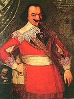
Georg Jenatsch, 1636
-
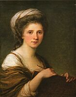
Angelika Kauffmann, self portrait, 1784
-
Philip Schaff
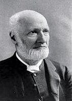
-
Kurt Huber
-
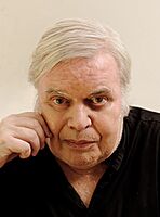
H. R. Giger, 2012
-
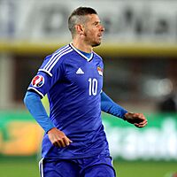
Mario Frick, 2015
-
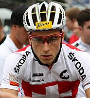
Nino Schurter, 2011


.jpg)

|
See also
 In Spanish: Coira para niños
