
Savoureuse facts for kids
Quick facts for kids Savoureuse |
|
| River | |
 The Savoureuse river in Valdoie
|
|
| Country | France |
|---|---|
| Region | Bourgogne-Franche-Comté |
| Departments | Territoire de Belfort, Doubs |
| Tributaries | |
| - left | Rosemontoise |
| - right | Rhôme, Douce |
| Cities | Belfort, Valdoie |
| Source | Ballon d'Alsace |
| - location | Vosges Mountains, Bourgogne-Franche-Comté, France |
| - elevation | 1,190 m (3,904 ft) |
| - coordinates | 47°49′17″N 6°50′56″E / 47.82139°N 6.84889°E |
| Confluence | Allaine |
| - location | Étupes, Bourgogne-Franche-Comté, France |
| - elevation | 317 m (1,040 ft) |
| - coordinates | 47°30′42″N 6°50′56″E / 47.51167°N 6.84889°E |
| Length | 41.2 km (26 mi) |
| Basin | 248 km² (96 sq mi) |
| Discharge | for Vieux-Charmont |
| - average | 5.93 m³/s (209 cu ft/s) |
The Savoureuse is a river in eastern France. It is the main river that flows through the Territoire de Belfort area.
Contents
About the Savoureuse River
The Savoureuse river is about 41.2 km (25.6 mi) long. It has a drainage basin (the area of land where all the water drains into the river) of about 248 km2 (96 sq mi).
How Much Water Flows?
The amount of water flowing in a river is called its discharge. This is how much water passes a certain point in the river each second. The Savoureuse's average yearly discharge has been measured in a few places:
- Near Giromagny, the river's flow is about 1.44 m3/s (51 cu ft/s).
- In Belfort, the flow increases to about 4.23 m3/s (149 cu ft/s).
- Near Vieux-Charmont, the flow is around 5.93 m3/s (209 cu ft/s).
Where the River Starts and Ends
.jpg)
The Savoureuse river begins high up in the mountains. Its source is on the Ballon d'Alsace, which is part of the Vosges Mountains. This spot is in the town of Lepuix, in the Territoire de Belfort department of France. It starts at a high point, about 1,190 m (3,904 ft) above sea level.
From its source, the river flows generally from north to south. It mostly stays within the Territoire de Belfort department. When it reaches Nommay, the river enters the Doubs department. Finally, in the town of Étupes, near the city of Sochaux, the Savoureuse joins another river called the Allaine. The Allaine river is a tributary of the Doubs river. The Savoureuse joins the Allaine at an elevation of about 317 m (1,040 ft).
Towns and Departments Along the River
The Savoureuse flows through one region, Bourgogne-Franche-Comté, and two different departments. It passes through 18 towns (called communes in France):
- In the Territoire de Belfort department, it flows through: Lepuix, Giromagny, Chaux, Sermamagny, Valdoie, Belfort, Danjoutin, Andelnans, Botans, Sevenans, Bermont, Trevenans, Chatenois-les-Forges, Évette-Salbert, and Rougegoutte.
- In the Doubs department, it flows through: Nommay, Vieux-Charmont, and Étupes.
Main Tributaries
A tributary is a smaller stream or river that flows into a larger one. The main rivers that flow into the Savoureuse are:
Rivers joining from the left side:
- Rosemontoise
Rivers joining from the right side:
- Rhôme
- Douce
Images for kids
-
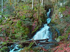
The Savoureuse at Lepuix.
-
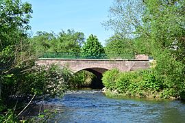
Pont de Sevenans bridge over the Savoureuse.
-
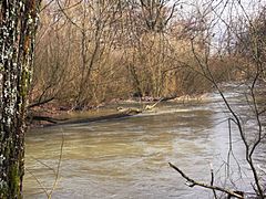
The Savoureuse at Nommay.
-
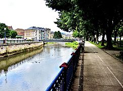
The Savoureuse flowing through Belfort.


Related pages
See also
 In Spanish: Savoureuse para niños
