Schunemunk Mountain facts for kids
Quick facts for kids Schunemunk Mountain |
|
|---|---|
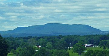
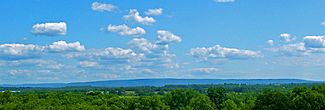
Schunemunk Mountain from across the Hudson River
|
|
| Highest point | |
| Elevation | 1,664 ft (507 m) |
| Listing | |
| Geography | |
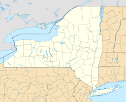
| Location | Orange County, New York, U.S. |
| Topo map | USGS Cornwall-on-Hudson |
| Climbing | |
| Easiest route | Hiking trail |
Schunemunk Mountain (sometimes spelled Schunnemunk) is the tallest mountain in Orange County, New York. Its peak is about 1,664 feet high. You can find it in the town of Blooming Grove. Parts of the mountain also stretch into Cornwall and Woodbury. A community called Mountain Lodge Park is built on its western side.
This mountain is a popular spot for outdoor activities. Even though only a small part of it is now Schunnemunk State Park, many hiking trails cross the private land on the mountain. People who work to protect nature hope that the state will eventually buy the entire mountain. This would help keep it wild and open for everyone to enjoy.
Contents
Exploring Schunemunk Mountain's Landscape
Schunemunk is a long, narrow mountain ridge. It runs from the northeast to the southwest. It sits between an area called Smith's Clove and the town of Salisbury Mills. For much of its northern part, the mountain has two main ridges. A swampy area called Barton Swamp lies between these two ridges. The very top of the mountain is on the ridge that is more to the southeast.
Waterways Around the Mountain
Water from Barton Swamp flows in two directions. Perry Creek drains the southern part of the swamp. Baby Brook drains the northern part. Most of the eastern side of the mountain is drained by Dark Hollow Brook. These streams are all part of the Moodna Creek watershed. A watershed is an area of land where all the water drains into a common river or lake. Moodna Creek eventually flows into the Hudson River. The southeastern part of Schunemunk Mountain drains into the Ramapo River watershed instead.
Nearby Peaks and Towns
About halfway along the mountain's length, on its southeastern side, is a smaller peak. This spur is known as High Knob or High Point. It offers great views over Woodbury, New York. To the northwest, across a valley, is Woodcock Mountain or Woodcock Hill. This smaller mountain reaches about 1,030 feet high.
The New York State Thruway highway runs along the eastern side of Schunemunk. It passes the mountain just north of the Harriman exit. Besides Mountain Lodge Park, two other small towns are close to the mountain. These are Mountainville to the northeast and Central Valley to the southeast. Because it is so tall and long, you can see Schunemunk Mountain from many parts of Orange County. You can also see it from some other nearby areas.
How Schunemunk Mountain Was Formed
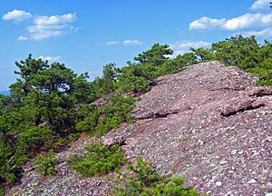
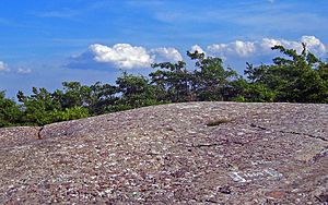
Schunemunk Mountain is different from other mountains nearby. Most mountains in the Hudson Highlands are made of older, harder rocks. Schunemunk, however, was formed from sedimentary deposits. These deposits include a type of rock called conglomerate. Conglomerate is a rock made of many different sized pebbles and stones cemented together. Later, cracks and shifts in the Earth's crust created the long valley that is now Barton Swamp.
A Brief History of Schunemunk Mountain
The name "Schunemunk" comes from the Lenape language. It means "excellent fireplace." The Lenni Lenape people, who were Native Americans, once had a village at the northern end of the mountain. During the American Revolution, the mountain was a place where small fights often happened. These were between groups loyal to the British (called Tories) and those fighting for American independence (called Patriots).
Today, more and more buildings are being planned around the mountain. However, the northern part of Schunemunk has become Schunnemunk State Park. This helps protect it. A small part of the southern area is also protected as Woodbury Park.
Hiking Trails on Schunemunk Mountain
Schunemunk Mountain has many trails for hikers to enjoy. The famous Long Path trail climbs the mountain using High Knob. It also crosses Perry Creek. When it meets the Jessup and Highland trails, it follows them to Gonzaga Park. The Highlands Trail uses several paths on the mountain. It goes up the eastern side along the Sweet Clover Trail. Then it follows the more southeastern ridge and crosses the summit using the Jessup Trail. This trail continues along the mountaintop to the southwestern end, finishing in Gonzaga Park. Other trails on the mountain include the Dark Hollow, Barton Swamp, Trestle, Western Ridge, and Otterkill trails.
 | James Van Der Zee |
 | Alma Thomas |
 | Ellis Wilson |
 | Margaret Taylor-Burroughs |


