Scott City, Missouri facts for kids
Quick facts for kids
Scott City, Missouri
|
|
|---|---|

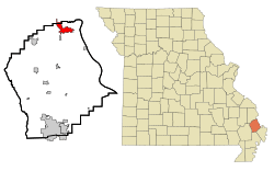
Location of Scott City, Missouri
|
|
| Country | United States |
| State | Missouri |
| Counties | Cape Girardeau, Scott |
| Area | |
| • Total | 4.92 sq mi (12.74 km2) |
| • Land | 4.84 sq mi (12.54 km2) |
| • Water | 0.08 sq mi (0.21 km2) |
| Elevation | 400 ft (100 m) |
| Population
(2020)
|
|
| • Total | 4,346 |
| • Density | 897.93/sq mi (346.68/km2) |
| Time zone | UTC-6 (Central (CST)) |
| • Summer (DST) | UTC-5 (CDT) |
| ZIP code |
63780
|
| Area code(s) | 573 |
| FIPS code | 29-66368 |
| GNIS feature ID | 2396557 |
Scott City is a city in the state of Missouri, USA. It is unique because it spans across two different areas: Cape Girardeau County and Scott County. In 2020, the city had a population of 4,346 people. The part of Scott City in Scott County is considered part of the Sikeston area. The part in Cape Girardeau County is part of the larger Cape Girardeau and Jackson metropolitan area.
Contents
History of Scott City
Scott City has grown over the years by combining with other nearby towns. On March 7, 1960, the town of Fornfelt and the area of Ancell became part of Scott City. Later, in 1980, Illmo, Missouri, also joined Scott City.
The town of Fornfelt was first called Edna. However, its name was changed because it was too similar to Edina, another town in Missouri. Illmo was once known as Whipporwhill Hollow. The current name, Scott City, comes from Scott County, where most of the city is located.
In December 1848, a serious illness spread to New Orleans from ships arriving with new settlers. This illness quickly traveled to many major cities along the Ohio and Mississippi Rivers. Six Irish monks, who were on their way to a monastery in Dubuque, Iowa, were among those affected. They were buried near the Thebes-Scott City railroad bridge.
Geography of Scott City
Scott City covers a total area of about 4.77 square miles (12.35 square kilometers). Most of this area, about 4.69 square miles (12.15 square kilometers), is land. The remaining small part, about 0.08 square miles (0.21 square kilometers), is water.
Population and People
| Historical population | |||
|---|---|---|---|
| Census | Pop. | %± | |
| 1910 | 1,209 | — | |
| 1920 | 2,017 | 66.8% | |
| 1930 | 1,721 | −14.7% | |
| 1940 | 1,810 | 5.2% | |
| 1950 | 1,834 | 1.3% | |
| 1960 | 1,963 | 7.0% | |
| 1970 | 2,464 | 25.5% | |
| 1980 | 3,262 | 32.4% | |
| 1990 | 4,292 | 31.6% | |
| 2000 | 4,591 | 7.0% | |
| 2010 | 4,565 | −0.6% | |
| 2020 | 4,346 | −4.8% | |
| U.S. Decennial Census 2020 | |||
Scott City in 2010
According to the 2010 census, there were 4,565 people living in Scott City. These people lived in 1,794 households, and 1,245 of these were families. The city had about 973 people per square mile.
Most of the people in Scott City were White (96.93%). A smaller number were Black or African American (0.68%), Native American (0.26%), or Asian (0.24%). About 1.45% of the population was Hispanic or Latino.
In terms of households, 36.2% had children under 18 years old living with them. About 50.2% were married couples. Some households (14.4%) had a female head with no husband, and 4.8% had a male head with no wife. About 26.1% of households were single-person homes. The average household had 2.54 people.
The average age of people in Scott City was 36.3 years. About 25.6% of residents were under 18 years old. About 13.2% were 65 years or older. The population was almost evenly split between males (48.3%) and females (51.7%).
Education in Scott City
Most of Scott City is served by the Scott City R-I School District. This district operates three schools: Scott City Elementary School, Scott City Middle School, and Scott City High School.
A small part of Scott City in Scott County is part of the Kelso C-7 School District. The section of Scott City that is in Cape Girardeau County is part of the Cape Girardeau 63 School District. This district includes Central High School.
Scott City also has a public library. It is a branch of the Riverside Regional Library, offering books and resources to the community.
See also
 In Spanish: Scott City (Misuri) para niños
 | Audre Lorde |
 | John Berry Meachum |
 | Ferdinand Lee Barnett |

