Seventeen Mile Rocks, Queensland facts for kids
Quick facts for kids Seventeen Mile RocksBrisbane, Queensland |
|||||||||||||||
|---|---|---|---|---|---|---|---|---|---|---|---|---|---|---|---|

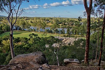
View across Rocks Riverside Park to the Brisbane River and beyond, 2019
|
|||||||||||||||
| Population | 2,699 (2021 census) | ||||||||||||||
| • Density | 1,227/km2 (3,180/sq mi) | ||||||||||||||
| Postcode(s) | 4073 | ||||||||||||||
| Area | 2.2 km2 (0.8 sq mi) | ||||||||||||||
| Time zone | AEST (UTC+10:00) | ||||||||||||||
| Location | 16.2 km (10 mi) SW of Brisbane CBD | ||||||||||||||
| LGA(s) | City of Brisbane (Jamboree Ward) |
||||||||||||||
| State electorate(s) | Mount Ommaney | ||||||||||||||
| Federal Division(s) | Oxley | ||||||||||||||
|
|||||||||||||||
Seventeen Mile Rocks is a suburb located in the city of Brisbane, Queensland, Australia. It's a place where people live, work, and enjoy the outdoors. In 2021, about 2,699 people called Seventeen Mile Rocks home.
Contents
Exploring Seventeen Mile Rocks
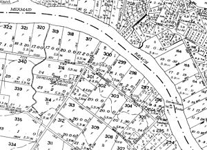
Seventeen Mile Rocks is about 11 kilometers (7 miles) south-west of the center of Brisbane. It sits right next to the Brisbane River.
The suburb has different areas. Part of it is used for businesses and factories. Another big part is Rocks Riverside Park, which is a popular spot for families. Most of the suburb is where people live in houses and new housing estates.
A Look Back in Time
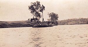
The name "Seventeen Mile Rocks" comes from a group of rocks in the Brisbane River. These rocks were about 17 miles (27 kilometers) from the river's mouth. John Oxley first wrote about them in 1823.
Over time, these rocks were removed. This happened between the 1860s and 1966. Removing the rocks made it easier for boats to travel further up the river.
In the past, Seventeen Mile Rocks had a church and a school. A church opened here in 1869. The Seventeen Mile Rocks State School opened around 1874 but closed in 1966.
For many years, the suburb was mostly industrial, meaning it had many factories and businesses. But recently, many new homes have been built. This has made the area more residential, with more families moving in. Some of these new areas even have walking paths and small lakes.
A fun piece of history is that Seventeen Mile Rocks used to have a drive-in movie theater. It was called the Western Drive-In and operated from 1966 to 1988. People would watch movies from their cars! Today, houses stand where the drive-in used to be.
People Living Here
The number of people living in Seventeen Mile Rocks has changed a bit over the years:
- In 2006, there were 2,899 people.
- In 2016, the population was 2,720.
- In 2021, there were 2,699 people.
Learning and Schools
Seventeen Mile Rocks does not have its own schools. Children living here usually go to primary schools in nearby suburbs like Darra, Corinda, or Jindalee. For high school, students often attend Corinda State High School or Centenary State High School.
Places to Visit
One of the best places in Seventeen Mile Rocks is Rocks Riverside Park. It's one of Brisbane's biggest parks along the river. You can find:
- Walking and cycling paths
- A basketball court
- A flying fox (a zip line!)
- A climbing web
- Picnic areas and sports fields
The suburb also has a few churches:
- iSee Church
- 17 Mile Church
- Riverlife Baptist Church
 | William L. Dawson |
 | W. E. B. Du Bois |
 | Harry Belafonte |


