Shingletown, California facts for kids
Quick facts for kids
Shingletown
|
|
|---|---|
 |
|

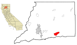
Location in Shasta County and the state of California
|
|
| Country | |
| State | |
| County | Shasta |
| Area | |
| • Total | 24.719 sq mi (64.021 km2) |
| • Land | 24.650 sq mi (63.844 km2) |
| • Water | 0.069 sq mi (0.178 km2) 0.28% |
| Elevation | 3,468 ft (1,064 m) |
| Population
(2020)
|
|
| • Total | 2,442 |
| • Density | 98.790/sq mi (38.144/km2) |
| Time zone | UTC-8 (Pacific (PST)) |
| • Summer (DST) | UTC-7 (PDT) |
| ZIP code |
96088
|
| Area code(s) | 530 |
| FIPS code | 06-71568 |
| GNIS feature ID | 1659646 |
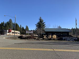
Shingletown is a small community in Shasta County, California, United States. It's called a census-designated place (CDP) because it's a recognized community, but not an official city. In 2020, about 2,442 people lived there.
Shingletown is located in the hills, just below Mount Lassen. It's often called "The Gateway to Lassen" because it's close to Lassen Volcanic National Park. Long ago, the area was known for cutting down large trees like pine, fir, and cedar. The town was first called "Shingle Camp." This was because workers cut wooden roofing pieces, called shingles, for miners during the Gold Rush.
Contents
Exploring Shingletown's Location and Nature
Shingletown is found in Northern California. It's very close to the beautiful Lassen Volcanic National Park. The total area of Shingletown is about 24.7 square miles (64 square kilometers). Most of this area is land, with a tiny bit of water.
The forests around Shingletown are home to a special and rare flower. It's called the Shasta clarkia. This plant is a type of Clarkia borealis and belongs to the evening primrose family.
Understanding Fire Safety in Shingletown
Because of its location in forested areas, Shingletown is in a "Very High Fire Hazard Severity Zone." This means there's a high risk of wildfires. To help keep everyone safe, Cal Fire has a plan. They want to clear away plants and trees along Highway 44. This road is the main route through Shingletown. This project is a top priority for fire safety in the state.
Shingletown's Weather
Shingletown has distinct seasons. Summers are usually warm to hot and very dry. Winters are cool and wet. Sometimes, if it gets cold enough, it can even snow!
| Climate data for Shingletown, CA | |||||||||||||
|---|---|---|---|---|---|---|---|---|---|---|---|---|---|
| Month | Jan | Feb | Mar | Apr | May | Jun | Jul | Aug | Sep | Oct | Nov | Dec | Year |
| Mean daily maximum °F (°C) | 48.5 (9.2) |
49.9 (9.9) |
53.7 (12.1) |
60.4 (15.8) |
68.5 (20.3) |
78.6 (25.9) |
88.0 (31.1) |
87.0 (30.6) |
81.0 (27.2) |
69.8 (21.0) |
53.7 (12.1) |
47.0 (8.3) |
65.5 (18.6) |
| Mean daily minimum °F (°C) | 31.0 (−0.6) |
31.4 (−0.3) |
34.1 (1.2) |
37.8 (3.2) |
44.8 (7.1) |
50.8 (10.4) |
57.3 (14.1) |
56.2 (13.4) |
52.1 (11.2) |
44.3 (6.8) |
36.6 (2.6) |
30.9 (−0.6) |
42.3 (5.7) |
| Average precipitation inches (mm) | 7.70 (196) |
6.31 (160) |
5.66 (144) |
3.95 (100) |
2.88 (73) |
0.82 (21) |
0.15 (3.8) |
0.32 (8.1) |
0.80 (20) |
2.67 (68) |
4.75 (121) |
7.65 (194) |
43.66 (1,108.9) |
| Average snowfall inches (cm) | 7.9 (20) |
7.6 (19) |
6.5 (17) |
2.5 (6.4) |
0.1 (0.25) |
0.0 (0.0) |
0.0 (0.0) |
0.0 (0.0) |
0.0 (0.0) |
0.1 (0.25) |
2.9 (7.4) |
8.7 (22) |
36.3 (92.3) |
| Source: The Western Regional Climate Center | |||||||||||||
Who Lives in Shingletown?
The 2010 United States Census counted 2,283 people living in Shingletown. Most residents were White (93.0%). A smaller number were Native American (2.1%) or from other racial backgrounds. About 3.8% of the population identified as Hispanic or Latino.
There were 1,007 households in Shingletown. About 18.7% of these households had children under 18 living there. Many households were married couples (54.9%). The average household had 2.27 people.
The population's age varied. About 15.7% were under 18 years old. A large portion, 38.6%, were between 45 and 64 years old. Also, 24.6% of the people were 65 years or older. The average age in Shingletown was 53.2 years.
Most homes (83.3%) were owned by the people living in them. The rest (16.7%) were rented.
Local Economy and Transportation
Shingletown has two radio stations, KRDG and KYTO. These stations broadcast to Redding and the areas nearby.
Shingletown Airport
|
Shingletown Airport
|
|||||||||||
|---|---|---|---|---|---|---|---|---|---|---|---|
| Summary | |||||||||||
| Airport type | Closed | ||||||||||
| Operator | Shasta County | ||||||||||
| Location | Shingletown, California | ||||||||||
| Closed | October 1, 2002 | ||||||||||
| Elevation AMSL | 3,880 ft / 1,182 m | ||||||||||
| Coordinates | 40°31′20″N 121°49′04″W / 40.52222°N 121.81778°W | ||||||||||
| Runway | |||||||||||
|
|||||||||||
|
Sources: county web site
|
|||||||||||
Shingletown used to have a small airport for general aviation. It was located about three miles (5 km) northeast of the town. The airport had one runway and covered 120 acres (49 hectares). However, it was closed on October 1, 2002, for safety reasons.
Education in Shingletown
There are two schools in Shingletown. Both are located on Ponderosa Way. They are Black Butte Elementary School and Black Butte Junior High School.
Famous People from Shingletown
- Greg Cadaret, a former professional baseball player.
- Lynsi Snyder, the owner of the popular fast-food chain In-N-Out Burger.
See also
 In Spanish: Shingletown para niños

