Sierra Pinta facts for kids
Quick facts for kids Sierra Pinta |
|
|---|---|
| Highest point | |
| Peak | Unnamed |
| Elevation | 2,202 ft (671 m) |
| Geography | |
| Country | United States |
| State | Arizona |
| Range coordinates | 32°15′47″N 113°32′35″W / 32.2631118°N 113.5429672°W |
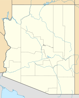
The Sierra Pinta (sometimes called Sierra Pintas) is a mountain range in southwestern Arizona, USA. Its name means "Painted Mountains" in Spanish. People gave it this name because the mountains look like they are painted with many colors during sunrise and sunset.
This mountain range is long and narrow, stretching about 22 miles (35 km). It is located in the dry northwestern part of the Sonoran Desert. Just south of it is the Pinacate Reserve in northern Sonora, Mexico. This reserve is known for its volcanoes and cinder cones.
The Sierra Pinta mountains are part of a larger area where the Earth's crust has moved, causing blocks of land to rise and fall. This creates the peaks and valleys you see.
Contents
What are the main peaks in Sierra Pinta?
The Sierra Pinta range has several notable peaks. At the northern end, you'll find Point of the Pintas, which is about 1,272 feet (388 m) high. South of that is Isla Pinta, standing at 2,008 feet (612 m). The highest point in the range is Pinta Benchmark, reaching about 2,950 feet (899 m).
Where is Sierra Pinta located?
The Sierra Pinta mountains are near the southern end of the Mohawk Valley. This valley borders the range on its eastern side. To the east of the Sierra Pintas are the Bryan Mountains. If you go west from the Sierra Pintas, you will find the Tule Desert.
An early explorer named Anza wrote about the Sierra Pinta Range during his travels a long time ago.
Exploring the Sierra Pinta Region
The area around the Sierra Pinta mountains is quite remote. There are not many paved roads.
How to access the Sierra Pinta area
West of the northern part of the Sierra Pintas, there is a road called "Christmas Pass Road." This road goes south from Interstate 8 and passes through Christmas Pass. It is next to the Tule Desert and the Cabeza Prieta Mountains. The road ends near the US-Mexico Border.
Near the border, you can find an unpaved road known as the El Camino del Diablo, or Devil's Highway. This old trail runs parallel to the border. This region can be very hot, especially in the summer.
Nature and Wildlife in Sierra Pinta
The Sierra Pinta mountains are located in the central-western part of the Cabeza Prieta National Wildlife Refuge. This refuge is a protected area for many animals and plants.
How to reach the wildlife refuge
The closest way to get to the refuge from the north is through Mohawk, a town on Interstate 8. Another town, Ajo, Arizona, is about 35 miles (56 km) to the east. To the southeast, across the border, is Sonoyta, Sonora, which is near the Organ Pipe Cactus National Monument.
What unique plants live in Sierra Pinta?
The Sierra Pinta range is an important place for where certain plant and animal species can be found. For example, it is the southernmost place where the California Fan Palm (Washingtonia filifera) grows naturally.
See also
 In Spanish: Sierra Pinta para niños
 | Stephanie Wilson |
 | Charles Bolden |
 | Ronald McNair |
 | Frederick D. Gregory |


