Sierra de Lema facts for kids
Quick facts for kids Sierra de Lema |
|
|---|---|
| Highest point | |
| Elevation | 1,650 m (5,410 ft) |
| Geography | |
| Location | Bolívar state, Venezuela |
| Range coordinates | 06°N 62°W / 6°N 62°W |
| Parent range | Guayana Shield |
| Geology | |
| Orogeny | igneous, metamorphic, & sedimentary rock |
| Age of rock | Precambrian, Mesozoic |
The Sierra de Lema is an amazing mountain range in southeastern Venezuela. It is found in the Bolívar state. This area is famous for its special flat-topped mountains called tepuis.
Sometimes, the eastern part of this range was called Sierra Rinocote. The western part was known as Sierra Usupamo.
Contents
Exploring Sierra de Lema
The Sierra de Lema is part of a huge land area called the Guayana Shield. It is also part of the Guayana Highlands, which is a region with many high plateaus.
Where is Sierra de Lema?
This mountain range is located north of the Gran Sabana. It acts like a natural wall, separating the water flow of two big rivers. These are the Caroní River and the Cuyuni River.
Part of the Sierra de Lema is inside Canaima National Park. This park is a protected area. The range includes several famous tepuis. These include the entire Los Testigos chain and the Ptari Massif. The mountains here range from about 150 meters to 1,650 meters (490 to 5,410 feet) above sea level.
How Big is This Mountain Range?
The chain of tepui mountains that makes up the Sierra de Lema is about 30 kilometers (19 miles) wide. It can be tricky to say exactly how long the Sierra de Lema is. This is because the names of places in this region are not always clear.
If we only look at the uplands that form the northern edge of the Gran Sabana, the Sierra de Lema stretches for about 80 kilometers (50 miles). However, if we include the entire chain that separates the Caroní and Cuyuni river basins, it is much longer. By this definition, the range is over 200 kilometers (120 miles) long. It goes from Cerro Venamo in the east to Serranía Supamo and Cerro Santa Rosa in the west. This western end is very close to where the Paragua River joins the Caroní River.
Amazing Nature and Ecology
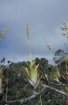
The old forests in the Sierra de Lema are almost untouched. They are part of the Guayanan Highlands moist forests area. These forests cover a large area of about 1,000 square kilometers (390 square miles). The soil here is not very rich in nutrients. It also has a low pH and a lot of aluminum.
There is a spot called El Mirador ("The Lookout") at the base of the Sierra de Lema. The soil and plants here have unusually high levels of a substance called Caesium-137. This is likely due to the type of ground and the misty, cloudy conditions of the forest. Another part of the Sierra de Lema is a hilly, forested area known as La Escalera ("The Staircase").
What is the Sierra de Lema Made Of?
The Sierra de Lema has a base made of igneous and metamorphic rocks. These are very old rocks that have been changed by heat and pressure. On top of this base are sedimentary rocks from the Precambrian time. These rocks were formed from layers of sediment. There are also diabase rocks from the Mesozoic era. These are rocks that pushed into the other layers.
See also
 In Spanish: Sierra de Lema para niños
- Guayana Highlands topics
- Distribution of Heliamphora — This plant species is found only in the Sierra de Lema.
 | May Edward Chinn |
 | Rebecca Cole |
 | Alexa Canady |
 | Dorothy Lavinia Brown |


