
Canaima National Park facts for kids
Quick facts for kids Canaima National Park |
|
|---|---|
|
IUCN Category II (National Park)
|
|

Wadakapiapué-tepui and Yuruaní-tepui in Canaima National Park
|
|
.svg)
Canaima National Park
Location in Venezuela
|
|
| Location | Bolívar State, Venezuela |
| Area | 30,000 km2 (12,000 sq mi) |
| Established | June 12, 1962 |
| Type: | Natural |
| Criteria: | vii, viii, ix, x |
| Designated: | 1994 (18th session) |
| Reference #: | 701 |
| Region: | Latin America and the Caribbean |


Canaima National Park (Spanish: Parque Nacional Canaima) is a huge park in southeastern Venezuela. It covers about 30,000 square kilometers, which is roughly the same size as the country of Belgium! This amazing park reaches the borders of Brazil and Guyana. In 1994, UNESCO named Canaima National Park a World Heritage Site because of its unique natural beauty.
Contents
History of Canaima National Park
Canaima National Park was officially created on June 12, 1962. This made it a protected area. In 1994, the park received a special title from UNESCO. It was named a World Heritage Site. This means it's considered very important for everyone in the world to protect.
However, in 2017, experts looked at the park's protection. They said it needed better care and management to keep it safe.
Exploring Canaima National Park
Canaima National Park is the second largest park in Venezuela. It's also the sixth biggest national park in the world!
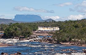
About 65% of the park is covered by amazing rock formations called tepuis. Imagine giant, flat-topped mountains with super steep sides. These tepuis are millions of years old. They are like natural skyscrapers that reach for the sky. They have unique plants and animals found nowhere else.
These towering cliffs and waterfalls create incredible views. One of the most famous is Angel Falls. It's the highest waterfall in the world, dropping an incredible 979 meters!
The most well-known tepuis in the park are Mount Roraima and Auyantepui. Auyantepui is where Angel Falls plunges down. These tepuis are made of sandstone. They formed when South America and Africa were once joined as one giant continent.
The park is also home to the Pemon people. They are an indigenous group who have lived here for a very long time. The Pemon have a special connection to the tepuis. They believe these mountains are home to spirits called 'Mawari'. Getting around the park can be an adventure. There are only a few roads. Most people travel by small plane, on foot, or by canoe.
Animals of Canaima National Park
Canaima National Park is home to many different animals. They live in various parts of the park, depending on the height of the land and the types of plants.
Here are some of the cool animals you might find:
- Giant armadillo (Priodontes maximus)
- Giant otter (Pteronura brasiliensis)
- Giant anteater (Myrmecophaca tridactyla)
- Cougar (Puma concolor)
- Jaguar (Panthera onca)
- Linnaeus's two-toed sloth (Choloepus didactylus)
- White-faced saki (Pithecia pithecia)
- Harpy eagle (Harpia harpyja)
- Red-shouldered macaw (Diopsittaca nobilis)
- Yellow-banded poison dart frog (Dendrobates leucomelas)
- Green iguana (Iguana iguana)
- Hummingbirds (Trochilinae)
- Toucans (Ramphastidae)
Canaima National Park is also recognized as an Important Bird Area. This means it's a very important place for birds and their natural homes.
Plants of Canaima National Park
The park is a treasure chest of plants. There are over 300 species found only in the La Gran Sabana region of the park.
Some plants here are very special. They are called "carnivorous" plants. This means they eat insects! They do this because the soil in the mountains doesn't have many nutrients. These plants include Brocchinia, Drosera, and Heliamphora.
Waterways of Canaima National Park
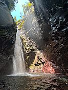
The park is filled with water! It includes the entire area that feeds the right side of the Caroní River. It also has two of the world's highest waterfalls: Angel Falls and Kukenán Falls. Plus, there are many other beautiful waterfalls of all sizes.
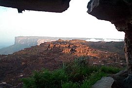
Unique Landforms: The Tepuis

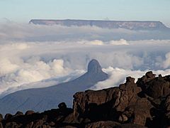
The most amazing landforms in the park are the tepuis. These are unique plateaus with very steep sides and almost flat tops. They are like ancient islands in the sky.
Geologically, tepuis are leftovers from a very old layer of sandstone. This sandstone sits on top of even older rocks, some nearly 3 billion years old! On their flat tops, you can find many plants and animals that live nowhere else. Some of the plants are "carnivorous" because food is scarce up there.
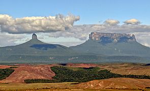
These geological formations are between 1.5 and 2 billion years old. This makes them some of the oldest formations on Earth! The most famous tepuis include Auyantepuy (home of Angel Falls), Roraima, Kukenan, and Chimantá.
Fun Things to Do in Canaima National Park
Canaima National Park is a popular place for visitors. About 100,000 tourists visit each year. Most of them come to see the amazing tepuis.
You can explore many parts of the park. Some tepuis, like Mount Roraima and Auyán-tepui, are open to visitors. Angel Falls is also a very popular spot. You can even take a canoe trip through the park's vast rainforest!
Western Sector Attractions
|
|
Eastern Sector Attractions
|
|
Canaima in Pop Culture
The name Canaima was used for a made-up coastal town in California. This town was featured in the movie Arachnophobia.
Gallery
-
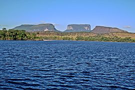
from left: Kurun tepui, Kusari tepui and Kuravaina tepui
-
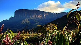
Kukenán-tepui view from base
-
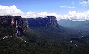
Rio Churun devils canyon and Angel Falls
-
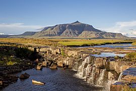
Uei-tepui and Chirimata Falls
-
Yuruaní River and Yuruaní-tepui
-
Wadakapiapué-tepui and Ilú–tepui
-
Yuruaní-tepui and Wadakapiapué-tepui
-
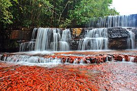
Jasper Creek
-
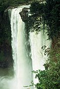
Kamá Falls
-
Waterfalls of Canaima
-
Kukenan Tepui
-
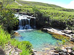
Pozo Azul
-
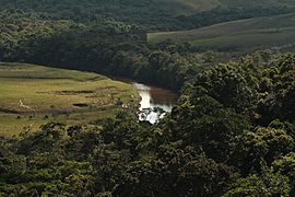
River in the Gran Sabana
-
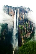
Salto Angel aerial view
-
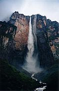
Angel Falls as seen from base
-
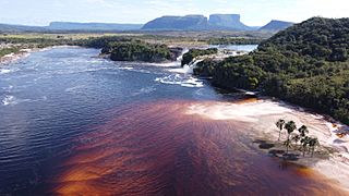
Canaima Lake and Ucaima Waterfalls
-
Kavac caves
-
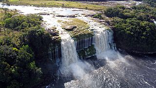
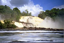
El Hacha falls
-
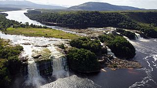
El Hacha and Ucaima falls. Carrao river and Canaima Lagoon


.jpg)


.jpg)


.jpg)


See also
 In Spanish: Parque nacional Canaima para niños
