Silverton, Texas facts for kids
Quick facts for kids
Silverton, Texas
|
|
|---|---|

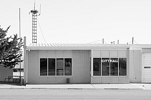
City Hall (2014)
|
|

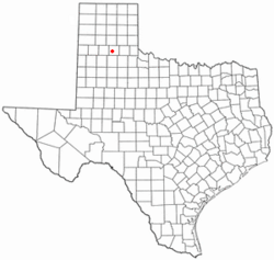
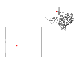
Location of Silverton, Texas
|
|
 |
|
| Country | United States |
| State | Texas |
| County | Briscoe |
| Area | |
| • Total | 1.00 sq mi (2.60 km2) |
| • Land | 1.00 sq mi (2.60 km2) |
| • Water | 0.00 sq mi (0.00 km2) |
| Elevation | 3,278 ft (999 m) |
| Population
(2020)
|
|
| • Total | 629 |
| • Density | 629/sq mi (241.92/km2) |
| Time zone | UTC-6 (Central (CST)) |
| • Summer (DST) | UTC-5 (CDT) |
| ZIP code |
79257
|
| Area code(s) | 806 |
| FIPS code | 48-67904 |
| GNIS feature ID | 1368288 |
Silverton is a city located in Briscoe County, Texas, United States. In 2020, the city had a population of 629 people. Silverton is also the main town, known as the county seat, for Briscoe County.
Contents
History of Silverton
Silverton began when Thomas J. Braidfoot and his partners created a townsite company. The name "Silverton" might have come from the shiny look of nearby lakes. The town grew quickly. By the fall of 1891, it had a post office, stores, a blacksmith shop, and a school.
In 1892, Silverton was chosen as the county seat for Briscoe County after a special vote. This meant it became the main center for the county's government. Soon after, a two-story courthouse and a stone jail were built. The town continued to develop, opening its first bank in 1909. A new brick schoolhouse was built in 1911.
In 1928, the Fort Worth and Denver South Plains Railway reached Silverton. This made Silverton the northern end of the railway line. Because of this growth, Silverton officially became an incorporated city.
In 1957, a strong F4 tornado hit Silverton. This natural event caused significant damage and impacted many lives in the community.
Geography and Location
Silverton is in the western part of Briscoe County, Texas. Its exact location is 34°28′17″N 101°18′17″W / 34.47139°N 101.30472°W.
Highways and Travel
Texas State Highway 86 goes through Silverton. You can travel southeast about 17 miles (27 km) to Quitaque. Going west on Highway 86, you will reach Tulia in about 27 miles (43 km), which is near Interstate 27.
Texas State Highway 207 also starts in Silverton. It goes south about 35 miles (56 km) to Floydada. If you head north on Highway 207, you will reach Claude in about 52 miles (84 km).
Size of Silverton
According to the United States Census Bureau, Silverton covers a total area of 1.0 square mile (2.6 square kilometers). All of this area is land.
Climate in Silverton
Silverton has a semi-arid climate. This means it is generally dry, but not a desert. It often has warm summers and cool winters.
| Climate data for Silverton, Texas (1991–2020 normals, extremes 1961–present) | |||||||||||||
|---|---|---|---|---|---|---|---|---|---|---|---|---|---|
| Month | Jan | Feb | Mar | Apr | May | Jun | Jul | Aug | Sep | Oct | Nov | Dec | Year |
| Record high °F (°C) | 80 (27) |
87 (31) |
94 (34) |
102 (39) |
107 (42) |
111 (44) |
110 (43) |
108 (42) |
103 (39) |
100 (38) |
88 (31) |
81 (27) |
111 (44) |
| Mean maximum °F (°C) | 73.5 (23.1) |
77.9 (25.5) |
85.6 (29.8) |
89.5 (31.9) |
95.9 (35.5) |
100.5 (38.1) |
100.7 (38.2) |
99.1 (37.3) |
96.1 (35.6) |
90.5 (32.5) |
80.9 (27.2) |
74.0 (23.3) |
103.5 (39.7) |
| Mean daily maximum °F (°C) | 52.2 (11.2) |
56.3 (13.5) |
64.7 (18.2) |
72.7 (22.6) |
80.6 (27.0) |
89.0 (31.7) |
92.1 (33.4) |
90.7 (32.6) |
83.5 (28.6) |
73.8 (23.2) |
62.0 (16.7) |
52.6 (11.4) |
72.5 (22.5) |
| Daily mean °F (°C) | 37.9 (3.3) |
41.5 (5.3) |
49.5 (9.7) |
57.4 (14.1) |
66.8 (19.3) |
75.8 (24.3) |
79.2 (26.2) |
77.9 (25.5) |
70.5 (21.4) |
59.4 (15.2) |
47.7 (8.7) |
38.9 (3.8) |
58.5 (14.7) |
| Mean daily minimum °F (°C) | 23.7 (−4.6) |
26.6 (−3.0) |
34.2 (1.2) |
42.1 (5.6) |
53.0 (11.7) |
62.6 (17.0) |
66.4 (19.1) |
65.1 (18.4) |
57.6 (14.2) |
45.1 (7.3) |
33.5 (0.8) |
25.3 (−3.7) |
44.6 (7.0) |
| Mean minimum °F (°C) | 9.6 (−12.4) |
11.8 (−11.2) |
17.8 (−7.9) |
27.2 (−2.7) |
38.8 (3.8) |
53.1 (11.7) |
59.5 (15.3) |
57.6 (14.2) |
44.6 (7.0) |
28.5 (−1.9) |
16.3 (−8.7) |
9.7 (−12.4) |
3.9 (−15.6) |
| Record low °F (°C) | −9 (−23) |
−8 (−22) |
4 (−16) |
19 (−7) |
27 (−3) |
43 (6) |
53 (12) |
50 (10) |
30 (−1) |
15 (−9) |
1 (−17) |
−10 (−23) |
−10 (−23) |
| Average precipitation inches (mm) | 0.69 (18) |
0.76 (19) |
1.26 (32) |
1.64 (42) |
2.87 (73) |
3.65 (93) |
2.42 (61) |
2.64 (67) |
2.31 (59) |
1.82 (46) |
0.85 (22) |
0.78 (20) |
21.69 (551) |
| Average snowfall inches (cm) | 1.9 (4.8) |
2.3 (5.8) |
1.0 (2.5) |
0.3 (0.76) |
0.0 (0.0) |
0.0 (0.0) |
0.0 (0.0) |
0.0 (0.0) |
0.0 (0.0) |
0.1 (0.25) |
1.8 (4.6) |
1.8 (4.6) |
9.2 (23) |
| Average precipitation days (≥ 0.01 in) | 3.0 | 3.4 | 4.4 | 4.3 | 6.6 | 7.6 | 5.8 | 6.3 | 5.3 | 5.0 | 3.5 | 3.3 | 58.5 |
| Average snowy days (≥ 0.1 in) | 1.1 | 1.3 | 0.5 | 0.1 | 0.0 | 0.0 | 0.0 | 0.0 | 0.0 | 0.1 | 0.5 | 1.0 | 4.6 |
| Source: NOAA | |||||||||||||
Population and People
The population of Silverton has changed over the years. Here's a look at how many people have lived in the city during different census years:
| Historical population | |||
|---|---|---|---|
| Census | Pop. | %± | |
| 1920 | 416 | — | |
| 1930 | 873 | 109.9% | |
| 1940 | 684 | −21.6% | |
| 1950 | 857 | 25.3% | |
| 1960 | 1,098 | 28.1% | |
| 1970 | 1,026 | −6.6% | |
| 1980 | 918 | −10.5% | |
| 1990 | 779 | −15.1% | |
| 2000 | 771 | −1.0% | |
| 2010 | 731 | −5.2% | |
| 2020 | 629 | −14.0% | |
| U.S. Decennial Census | |||
2020 Census Information
In 2020, the United States Census counted 629 people living in Silverton. There were 277 households and 165 families in the city.
The table below shows the different groups of people living in Silverton based on the 2020 census:
| Race | Number | Percentage |
|---|---|---|
| White (NH) | 388 | 61.69% |
| Black or African American (NH) | 9 | 1.43% |
| Native American or Alaska Native (NH) | 3 | 0.48% |
| Some Other Race (NH) | 2 | 0.32% |
| Mixed/Multi-Racial (NH) | 16 | 2.54% |
| Hispanic or Latino | 211 | 33.55% |
| Total | 629 |
Education in Silverton
Students in Silverton attend schools that are part of the Silverton Independent School District. The local high school is Silverton High School, whose sports teams are known as the Owls.
See also
 In Spanish: Silverton (Texas) para niños
 | Emma Amos |
 | Edward Mitchell Bannister |
 | Larry D. Alexander |
 | Ernie Barnes |

