Siskiyou Summit facts for kids
Quick facts for kids Siskiyou Summit |
|
|---|---|

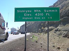
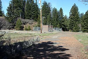
Siskiyou Mountain Summit marker at southbound truck brake check area
|
|
| Elevation | 4,310 ft (1,314 m) |
| Traversed by | |
| Location | Jackson County, Oregon, United States |
| Range | Siskiyou Mountains |
| Coordinates | 42°3′38″N 122°36′21″W / 42.06056°N 122.60583°W |
The Siskiyou Summit is a very high point on Interstate 5 (I-5) in the state of Oregon. It's often called Siskiyou Mtn. Summit or Siskiyou Pass. This summit is different from the older, historical Siskiyou Pass nearby. The Siskiyou Summit is located in the Siskiyou Mountains. It's about 4 miles (6.4 km) north of the California border. At 4,310 feet (1,314 m) high, it is the highest point on all of Interstate 5. When the highway was built, the road was cut lower. This made the summit 49 feet (15 m) shorter than it used to be.
Contents
Where is Siskiyou Summit?
The Siskiyou Mountains create a natural border. They separate the Klamath River and Rogue River areas. They also form a rough natural line between Oregon and California. The summit on Interstate 5 is about 12 miles (19 km) south of Ashland, Oregon. It's also 25 miles (40 km) north of Yreka, California. The summit is only about half a mile (0.8 km) east of the old Siskiyou Pass. That old pass was the most used mountain pass in Oregon. The Pacific Crest National Scenic Trail crosses the highway here. This famous trail goes all the way from Mexico to Canada.
Weather at Siskiyou Summit
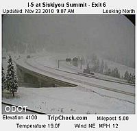
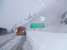
The road over Siskiyou Summit can be closed for many days in winter. This happens because of very bad weather like heavy snow and ice. Sometimes, it might even close when the weather seems fine. Knowing the weather here is very important for people traveling over the summit.
Snow usually falls from November to April. December often has the most snow, with about four snowy days. Wind speeds change throughout the year. They average about 13 km/h (8 mph) in May. But winds can sometimes reach up to 80 km/h (50 mph). The number of rainy days also changes. December has about 11 rainy days. June, August, and September have only about two rainy days each.
| Climate data for Siskiyou-Summit | |||||||||||||
|---|---|---|---|---|---|---|---|---|---|---|---|---|---|
| Month | Jan | Feb | Mar | Apr | May | Jun | Jul | Aug | Sep | Oct | Nov | Dec | Year |
| Mean daily maximum °F (°C) | 43 (6) |
45 (7) |
49.5 (9.7) |
54 (12) |
63 (17) |
71 (22) |
82 (28) |
81.9 (27.7) |
74 (23) |
61 (16) |
47.3 (8.5) |
40.6 (4.8) |
59.4 (15.1) |
| Mean daily minimum °F (°C) | 29.1 (−1.6) |
28.9 (−1.7) |
30.0 (−1.1) |
32.9 (0.5) |
39.7 (4.3) |
44.6 (7.0) |
53.9 (12.2) |
53.9 (12.2) |
48.9 (9.4) |
40.1 (4.5) |
33.1 (0.6) |
28.9 (−1.7) |
38.7 (3.7) |
| Average precipitation inches (mm) | 5.94 (151) |
4.71 (120) |
3.13 (80) |
2.46 (62) |
1.71 (43) |
0.99 (25) |
0.57 (14) |
0.39 (9.9) |
1.16 (29) |
2.21 (56) |
4.43 (113) |
5.22 (133) |
32.92 (835.9) |
| Average snowfall inches (cm) | 35 (89) |
24 (61) |
10 (25) |
8 (20) |
2 (5.1) |
0 (0) |
0 (0) |
0 (0) |
0 (0) |
1 (2.5) |
9 (23) |
28 (71) |
117 (296.6) |
History of Siskiyou Trail
The Hudson's Bay Company created a path from Oregon to California. They were looking for animal furs and used trails made by Native Americans. In 1827, the company developed the Siskiyou Trail. This trail included crossing the Siskiyou Summit.
In the 1830s, a person named Ewing Young led many cattle over the Siskiyou Trail. This made the trail wider. It took three months to make the trail wide enough for the cattle. This wider trail connected the Shasta Valley in California with the Rogue Valley in Oregon.
Scientists studied this trail in 1841. Later, during the California Gold Rush, miners used the trail to reach gold fields. In the 1860s, the trail was made even wider. This allowed stagecoaches to travel on it easily. The first telegraph line was added in 1864. It wasn't until the 1960s that this old trail became the modern highway we know today as Interstate 5.
Driving the Summit Road
The Siskiyou Summit is very high, at 4,310 feet (1,314 m). The road goes straight up and straight down, with many curves. There is enough space at the summit for two lanes of trucks to park on both sides of the road. The road has a steep slope of about 6%. This makes it a good place for truck drivers to stop. They can refuel, check their vehicles, and rest here.
The road going down from the summit on the north side is very steep and winding. In winter, reaching the summit can be very hard. This is because of snow and ice on the road. In 2008, a train line between Medford, Oregon and Weed, California closed. After that, more trucks used the highway to carry timber and other products. To make this dangerous mountain road less used, people suggested reopening the train line. The train line over the pass was finally reopened in 2015.
 | Selma Burke |
 | Pauline Powell Burns |
 | Frederick J. Brown |
 | Robert Blackburn |


