
Six Mile Run (New Jersey) facts for kids
Quick facts for kids Six Mile Run |
|
|---|---|

Six Mile Run near its mouth in the Millstone River
|
|

Map of area with Six Mile Run highlighted
|
|
| Country | United States |
| Physical characteristics | |
| Main source | 39 ft (12 m) 40°27′35″N 74°29′11″W / 40.45972°N 74.48639°W |
| River mouth | 40°28′21″N 74°34′20″W / 40.47250°N 74.57222°W |
| Basin features | |
| Progression | Millstone River, Raritan River, Atlantic Ocean |
| Tributaries |
|
Six Mile Run is a small river, also called a tributary, that flows into the Millstone River in New Jersey, United States. It helps drain water from a big area in Somerset County and parts of Middlesex County. This includes areas in Franklin Township, North Brunswick, and South Brunswick.
Contents
Why Is It Called Six Mile Run?
Six Mile Run got its name a long time ago from early land surveyors. They were measuring distances from a historic road called King's Highway (now Route 27). This road started near the Raritan River in New Brunswick.
The surveyors guessed that this stream was about six miles from that starting point. Other nearby streams, like Nine Mile Run and Ten Mile Run, got their names the same way. Even though the measurements weren't super accurate, the names have stuck around ever since!
Where Does Six Mile Run Flow?
Six Mile Run begins its journey near Corporate Road in North Brunswick. From there, it flows across Cozzens Lane and then through a neighborhood. It collects water from a lake before crossing under Route 27.
Further along, it meets up with a larger stream called Nine Mile Run. After that, it crosses South Middlebush Road and Canal Road. Finally, Six Mile Run empties into the Millstone River.
How Can You Visit Six Mile Run?
It's easy to get to Six Mile Run in many spots. You can find access points at Cozzens Lane and within the residential areas it flows through. Other good places to see the stream are at Route 27, South Middlebush Road, and Canal Road.
You can also explore parts of the stream by walking or biking on the D&R Canal Trail. Plus, there are trails in the Six Mile Run Reservoir Site that offer more ways to experience the area.
What Is the Riverbed Like?
The streambed of Six Mile Run changes as it flows. Near Cozzens Lane, the bottom is mostly rocky, but it has a layer of mud on top. In some places, the water can be quite deep.
As the stream moves into the residential areas, it becomes more rocky and the water flows faster. Near Route 27, it's still rocky and deep. This rocky and deep nature continues for most of its path downstream. When it joins Nine Mile Run, the stream gets much wider. Closer to where it meets the Millstone River, the streambed is a mix of small pebbles and sand. You might even spot large fish in the deep pools near the Delaware and Raritan Canal.
What Are Six Mile Run's Tributaries?
A tributary is a smaller stream or river that flows into a larger one. Six Mile Run has several tributaries that add water to it:
There's also a large unnamed tributary that flows north into Six Mile Run. This stream crosses Skillmans Lane, Bennets Lane, and Veronica Avenue.
Gallery
-
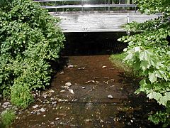
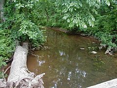
Six Mile Run crossing Cozzens Lane
-
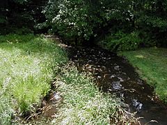
Six Mile Run running through a residential development
-
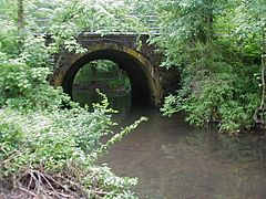
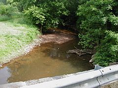
Six Mile Run at Route 27
-
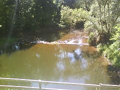
Six Mile Run at South Middlebush Road
-
Six Mile Run at South Middlebush Road, other side
-
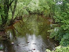
Six Mile Run at Canal Road, near its mouth to the Millstone River
-
Six Mile Run after the D&R Canal and before the Millstone River, viewed from the canal towpath


