Slough Arm facts for kids
Quick facts for kids Slough Arm |
|
|---|---|

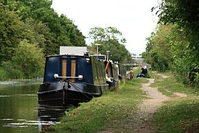
The Slough Arm towpath at Yiewsley
|
|
| Specifications | |
| Locks | 1 stop gate |
| Status | navigable |
| History | |
| Principal engineer | Alfred Walker |
| Date of act | 1879 |
| Date completed | 1882 |
| Date closed | 1960 |
| Date restored | 1975 |
| Geography | |
| Start point | Slough |
| End point | Cowley Peachey |
| Connects to | Grand Union Canal |
The Slough Arm is a short canal branch in England. It connects the Grand Union Canal to the town of Slough. This canal was first built to help the brick-making industry.
Even though it stopped being used for business in 1960, local people wanted to save it. So, the canal was reopened in 1975 and is still used today for boats and recreation.
Contents
Building the Slough Arm Canal
In 1878, people in London needed more bricks for new buildings. Hubert Thomas suggested building a canal to Slough to help transport these bricks. New brick factories were planned for Slough.
Planning the Route
Hubert Thomas surveyed the area in 1879. The plan was to connect the canal from Bulls Bridge on the Grand Union Canal. Later, the starting point was moved slightly to Cowley Peachey.
To build the canal, they needed a special law called an Act of Parliament. The Great Western Railway company did not want the canal built. But the law was passed in July 1879. The Slough end of the canal had to be made shorter. This was because the original plan would have crossed land owned by important people like the Duke of Leeds and Eton College.
Construction Begins
Building the canal started in early 1880 at Cowley Peachey Junction. Alfred Walker was the engineer in charge. He had experience building other canals.
The route included a big digging project (a cutting) and a raised earth path (an embankment) near Iver. These parts started in February and May 1880. By April 1881, work was also happening at the Slough end. The big earthworks at Iver were finished in June 1882. The entire canal opened on December 4, 1882. It was about 5 miles (8 km) long and did not need any locks.
Early Use and Decline
After the canal opened, Alfred Walker stayed to make sure everything worked well. He helped build places for boats to load and unload goods. He also fixed any problems with the ground settling.
The canal was very busy in 1905. It carried 192,000 tons of goods. Most of this was bricks, sand, and gravel. Small railways called tramways helped bring goods to the canal.
After 1905, the amount of cargo slowly went down. Bricks and gravel were still carried in the 1920s and 1930s. But by the 1940s, the clay and gravel pits were running out. The pits were then used for dumping waste, which brought some traffic. Timber was also delivered to Slough Wharf. However, the last time the canal was used for business was in March 1960.

Saving the Canal
After 1960, it looked like the canal would not be used again. The local council in Slough thought about buying part of it. They wanted to build a road for a business park where the canal was.
The Fight to Save It
In 1968, a group called the Slough Canal Group was formed. They worked very hard to save the canal. The local newspaper, the Slough Observer, also supported them.
Their efforts were successful! The canal was reopened in 1975. The Slough Arm was one of seven canals that were officially improved in 1983. These canals were made better for boats to cruise on.
The Slough Arm was one of the last canals ever built in Britain. Only the Manchester Ship Canal and the New Junction Canal (opened in 1905) were built later.
Future Plans: Connecting to the Thames
There have been ideas to build a new link from the end of the Slough Arm to the River Thames. The closest point is about 2 miles (3 km) away in the center of Slough.
Building this link would cost a lot of money, around £30 million. This plan was first suggested in 2008. In 2012, it was confirmed as a long-term goal for when the economy improves.
The Canal's Journey
The Slough Arm canal starts where it meets the Grand Union Canal. At this point, there are special gates to control the water.
Crossing Rivers
Right away, the canal crosses over three rivers using special bridges called aqueducts. These rivers are the Frays River, the River Colne, and the Colne Brook.
Through the Countryside
After passing under the M25 motorway, the canal goes into the Iver cutting. This is a deep channel dug into the ground. It then comes out near the main railway line from Paddington.
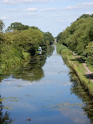
The canal and the railway run along the northern edge of Slough. Then, the canal turns north and ends at Stoke Road. Most of the canal's route, except for the last mile, feels very rural and peaceful.
Places of Interest
| Point | Coordinates (Links to map resources) |
OS Grid Ref | Notes |
|---|---|---|---|
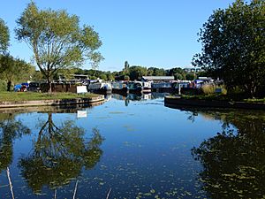
| Slough basin | 51°31′02″N 0°35′21″W / 51.5172°N 0.5892°W | SU979807 | The very end of the canal |
| A412 Uxbridge road bridge | 51°30′47″N 0°34′26″W / 51.5131°N 0.5740°W | SU990803 | A road bridge over the canal |
| M25 motorway bridge | 51°30′50″N 0°30′05″W / 51.5140°N 0.5014°W | TQ040805 | The M25 motorway crosses here |
| Cowley Peachey junction | 51°31′03″N 0°28′49″W / 51.5175°N 0.4802°W | TQ055809 | Where the Slough Arm meets the Grand Union Canal |
 | Georgia Louise Harris Brown |
 | Julian Abele |
 | Norma Merrick Sklarek |
 | William Sidney Pittman |


