Cowley, London facts for kids
Quick facts for kids Cowley |
|
|---|---|
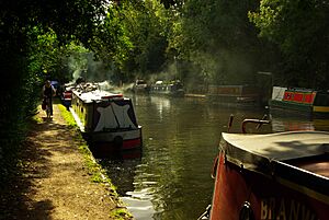
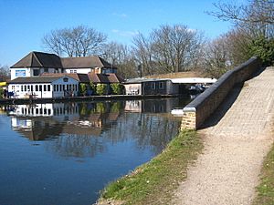 The Water's Edge restaurant, Cowley Peachey |
|
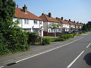 Cowley |
|
| Population | 8,776 |
| OS grid reference | TQ055825 |
| • Charing Cross | 15.4 mi (24.8 km) E |
| London borough | |
| Ceremonial county | Greater London |
| Region | |
| Country | England |
| Sovereign state | United Kingdom |
| Post town | UXBRIDGE |
| Postcode district | UB8 |
| Dialling code | 01895 |
| Police | Metropolitan |
| Fire | London |
| Ambulance | London |
| EU Parliament | London |
| UK Parliament | |
| London Assembly |
|
Cowley is a village right next to the town of Uxbridge in the London Borough of Hillingdon. It's mostly a quiet, residential village with many old, important buildings. Cowley is about 15 miles west of central London. On its west side, you'll find green spaces like Uxbridge Moor and the Green Belt and the River Colne, which forms the border with Buckinghamshire. Cowley used to be an old parish in the historic county of Middlesex.
Contents
- What's in a Name? The History of Cowley's Name
- Cowley Through Time: A Look at Its History
- The Industrial Revolution: New Industries and Transport
- Cowley's Landscape: Geology and Geography
- Important Places: Landmarks in Cowley
- Getting Around: Transport in Cowley
- Famous Faces: Notable People from Cowley
What's in a Name? The History of Cowley's Name
Have you ever wondered where the name Cowley comes from? It's thought to come from an old Anglo-Saxon phrase, Cofenlea, which means "Cofa's woodland clearing." The very first time Cowley was written down was in the year 959.
Cowley Through Time: A Look at Its History
The Medieval Period: Early Days of Cowley
The church of St. Laurence was first mentioned in the year 1086, in a famous book called the Domesday Book. This book listed all the land in England. At that time, Westminster Abbey owned land in Cowley. The land was worth two pounds a year in 1066, which was a lot of money back then!
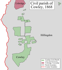
Cowley was surrounded by a larger area called Hillingdon parish. The town of Uxbridge and Uxbridge Moor were also part of Hillingdon. These areas separated Cowley from Buckinghamshire in the west. Today, part of the Moor is where the M25 motorway runs.
The borders of Cowley were quite mixed up with Hillingdon. Some parts of Cowley were even completely separate from the main village. This happened because Cowley was once a smaller part of a bigger estate in Hillingdon.
In the west, along the main road between Uxbridge and Yiewsley, you would find a village called Cowley Street. This area, along with the church area, was where most people lived in Cowley. There were also a few houses in what is now called Cowley Peachey, which is the southern part of Cowley. In 1252, a man named Bartholomew Peche was given the right to use the land owned by Westminster Abbey in Cowley. His family held the land for over a hundred years, and by 1358, the area became known as Couele Peche, or Cowley Peachey.
Changes After the Reformation and New Borders
Before 1882, Cowley parish was about 300 acres in size. It had a very unusual shape, mostly south of Uxbridge. It stretched between Frays River (which was the county border) in the west and the River Pinn in the east.
In 1796, a big change happened when Cowley Field was divided up. This helped to combine the areas of Hillingdon and Cowley. As a result, Cowley gained several new pieces of land. Some of these new areas were connected to the church part of the parish and to Cowley Street by new roads.
In 1547, there were 36 people living in the parish. By 1719, the population grew to 109, and in 1801, it reached 214. Because homes were spread out, people didn't always feel like a strong community.
The Industrial Revolution: New Industries and Transport
The Grand Junction Canal: A Waterway for Trade
On November 3, 1794, the Grand Junction Canal opened. This canal connected the River Thames at Brentford to Uxbridge, passing along the western side of Cowley Peachey and Cowley Street. Building the canal started in May 1793.
By July 10, 1801, a part of the canal called the Paddington Arm opened. This meant that special boats called "packet boats," pulled by four horses, could travel from Paddington Basin in London all the way to Cowley Peachey. Places like Packet Boat Lane and the old Paddington Packet Boat pub (which opened in 1804) remind us of this time.
Cowley Stock Bricks: Building the Future
The new canal helped the brick-making industry grow in Cowley. In December 1810, land was offered for rent that had enough clay to make millions of bricks! In 1811, a special branch of the canal called Cowley Hall Dock was opened to serve the Cowley Hall Brick-Field. Between March and October 1814, four million bricks were delivered from this brick-field. Because of this early success, the bricks made in West Middlesex became known as "Cowley Stock Bricks."
The Great Western Railway: Connecting Cowley
In 1856, a Great Western Railway branch line opened. This railway ran between West Drayton station and Uxbridge Vine Street Station. The railway helped Cowley become a place for market gardens and nurseries, which grew fresh flowers for markets in London.
Even though the railway ran through Cowley, a station wasn't built there until 1904. Cowley railway station closed in 1962 because fewer people were using it. Station Road today reminds us of where the old station used to be.
Cowley remained a mostly rural village until after World War I. In 1891, the population was 322. By 1901, it had grown to 869, and by 1931, it was 1,170. In the 1930s, many more houses were built, and by 1951, the population was 3,687. Even more houses were built until 1965, with the local council providing nearly 1,000 homes by 1959.
Cowley became part of the Uxbridge urban district in 1929 and part of the Uxbridge civil parish in 1937.
Cowley's Landscape: Geology and Geography
What is Cowley's Soil Like?
The soil in Cowley, between the Pinn and Colne rivers, is known as "brick-earth." This type of soil is fertile and allows water to pass through it fairly well. East of the River Pinn, the soil is mostly London clay and gravel. Modern studies describe Cowley's soil as "slowly permeable seasonally wet acid loamy and clayey soil."
Where is Cowley Located?

Cowley sits on a ridge that slopes down towards the southwest. It's about 28 to 45 meters above sea level. It's a village that connects directly to Uxbridge in the north. To the west, it's bordered by the Metropolitan Green Belt, the River Colne, and Buckinghamshire. To the south, the River Pinn forms its boundary with Yiewsley, and to the east, it borders Hillingdon.
Cowley has two special conservation areas: Cowley Lock and Cowley Church (St Laurence). Cowley Lock was named a conservation area in 1975. It includes Old Mill Lane, Cowley Lake, and the Packet Boat Lane area. Cowley Church (St. Laurence) Conservation area was named in 1988 and includes the Church and nearby buildings like Manor Farm.
Little Britain Lake: A Natural Gem
Little Britain Lake is located in the west of Cowley. It stretches for about 450 meters between the River Colne and another channel of it called Frays River. The lake is part of the Colne Valley Regional Park conservation area. It's known for its interesting water birds, like gadwall and great crested grebe, as well as common birds like mute swan and grey heron.
Important Places: Landmarks in Cowley
Cowley has several old buildings that are still standing. Most of the 15 architecturally listed buildings in Cowley are here, meaning they are protected because of their special history or design. The main lecture building of Brunel University is also a listed building.
Cowley House and Manor Farm are among the most important buildings for their architecture and history. On the High Street, you can find Old Vine Cottage, The Crown pub, and Maygood's Farm, which all date back to before 1700. There are also several 18th-century houses. In Cowley Peachey, there are two timber-framed houses. The Old Cottage might be from the 15th or early 16th century. The Malt Shovel pub in Iver Lane is also a Grade II listed building.
St Laurence Church: A Historic Place of Worship
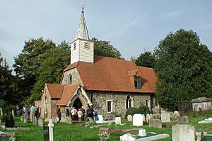
St Laurence Church is considered the most important building in Cowley for its architecture, listed at Grade II*. This church has been around since the 12th century and was once the smallest Parish Church in Middlesex. It stands near the River Pinn.
Brunel University: A Hub for Learning
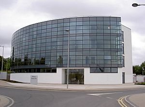
The main "Uxbridge campus" of Brunel University is located in the northeast part of Cowley.
Getting Around: Transport in Cowley
Nearest Tube Station
- Uxbridge (Metropolitan and Piccadilly lines) is about 1.3 miles away.
Nearest Railway Stations
- West Drayton is about 1.1 miles away.
- Iver is about 1.9 miles away.
Buses
The 222 Metroline London buses route also serves Cowley. This bus provides connections to Uxbridge, Yiewsley, and Hounslow.
Famous Faces: Notable People from Cowley
- Roger Williams (1603–1683) was born in Cowley. He was important for supporting religious freedom and the idea of keeping church and state separate.
- Barton Booth (1681–1733), a very famous actor from the early 1700s, lived and is buried in Cowley.
- John Rich (1692–1761), known as the "father of English pantomime" (a type of musical play), lived in Cowley.
- The botanist John Lightfoot (1735–1788) lived in Uxbridge and is buried here.
- England footballer Jim Taylor (1917–2001) was born in Cowley.
- Racing driver Robin Widdows (1942–) was born in Cowley.
- Natasha Baker (born 1989) is a Para-equestrian and won two gold medals at the 2012 Summer Paralympics. She lives in Cowley. A postbox in Uxbridge was painted gold to celebrate her achievements!
 |
across Uxbridge Moor and the M25 motorway Iver Heath (village) |
Uxbridge | across Brunel University and Hillingdon Golf Course North Hillingdon |
 |
| across Uxbridge Moor and the M25 motorway Iver |
Hillingdon | |||
| across Thorney and the M25 motorway Richings Park |
Yiewsley | Yiewsley |
 | John T. Biggers |
 | Thomas Blackshear |
 | Mark Bradford |
 | Beverly Buchanan |


