Uxbridge facts for kids
Quick facts for kids Uxbridge |
|
|---|---|
|
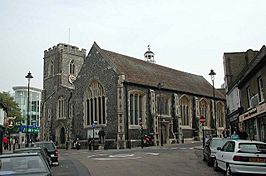
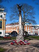
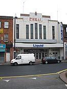
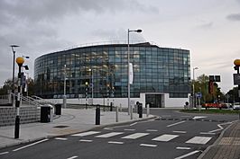
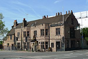
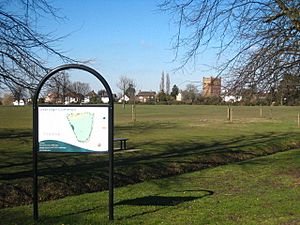
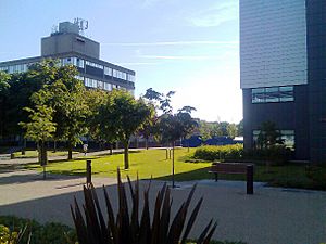
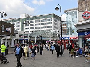
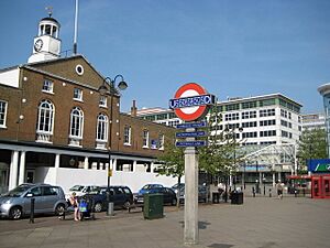
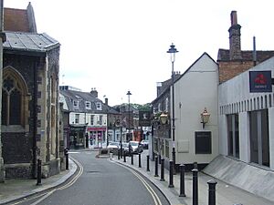
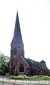
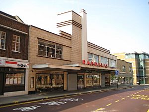
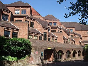
Clockwise from top: St Margaret's Church; The listed Regal Cinema building; Brunel University; Uxbridge War Memorial
|
|
| Population | 70,560 (2011 Census) |
| OS grid reference | TQ055835 |
| • Charing Cross | 15 mi (24 km) ESE |
| London borough | |
| Ceremonial county | Greater London |
| Region | |
| Country | England |
| Sovereign state | United Kingdom |
| Post town | UXBRIDGE |
| Postcode district | UB8 |
| Dialling code | 01895 |
| Police | Metropolitan |
| Fire | London |
| Ambulance | London |
| EU Parliament | London |
| UK Parliament | |
| London Assembly |
|
Uxbridge is a town in west London, England. It is the main office area for the London Borough of Hillingdon. The town is about 15.4 miles (24.8 km) northwest of Charing Cross in central London.
Uxbridge used to be part of the Hillingdon area in Middlesex. In the 20th century, London grew a lot. Uxbridge grew too and became a special town in 1955. In 1965, it became part of Greater London.
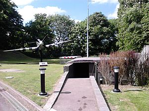
During the English Civil War, King Charles I and the Parliamentary Army tried to talk things out in Uxbridge. This happened at a place called the Crown and Treaty. RAF Uxbridge was also very important. It had the Battle of Britain Bunker. From here, people managed the air defence of south-east England during the Battle of Britain. This bunker was also used during the D-Day landings.
Today, Uxbridge is a busy place for shops and businesses. It is home to Brunel University London and a campus of Buckinghamshire New University. A part of the town has old flour mills. It is next to Buckinghamshire, with the River Colne as the border.
In 2011, about 70,560 people lived in Uxbridge.
Contents
Discovering Uxbridge's Past
What's in a Name?
The name Uxbridge comes from "Wixan's Bridge". This bridge was near where Oxford Road is now, close to the Swan and Bottle pub. The Wixan were a Saxon tribe from the 7th century. They came from Lincolnshire and settled in what became Middlesex. Anglo-Saxons started living and farming in Uxbridge in the 5th century. They cleared away many trees. Two other places in Middlesex were also named after the Wixan: Uxendon and Waxlow.
Archaeologists found old things from the Bronze Age (before 700 BC) when building The Chimes shopping centre. Even older remains were found nearby in Denham. Uxbridge is not mentioned in the Domesday Book from the 11th century. But about 100 years later, St Margaret's Church was built. The town's name first appeared in records in 1107 as "Woxbrigge".
Early Days and Key Events
In 1642, the Parliamentary Army stayed in Uxbridge during the English Civil War. They made it their main base in 1647. King Charles I visited Uxbridge in 1646. He rested at the Red Lion pub. In 1645, King Charles I met with Parliament's representatives at the Crown Inn in Uxbridge. They tried to end the war, but the talks failed. Uxbridge was chosen because it was between the King's base in Oxford and Parliament's base in London.
The covered market was built in 1788. It replaced an older building from 1561. In the early 1800s, Uxbridge was known for its flour mills. Most of London's flour came from this area for about 200 years.
The Grand Junction Canal opened in 1794. This canal connected Uxbridge to Birmingham and the River Thames at Brentford. By 1800, Uxbridge was a very important market town in Middlesex. It was the first stop for coaches traveling from London to Oxford. But when the Great Western Railway opened in 1838, Uxbridge's growth slowed down. A train line to Uxbridge opened in 1856. Then, the Metropolitan Line opened in 1904. This line gave Uxbridge a direct link to London and helped the town grow again.
Harman's Brewery started in Uxbridge in 1763. It moved to a new main office in 1875. The company that owned it later, Courage, closed the office in 1964. The building was taken down and replaced by a supermarket. The brewery building itself was removed in 1967. An office building called Harman House was built there in 1985, named after the brewery.
How Uxbridge Grew and Changed
In 1819, Uxbridge Common, a large open space, was made smaller. It used to be about 4 miles (6.4 km) around.
In 1871, the town's first police station was built. It had three cells and stables. The Metropolitan Police used it until 1988. The building later became a pub.
In the early 1900s, Uxbridge got electricity. Most of the town had power by 1902. A water tower was built on Uxbridge Common in 1906. It looked like a church tower and helped improve the town's water supply.
Wood panels from the Crown & Treaty pub were sold in 1924. An American businessman put them in his office in the Empire State Building in New York. In 1953, they were given back to Queen Elizabeth II as a gift. The panels were returned to the pub, but the Queen still owned them.
On August 31, 1935, the Uxbridge Lido opened. This was an outdoor swimming pool built in the Art Deco style. Before it opened, many people swam in the nearby Frays River or Colne. The pool and its buildings became special listed buildings in 1998. The pool closed for a while but was fixed up in 2009. It reopened in May 2010. The site is now called Hillingdon Sports and Leisure Complex. It has an indoor pool, a gym, an athletics track, and more.
During World War II, Uxbridge helped pay for a Royal Navy ship called HMS Intrepid. The town also faced bombing by the Luftwaffe. V1 flying bombs fell on Uxbridge from June 1944 to March 1945. The first V1 bomb hit four houses, killing seven people. In total, 79 people in the Uxbridge area died because of enemy attacks during the war.
In 1958, a large plant nursery called Lowe & Shawyer closed down. It was the biggest producer of cut flowers in the country. In 1962, the nursery was taken down. Brunel University was built there. The university opened in 1966.
The Uxbridge Cricket Club moved in 1971 to make way for the new Civic Centre. The club moved to Uxbridge Common. The Market Square shopping area was built in the late 1970s. It was later covered with a roof and became the Pavilions Shopping Centre.
The Chimes shopping centre was built next to Uxbridge station in 2001. It included some old buildings. The name "The Chimes" refers to the bells from the nearby market house. An Odeon cinema opened there.
In 2002, the dry ski slope near Uxbridge Lido closed. It had been built in 1977. The area was left to return to nature.
Work began in 2008 to fix up and expand Uxbridge Lido. It reopened in February 2010 as the Hillingdon Sports and Leisure Complex. In September 2010, the Lido celebrated its 75th birthday.
How Uxbridge is Governed
Uxbridge was first known as a small church area within the larger Hillingdon parish. In 1827, the town centre became its own parish. Later, two more parishes were added: Saint John in 1838 and Saint Andrew in 1865.
In 1866, Uxbridge got its own local council. In 1894, it became an Urban District. In 1955, it became a special municipal borough. This lasted for ten years. Then, in 1965, Uxbridge became part of the new London Borough of Hillingdon.
Uxbridge also had its own Member of Parliament (MP) from 1885 until 2010. After some changes, it became the Uxbridge and South Ruislip area. The current MP for this area is Danny Beales from the Labour Party.
Geography of Uxbridge
Uxbridge is about 40 meters (130 feet) above sea level. Like most of the UK, it has a mild climate. This means the temperatures are not too extreme.
The land around Uxbridge has not changed much since ancient times. It used to be covered with oak and elm trees. Early settlers slowly cleared these trees. Digs by the Museum of London found tools from ancient hunters and animal bones.
The River Pinn flows through Uxbridge. It goes through the old RAF Uxbridge site and Brunel University. It then joins the Frays River. The Frays River branches off the River Colne. It forms the border between Uxbridge and Buckinghamshire.
Uxbridge is about 15.4 miles (24.8 km) from Charing Cross in Central London. It is also close to other towns like Hayes, Ruislip, Northolt, Slough, and High Wycombe.
People of Uxbridge
Here's a look at the types of homes in Uxbridge and nearby areas, based on the 2011 Census:
| Ward | Detached | Semi-detached | Terraced | Flats and apartments |
|---|---|---|---|---|
| Brunel | 17.1% | 32.0% | 21.8% | 29.2% |
| Harefield | 15.4% | 37.9% | 23.8% | 22.7% |
| Hillingdon East | 5.9% | 34.2% | 45.1% | 14.7% |
| Ickenham | 45.3% | 40.3% | 5.0% | 9.4% |
| Uxbridge North | 30.1% | 28.5% | 15.1% | 26.2% |
| Uxbridge South | 7.8% | 30.3% | 20.7% | 40.6% |
In 2011, the population of Uxbridge North was 12,048. The population of Uxbridge South was 13,979. In Uxbridge North, most people (69.8%) were White British. The next largest group (19.5%) was Asian or Asian British. In Uxbridge South, White British people were also the largest group (62.1%). Asian or Asian British people made up 22.6% of the population.
For jobs, the biggest area of work in Uxbridge North was management.
People in Uxbridge North tend to live longer. Men there live about 77 years, while in Uxbridge South, it's 74 years. For women, it's 83 years in Uxbridge North and 81 years in Uxbridge South.
Faith in Uxbridge
In the 2011 census, most people in Uxbridge North (72.8%) said they had a religion. About 53% of them were Christian. Other religions included Muslim (6.7%), Sikh (6.2%), and Hindu (5.4%).
In Uxbridge South, 69.2% of people said they had a religion. The majority (46.4%) were Christian. Other religions included Muslim (13.4%), Hindu (5%), and Sikh (2.3%).
Churches in Uxbridge
St Margaret's Church
This is Uxbridge's oldest church. It is on Windsor Street. We know it has been there since at least 1245. The oldest part of the church was built in the late 1300s. The main part of the church dates from the early 1400s. The south side, with its beautiful roof, was added around 1450. The carved stone font (for baptisms) was put in the church around 1480. For most of its history, St Margaret's was a smaller church connected to St John the Baptist's Church in Hillingdon. It became its own parish church in 1827.
St Andrew's Church
By the 1850s, more people were living in Hillingdon and Uxbridge. A new church was needed for a newer part of town. Sir George Gilbert Scott designed the church. A local builder, William Fassnidge, built it. The foundation stone was laid on June 29, 1864. The church officially opened on May 1, 1865. The tall spire was finished the next year. The whole building cost about £12,000 back then.
Church of Our Lady of Lourdes and St Michael
After the Reformation in the 1500s, there was no official Catholic church in Uxbridge for a long time. In 1892, a temporary church was built. It was made of corrugated iron and named after Our Lady of Lourdes and St Michael. A school was also started. More people joined the church. In 1907, there were 150 members. Plans were made for a bigger, permanent church. The new church was built in Oxford Road. It was designed in the Romanesque style and could seat 350 people. It opened on September 29, 1931.
Faith Assembly, Uxbridge
The Redeemed Christian Church of God is located on Harefield Road. It holds modern, Pentecostal worship services.
Uxbridge's Economy
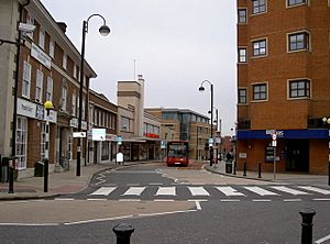
In 2012, Uxbridge had a lot of shop space. It has two main shopping centres: The Pavilions and The Chimes. Much of the town centre is for people walking, not cars. Windsor Street, a short street with older shops, is just off the High Street.
The town centre has many shops and offices. Big international companies like Coca-Cola European Partners, Cadbury, and Xerox have offices here. Other companies include General Mills, PAREXEL, and Bristol-Myers Squibb.
Many people who live in the London Borough of Hillingdon travel to Uxbridge for work. Only a small number of people who work in Uxbridge also live there.
In 2005, Uxbridge was ranked 9th in London for how much money people spent in its shops.
A famous building on Vine Street used to be Randalls. This department store was built in 1939 in the Art Deco style. It closed in January 2015.
Learning in Uxbridge
Uxbridge has several primary schools. These include Hermitage Primary School, St Andrew's Church of England Primary School, St Mary's Catholic Primary School, Whitehall Infant School, and Whitehall Junior School. Uxbridge High School is a large secondary school in the town.
Uxbridge is also home to Brunel University. Buckinghamshire New University has a nursing campus here too. The main campus of Uxbridge College is also in the town.
Getting Around Uxbridge
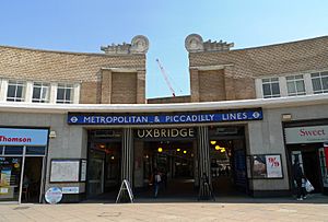
Uxbridge tube station is the last stop for some Metropolitan and Piccadilly trains on the London Underground. The station was built in 1933. It is connected to a bus station. From here, you can get buses to Hillingdon, Hayes, Ealing, Ruislip, and Slough.
Uxbridge used to have two train lines from the Great Western Railway. These ended at Uxbridge Vine Street and Uxbridge High Street. The High Street station closed in 1939. The Vine Street line closed to passengers in 1962.
The B483 road connects Uxbridge centre to the A40. Uxbridge is also connected by main roads to Slough, Denham, and Hayes.
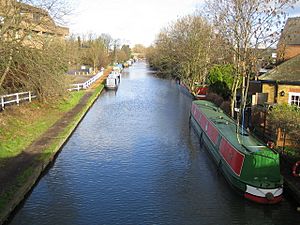
The Grand Union Canal passes just west of Uxbridge. It connects London to Birmingham. The first part of the canal was built in the late 1700s. There is a lock nearby called Uxbridge Lock. There is also an old flour mill that used to be called "Kingsmill". The Kingsmill brand of bread is still used today.
Many London Buses routes serve Uxbridge. These include routes 222, 331, 427, 607, A10, and several "U" routes. Other bus companies also run routes through Uxbridge.
A plan for a West London Tram was put on hold in 2007. Now, bus services cover that route.
Famous Places in Uxbridge
Hillingdon Civic Centre
The Hillingdon Civic Centre was built in Uxbridge High Street in 1973. This building brought together all the council services. Before this, the council's offices were spread out. Part of the old Middlesex County Council office building was used in the new Civic Centre. The clock tower is the only part of the old building you can still see. The Uxbridge Cricket Club and fire station moved because of this new building.
Uxbridge Magistrates' Court
The original Magistrates' Court opened in 1907. It was built in the Edwardian style. A new court building opened nearby in the 1990s. Legal cases are now heard there.
RAF Uxbridge and the Battle of Britain Bunker
Uxbridge used to have a Royal Air Force station called RAF Uxbridge. It closed on March 31, 2010. The station was built on the land of Hillingdon House, a large house from the 1800s. This station became the home of RAF Fighter Command's No. 11 Group Operations Room during the Battle of Britain. From here, fighter planes in south-east England were told where to go. Prime Minister Winston Churchill visited the station during the battle.
After the station closed, a replica Supermarine Spitfire plane was moved to the entrance of the Operations Room. This room is now called the Battle of Britain Bunker. Another plane, a Hawker Hurricane, was added in 2010.
Sports and Fun in Uxbridge
Uxbridge has a football team called Uxbridge F.C.. They play at Honeycroft in Yiewsley. Uxbridge Cricket Club is also in Uxbridge. They are part of the Middlesex County Cricket League. The Hillingdon Sports and Leisure Complex was updated in 2010. It has indoor and outdoor swimming pools, an athletics track, and a big sports area. The South Korean Olympic Team trained here for the 2012 Olympic Games.
Nearby Areas
 |
Denham, Gerrards Cross | Denham Country Park, South Harefield | North Hillingdon, Ickenham, Ruislip |  |
| Iver Heath, Black Park Country Park | North Hillingdon, Northolt Aerodrome, Northolt | |||
| Iver Heath | Cowley, Yiewsley, West Drayton | Hillingdon, Hayes |
Famous People from Uxbridge
- Charles Brown (1827–1905), an engineer and inventor, was born in Uxbridge.
- Annie Isherwood (1862–1906), a nun who started a community in Southern Africa, was born in Uxbridge.
- Bernard Miles (1907–1991), an actor, writer, and director, went to school in Uxbridge.
- Peggy Eileen Whistler (1909–1958), a poet and novelist, was born in Uxbridge.
- Joan Dowling (1928–1954), an actress, grew up in Uxbridge.
- John Stears (1934–1999), who created famous things like James Bond's Aston Martin and Star Wars robots, was born in Uxbridge.
- Christine Keeler (1942–2017), a model from the 1960s, was born in Uxbridge.
- Rianna Dean (born 1998), a footballer for Southampton, is also from Uxbridge.
See also
 In Spanish: Uxbridge para niños
 | John T. Biggers |
 | Thomas Blackshear |
 | Mark Bradford |
 | Beverly Buchanan |


