Ruislip facts for kids
Quick facts for kids Ruislip |
|
|---|---|
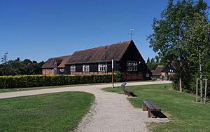 Ruislip library at Manor Farm, Ruislip |
|
| Population | 58,217 (2011 Census |
| OS grid reference | TQ0887 |
| • Charing Cross | 14 mi (23 km) ESE |
| London borough | |
| Ceremonial county | Greater London |
| Region | |
| Country | England |
| Sovereign state | United Kingdom |
| Post town | RUISLIP |
| Postcode district | HA4 |
| Dialling code | 01895 |
| Police | Metropolitan |
| Fire | London |
| Ambulance | London |
| EU Parliament | London |
| UK Parliament |
|
| London Assembly |
|
Ruislip (pronounced RY-slip) is a lively suburb located in West London. It is part of the London Borough of Hillingdon. Before 1965, Ruislip was in a different area called Middlesex. It is about 14 miles west-north-west of Charing Cross, which is a famous spot in central London.
Ruislip has a long history, with its name appearing in the ancient Domesday Book. Some of its oldest settlements are still here today. The local church, St Martin's, was built way back in the 13th century and is still used. The buildings at the top of Ruislip High Street are the heart of the old village square. They are now protected as important historical sites.
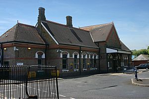
The arrival of the Metropolitan Railway in the early 1900s helped Ruislip grow a lot. Ruislip station opened in 1904. This led to a new local government area being formed to manage the growing population. Ruislip became part of the London Borough of Hillingdon in 1965.
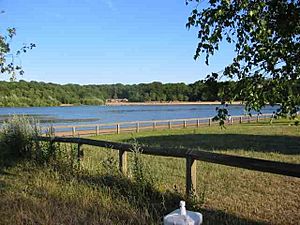
Important places in Ruislip include Ruislip Lido, which used to be a reservoir. Now, it is a public park with its own miniature railway. Another key spot is Manor Farm, a very old settlement from the 9th century. Ruislip is represented by two Members of Parliament (MPs) in the UK Parliament.
Contents
Ruislip's Past: A Journey Through Time
How Ruislip Got Its Name
Long ago, around the time of King Edward the Confessor, a Saxon named Wulfward White owned the lands of Ruislip and Ickenham. Ruislip parish was much larger then, including areas like Northwood and Eastcote. After the Norman conquest of England, a Norman lord named Arnulf de Hesdin took control of Ruislip. This was recorded in the 1086 Domesday Book.
The name Ruislip comes from Old English words. It is thought to mean 'leaping place on the river where rushes grow'. This refers to the River Pinn that flows through the area. The Domesday Book entry for Ruislip described it as a large area with land for farming, pastures for animals, and woodlands. It also mentioned a priest, villagers, smallholders, and even some Frenchmen living there.
Ruislip was valued at £30 before the Norman Conquest. But its value dropped to £12 when Arnulf de Hesdin took over. This was probably because the Norman army took crops as they passed through. This led to buildings being built at Manor Farm to protect the food.
In 1087, Arnulf de Hesdin gave Ruislip to the Benedictine Bec Abbey before he went to fight in the Holy Lands. He died fighting, and his memory is still honored today. Ruislip was an ancient parish in the historic county of Middlesex.
Early Buildings and Life
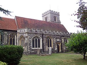
The local church, St Martin's, was built in the mid-13th century. It is believed an even older church stood there during the Norman period. The monks from Bec Abbey likely named it after Martin of Tours, a saint from Normandy.
The current church was built because the population was growing. The first known vicar was William de Bermington in 1327. The church has been changed over the years and was largely restored in 1870. It is now a Grade II listed building, meaning it is protected for its historical importance.
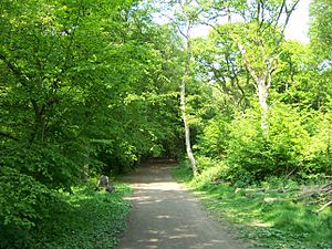
Under the Bec Abbey's ownership, wood from Ruislip's forests – Park Wood, Mad Bess Wood, and Copse Wood – was used for famous buildings. This included the Tower of London in 1339, Windsor Castle in 1344, and the Palace of Westminster in 1346. The woods were managed carefully, and timber was also sold to local businesses.
How Ruislip Grew
In 1812, Bishop Winnington Ingram School was started in Eastcote Road. It had 111 students by 1845.
The Metropolitan Police started looking after Ruislip in 1845. By 1869, they had a police station in the High Street. A new station was built in 1961.
In 1863, the White Bear pub became part of Harman's Brewery. It was near Primrose Hill Farm. Kings End, a small group of houses, was named after a family who lived there in the 16th century.
A well was dug in the High Street in 1864 to provide water. In 1898, during a dry spell, another well was created near the Pinn Meadows to use a natural spring.
By 1903, Northwood had grown a lot, but most of Ruislip was still countryside. The local council knew the Metropolitan Railway was extending its line from Harrow on the Hill to Uxbridge, with a new station planned for Ruislip. They also knew that King's College, Cambridge, who owned much of the land, planned to sell some for building. Because of this, the council decided Ruislip should become an "urban district" to manage the expected growth better.
The first train on the new railway line ran on June 30, 1904. Ruislip station opened on July 4. The area became popular with people who loved walking and day-trippers wanting to enjoy the countryside. Local residents opened tea gardens for visitors. For example, The Poplars, a beautiful Georgian house, opened a tea garden. It was later taken down in 1929 to make way for shops. The Orchard Bungalow also opened and later became The Orchard Hotel.
The new urban district was officially formed on September 30, 1904. It included Ruislip, Ruislip Manor, South Ruislip, Eastcote, and Northwood.
King's End became a residential street in the early 1900s, with the first new homes finished by 1907.
The area's population grew very quickly, from 6,217 in 1911 to 72,791 in 1961. This was mainly due to the railway extension, which led to many new houses being built. Because of this fast growth, Ruislip was one of the first places in England to create a special planning scheme in 1914. This helped control how new buildings were put up.
The council worked with King's College to plan new building areas. A competition was held, and a design by A & J Soutar won. Their plan was to create a symmetrical layout across Ruislip. Many woods and historic sites like Manor Farm were originally planned to be removed for 7,642 new homes. Only St. Martin's Church would have been saved. However, only three roads were built before World War I stopped construction.
Luckily, Manor Farm and the local woods were saved from demolition in January 1930. The Great Barn and Little Barn, along with other old buildings, were chosen to be preserved. The local council bought the woods from King's College in February 1931. Park Wood was bought for £28,100, and Manor Farm and the old post office were given as a gift to the people of Ruislip. The council agreed to look after the woods and not build anything new without permission.
Copse Wood and Mad Bess Wood were also bought by the county councils in 1936 to protect them.
In 1946, a plane taking off from Northolt Aerodrome crashed into a house in Angus Drive, Ruislip. Luckily, no one was seriously hurt. In 1948, another plane crashed near Ruislip while trying to land, and one crew member sadly died.
In 1961, the Portland spy ring was discovered. Peter and Helen Kroger, who lived in Ruislip, were found to be involved. They were arrested, and secret items like codes and film were found hidden in their home. A radio transmitter was found in their garden years later.
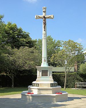
Many old farms in Ruislip were taken down to build new houses in the 1960s and 70s. The war memorial was moved to the entrance of Manor Farm in 1976.
In 1984, the Battle of Britain House, built in Copse Wood, was destroyed by fire. It had been a college and a memorial to the Royal Air Force squadrons involved in the Battle of Britain.
In 2007, work began to restore the Manor Farm site. This work was finished in 2008 and included fixing up the old library. The Duck Pond Market started in the Great Barn in December 2008 and is held regularly.
Ruislip's Population Growth
Between 1911 and 1961, the population of Ruislip-Northwood grew a lot. This was mainly because of the railway extension, which encouraged more people to move to the area.
| 1881 | 1,455 |
|---|---|
| 1891 | 1,836 |
| 1901 | 3,566 |
| 1911 | 6,217 |
| 1921 | 9,112 |
| 1931 | 16,042 |
| 1941 | war* |
| 1951 | 68,288 |
| 1961 | 72,791 |
| * no census was held due to war | |
| source: UK census | |
In 2011, the total population of the five areas that make up Ruislip was 58,217 people.
Learning in Ruislip: Schools and Education
Ruislip has several primary schools for younger students. These include Bishop Winnington Ingram Church of England Primary School, Lady Bankes Infant School, Lady Bankes Junior School, Warrender Primary School, Whiteheath Infant School, and Whiteheath Junior School.
For older students, the secondary schools in Ruislip are Bishop Ramsey School and Ruislip High School.
Sports and Recreation in Ruislip
Ruislip is home to a few sports clubs. The Non-League football club Hillingdon Borough F.C. plays at the Middlesex Stadium. Another non-league club, Wealdstone FC, has been based at the Grosvenor Vale Stadium since 2008. This stadium was also home to Ruislip Manor F.C. for many years until the club closed.
Ruislip Rugby Club was formed in 1954 and has its ground on West End Road. Ruislip Golf Course, located on Ickenham Road, opened in 1922. Eastcote Hockey Club is also based in Ruislip, at Kings College playing fields.
Getting Around Ruislip: Transport Links
London Underground Stations
Ruislip is well-connected by the London Underground, also known as the Tube. Here are the stations in the area:
- South Ruislip station (on the Central line and Chiltern Railways)
- Ruislip station (on the Metropolitan line & Piccadilly line)
- Ruislip Manor station (on the Metropolitan line & Piccadilly line)
- Ruislip Gardens station (on the Central line)
- West Ruislip station (on the Central line & Chiltern Railways)
London Buses
Many London Buses routes serve Ruislip, helping people travel around the area and to other parts of London:
| Route | Start | End | Operator |
| 114 | Mill Hill Broadway station | Ruislip | Metroline |
| 278 | Ruislip station | Heathrow Central bus station | Transport UK London Bus |
| 331 | Ruislip | Uxbridge | Metroline |
| 398 | Ruislip | Wood End | London Sovereign |
| 696 | Bishop Ramsey School | Hayes | London United |
| E7 | Ruislip | Ealing Broadway | Transport UK London Bus |
| H13 | Ruislip Lido | Northwood Hills | Metroline |
| U1 | Ruislip | West Drayton | Metroline |
| U10 | Uxbridge | Ruislip | Metroline |
Famous Places in Ruislip
The Village Square
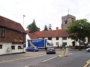
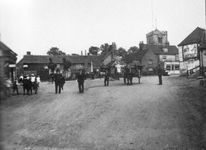
The buildings at the northern end of Ruislip High Street, including Nos 1 to 15, the Duck House restaurant, and the Swan pub (now Cafe Rouge), are the heart of the old village. They are all Grade II listed, meaning they are historically important. This area was once the village square, where the High Street, Bury Street, and Eastcote Road meet. A water pump was placed in the center of the square in 1864. It was later moved in the 1970s and again in 1982.
Manor Farm: A Historic Site
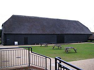
North of Ruislip High Street is the 22-acre Manor Farm site. It holds the remains of settlements that date back to the 9th century. It also has buildings like the Great Barn, which was built around 1280. Manor Farm was a working farm until the 1930s. It is now a local heritage site and was restored between 2007 and 2008.
Ruislip Lido: Lake and Miniature Railway
Ruislip Lido is a 19th-century reservoir with an artificial sand beach. It is surrounded by woodlands. Through these woods runs the Ruislip Lido Railway, a miniature railway with diesel and steam trains. The Lido was created in 1811 to supply water to the Grand Union Canal. It was not very successful for the canal, so it was turned into a fun resort in 1933.
The Orchard Hotel
When the Metropolitan Railway came to Ruislip, many visitors arrived. Albert Cross built a small bungalow where he served tea to these day-trippers. This became very popular, and he expanded it into the Orchard Hotel. It later became a well-known restaurant and now includes a Premier Inn hotel. During the Battle of Britain, the Orchard Hotel was a favorite spot for the pilots of No. 303 Polish Fighter Squadron from RAF Northolt. They would celebrate their victories there.
Famous People from Ruislip
- Stuart Olof Agrell (1913–1996), a mineralogist, was born in Ruislip.
- Mary Bankes (c. 1598–1661), a Royalist figure, lived in Ruislip. Lady Bankes Infant and Junior School are named after her.
- Paul Burwell (1949–2007), an experimental musician, was born in Ruislip.
- Conn Iggulden, a famous author, went to Sacred Heart Roman Catholic Primary School.
- Poet Peter Levi (1931–2000) was born in Ruislip.
- Actress Lana Morris (1930–1998) was born in Ruislip.
- Author Leslie Thomas wrote about Ruislip in his novel Tropic of Ruislip.
- Fred Tomlinson, a choral director and TV song composer, lived in Walnut Way.
- Actress Jessie Matthews (1907-1981) is buried in St Martin's graveyard.
- Actor Simon Fisher-Becker was born in Ruislip in 1961.
Ruislip in Pop Culture
Ruislip has appeared in films and TV shows.
- The 1967 film Poor Cow was set in Ruislip.
- The now-demolished Punch and Judy cafe on Ducks Hill Road was used for a sketch by comedian Dave Allen.
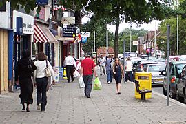
- Alvin Stardust filmed a Green Cross Code safety advert on Ruislip High Street around 1976.
- The children's TV show Come Outside featured Ruislip Manor library in an episode about buses.
- Episode 7 of series 7 of The Two Ronnies had a sketch called "Home Rule for Ruislip."
See also
 In Spanish: Ruislip para niños
 | Selma Burke |
 | Pauline Powell Burns |
 | Frederick J. Brown |
 | Robert Blackburn |


