Yiewsley facts for kids
Quick facts for kids Yiewsley |
|
|---|---|
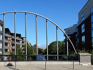
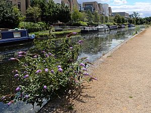 The Grand Union Canal in Yiewsley |
|
| Population | 12,979 (2011 Census. Ward) |
| OS grid reference | TQ0608880405 |
| • Charing Cross | 17.29 mi (27.83 km) E |
| London borough | |
| Ceremonial county | Greater London |
| Region | |
| Country | England |
| Sovereign state | United Kingdom |
| Post town | WEST DRAYTON |
| Postcode district | UB7 |
| Dialling code | 01895 |
| Police | Metropolitan |
| Fire | London |
| Ambulance | London |
| EU Parliament | London |
| UK Parliament | |
| London Assembly |
|
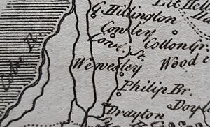
Yiewsley (pronounced YOOZ-lee) is a large village in the London Borough of Hillingdon, England. It's about 2 miles (3 km) south of Uxbridge, which is a big town and the main centre for the area. Yiewsley used to be a small part of the old Hillingdon parish in Middlesex. In 2011, about 12,979 people lived in the Yiewsley area.
Contents
- What's in a Name?
- Where is Yiewsley?
- How the Land Was Formed
- A Look Back in Time
- Community Services
- Schools in Yiewsley
- St Matthew's Church
- Fun and Activities
- Businesses in Yiewsley
- Getting Around
- Famous People from Yiewsley
What's in a Name?
Yiewsley isn't mentioned in the Domesday Book from 1086. Its name probably comes from an old Anglo-Saxon phrase, Wifeleslēah, which means "Wifel's woodland clearing." The first time Yiewsley was written down was in 1235, where it was called Wiuesleg.
Where is Yiewsley?
The western part of Yiewsley is inside the Colne Valley Regional Park. Here, the River Colne forms the border between the London Borough of Hillingdon and Buckinghamshire. The Frays River and River Pinn also meet in this area, and there are several lakes made by people.
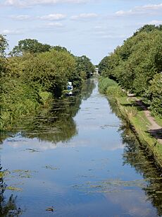
The Grand Union Canal comes through Yiewsley after climbing over the Chiltern Hills using 52 locks. It then turns east towards London. About half a mile north, the Slough Arm of the canal branches off. This part of the canal is five miles long and crosses over the Frays River and River Colne on special bridges called aqueducts.
To the east of Yiewsley is Stockley Country Park. This park has 274 acres of land with many walking paths.
Near Yiewsley, you'll find these places:
- To the west, across the River Colne, are the villages of Iver, Richings Park, and Thorney in Buckinghamshire.
- To the north, over the River Pinn, is Cowley Peachey.
- To the northeast are Hillingdon and the villages of Colham Green and Goulds Green.
- To the east is Stockley Park.
- To the south, across the Great Western Railway, is West Drayton.
How the Land Was Formed
Over thousands of years, the River Thames changed its path. It used to flow north of Yiewsley, then over the Yiewsley area itself. Today, it's about 4.8 miles (7.7 km) southwest of Yiewsley. As the Thames moved, it left behind layers of gravel, silt, sand, and loam. These layers are important because they contain valuable materials like "brickearth," which is a type of silt used for making bricks.
A Look Back in Time
Stone Age Discoveries
Early Human Tools
When people started digging for materials in Yiewsley in the 1800s, they found many ancient tools made by early humans. These tools were in the brickearth and gravel left by the Thames.
One of the first people to collect these tools was John Allen Brown (1833-1903), a geologist. He collected items between 1889 and 1901. The main collector was Robert Galloway Rice (1852-1933), who found over 2,600 items from Yiewsley between 1905 and 1929. In 1937, his collection of very old stone tools (from the Lower and Middle Palaeolithic periods) was given to the Museum of London.
In 1978, a scientist named Desmond Collins wrote that the Yiewsley sites are very important for archaeology:
- "The Yiewsley pits have given us one of the largest collections of early stone hand tools in Europe."
- "Yiewsley is special because it has stone tools from the Middle Palaeolithic (Mousterian) period, which means people lived here about 70,000 years ago. This was during the time of Neanderthals, and it's rare to find such clear evidence in Britain."
Bronze Age Burials
In 1913–1914, an ancient burial ground from the Bronze Age was found. People excavated 14 urns (pots) that held the ashes of people who had died. These urns and other Bronze Age items are now kept at the British Museum.
Anglo-Saxon and Viking Times
The Danes at Thorney Island (893 AD)
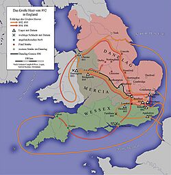
In the spring of 893, a Viking army was heading east after raiding parts of England. However, King Alfred's son, Edward, and his army (called the Fyrd) stopped them at Farnham in Surrey. The Danes were defeated and ran away, crossing the River Thames into Mercia, with Edward's army chasing them.
When they reached the River Colne, the Danes set up a defence on an area called Thorney Island. This island was likely between the Colne and another channel of the river, about half a mile west of Yiewsley High Street today. Edward's army surrounded the island. Æthelred of Mercia and soldiers from London joined him.
After a long standoff, which might have lasted up to six months, the Danes agreed to leave peacefully. They gave up hostages and promised to go straight to the lands controlled by Danes (known as the Danelaw) without any of their stolen goods.
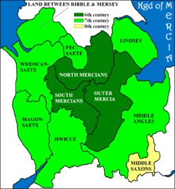
Yiewsley (or Wifeleslēah) was part of the Kingdom of Essex but later came under the control of Mercia. By the time of the siege in 893, eastern Mercia had been taken by the Danes. When Æthelred died in 911, Middlesex (where Yiewsley is) became part of Wessex, ruled by King Edward. Edward eventually united all of Mercia, helping to create a single kingdom of England.
From Norman Conquest to 1794
Hillingdon Parish and Colham Manor
For most of its history, Yiewsley was a small village within the area of St John the Baptist Church in Hillingdon. It was connected to Colham Manor. Before the Norman Conquest in 1066, Colham Manor belonged to Wigot of Wallingford. By 1086, it was owned by Roger de Montgomery, a key advisor to William the Conqueror.
In the late 1300s, farmers in Colham Manor mostly grew wheat, but also rye and oats. Any extra grain was sold in London or Uxbridge. By the 12th century, Uxbridge became the main market town for the Hillingdon area.
The many rivers and streams, like the River Colne, helped the Hillingdon area become a centre for flour milling. The Frays River was probably dug or changed by John Fray in the 1400s to power water mills. An 1842 map shows that the River Colne and Frays River powered eight corn mills in the area.
The oldest buildings in Yiewsley today are from the late 1500s or early 1600s. These include Yiewsley Grange (now Hillingdon Manor School) and the Six-bay Barn at Philpot's Yard. At the other end of the High Street is the De Burgh Arms Public House, named after the De Burgh family who owned Colham Manor from 1787.
The Industrial Age
The Grand Junction Canal (1794)
Yiewsley's farming way of life began to change when the Grand Junction Canal opened. Building started in 1793. The canal was designed to avoid many locks by following the natural shape of the land. It was dug through Yiewsley, then turned north to follow the River Colne. It even crossed over the Fray's River on an aqueduct near Cowley Lock.
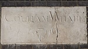
The canal opened between the River Thames and Uxbridge on November 3, 1794. Yiewsley's first dock, Colham wharf, opened in 1796. In 1801, the Paddington Arm of the canal opened, becoming a very important trade route to and from London.
Yiewsley's Brick Industry
The canal made it easy to transport "Cowley (or London) stock bricks," which were made from Yiewsley's rich "brick-earth" deposits. The first big sale of bricks in Yiewsley was in 1809. In 1820, a branch of the canal called Otter Dock opened. This became the longest of nine docks built in Yiewsley. They were used to ship out bricks and bring in coal from the Midlands to fire the brick kilns. The finished bricks were sent mainly to London.
By the 1890s, it's thought that 100 million bricks were made each year in West Middlesex, supplying London's building boom. Because so many bricks were made, the brick-earth deposits started to run out around 1900. The brickworks closed in 1935, but gravel and sand were still dug up until the 1970s.
The Great Western Railway
The Great Western Railway (GWR) started building in 1835. The line between Paddington and Maidenhead opened in 1838, with West Drayton as its first station. A GWR branch line to Uxbridge Vine Street was finished in 1856. West Drayton Station moved to its current spot in 1884. In 1895, the station was renamed West Drayton and Yiewsley station.
New Industries (Mid-1800s Onwards)
By the mid-1800s, Yiewsley's main industries were brick making and flour milling. But new businesses started to appear.
- The Victoria oil mills, making linseed cake, were set up before 1855.
- A chemical works opened by 1864.
- The Hillingdon Varnish works started by 1868.
- In the 1870s, companies made engines, boilers, and electrical equipment.
- An Indian rubber mill opened by 1894.
- By 1900, the Rotary Photographic Company was established.
- In 1903, the Power Plant Co started making gears and couplings. During World War I, they supplied steam turbines for the Royal Navy.
- By 1913, printing works were established.
- In 1916, the Onslow Cotton Mill and the West Drayton Glass Works opened.
- In 1918, Frederick Bird & Co made engineering products for the Army and Navy during the war.
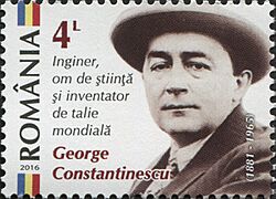
In 1920, the Admiralty Engineering Laboratory opened in Yiewsley. It focused on experiments for the Royal Navy. During World War I, a special "Sonic laboratory" was set up there to develop inventions by George Constantinescu.
Constantinescu created a special "Fire Control Timing Gear" (C.C. Gear) that allowed machine guns to fire through airplane propellers without hitting them. His system used waves in a fluid instead of mechanical parts, making it more reliable and faster. The first working C.C. gear was tested in August 1916 and was used on British aircraft from March 1917. It played a big part in helping Britain gain control of the skies during the war. In 1919, Queen Mary and Queen Marie of Romania visited the laboratory and praised Constantinescu's work.
In the 1920s, Trout Road became a centre for oil and chemical companies. Many smaller companies making chemicals, plastics, and engineering parts were set up around Trout Road, growing to over forty businesses in the area.
After World War II, two companies started making vehicles in Yiewsley: Road Machines made construction equipment, and James Whitson & Co made coaches and fire engines.
It's interesting that many early companies in Yiewsley used "West Drayton" as their business address, even if they weren't in West Drayton. This was probably because the railway station was called West Drayton Station from 1838, and businesses thought it was better for trade to use that name.
Railway Changes
By the 1960s, fewer people were using trains. The branch line to Uxbridge Vine Street was especially affected by competition from London Underground lines. Passenger services to Uxbridge stopped in 1962. The line to Staines closed to passengers in 1965 because of a report by Dr. Richard Beeching, which led to many railway line closures across Britain.
Another result of the "Beeching cuts" was that many station names were shortened. In 1974, "Yiewsley" was removed from the station name, so it became just "West Drayton" again after 79 years.
Yiewsley Today
Yiewsley is a growing community with homes and businesses. With the new Elizabeth line train service and local development plans, many new apartments have been built on old industrial sites. Yiewsley has a busy High Street with shops like Tesco, Iceland, and Aldi, as well as local businesses. Heathrow Airport is also a major source of jobs in the area.
Community Services
- Yiewsley Library is on Yiewsley High Street.
- P3 Navigator is an advice centre for young people on Fairfield Road.
- Yiewsley Health Centre on Yiewsley High Street includes The High Street Practice and the Yiewsley Family Practice.
- Otterfield Medical Centre is on Otterfield Road.
- West Drayton and Yiewsley Dental provides NHS dental care on Providence Road.
Schools in Yiewsley
Primary schools:
- St Matthew's CE Primary School
- Rabbsfarm Primary School
Secondary school:
- Park Academy West London
Special and Alternative schools:
- Hillingdon Manor School, Yiewsley Grange
- The Pride Academy
- The Skills Hub
St Matthew's Church
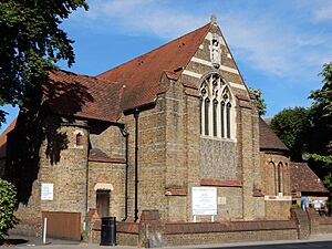
Until the mid-1800s, Yiewsley was part of the St John the Baptist church parish in Hillingdon. As Yiewsley's population grew, especially with the brick-fields opening, a new church was needed. St Matthew's Church was designed by Sir George Gilbert Scott and opened on July 6, 1859. Yiewsley became its own church parish in 1874.
As Yiewsley continued to grow, the church needed more space. Sir Charles Nicholson designed an expansion, and the enlarged church opened on April 25, 1898.
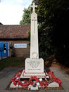
The Yiewsley War Memorial is in the grounds of St Matthew's Church. It was revealed on May 28, 1921, to honour the 128 men from the parish who died in World War I. Lady Delia Peel unveiled it, and her husband, Sidney Peel (Yiewsley's Member of Parliament), spoke at the ceremony. He said that out of Yiewsley's population of under 5,000, more than 530 men had served in the war. He hoped that in the future, people would bring their children to the memorial to remember their relatives and be inspired by their bravery.
On October 4, 2009, the memorial was rededicated to include the names of the 73 men from the parish who died in World War II. A ceremony with wreath-laying is held at the War Memorial every Remembrance Sunday.
Fun and Activities
- The Yiewsley and West Drayton Arts Council runs the Southlands Arts Centre in West Drayton. They organize events and support local artists, with exhibitions, music festivals, and groups for fine arts, photography, film, and music.
- Community events are held at Yiewsley's three churches: St Matthew's Parish Church, Yiewsley Baptist Church, and Yiewsley Methodist Church. Events also happen at the Yiewsley and West Drayton Community Centre.
- The Outline Community Theatre Company performs plays in the local area.
- The Hillingdon Theatre Dance Centre has its studio on Yiewsley High Street.
- The Yiewsley and West Drayton Band is a brass band started in 1890. They perform concerts and community events all year.
- The 1381 Squadron (West Drayton & Yiewsley) Royal Air Force Air Cadets are based in West Drayton.
- Yiewsley Recreation Ground is a park between Falling Lane and Yiewsley High Street.
- Stockley Country Park has many walking paths and an 18-hole golf course. The Gould Green Riding School offers horse riding lessons in the park.
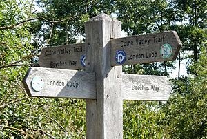
- Several long-distance walking routes, like the London Loop and the Grand Union Canal walk, pass through Yiewsley.
- Uxbridge F.C., one of the oldest football clubs in southern England, plays at Honeycroft on Horton Road.
- Thorney Weir and other lakes in Yiewsley offer coarse fishing.
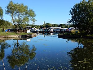
- The Grand Union Canal allows boating access to England's canal network. You can moor boats along the canal in Yiewsley. The nearest marina is Packet Boat Marina at Cowley Peachey.
Businesses in Yiewsley
Yiewsley's main business area is on and near Horton Road. There are over 70 businesses here, including John Guest, which makes "Speedfit" plumbing parts. Virtus, a data centre company, has the UK's largest data centre campus here. New Pro Foundries in Horton Close have even made the bronze BAFTA awards.
Getting Around
Trains
West Drayton railway station is at the southern end of Yiewsley High Street. It's on the Great Western Main Line. The Elizabeth line runs services between Abbey Wood and Reading. Great Western Railway (GWR) also runs services between London Paddington and Didcot Parkway.
Roads
Yiewsley is close to the M4 and M25 motorways, which are just over a mile away. The A408 Stockley Road is a dual carriageway on the eastern side of Yiewsley that helps traffic avoid the village centre.
Buses
There are regular London bus services from Yiewsley to Uxbridge, Hayes, Ruislip, Hounslow, and to the Heathrow Airport Terminals.
Air Travel
Heathrow Airport is only 2.5 miles (4 km) south of Yiewsley.
Famous People from Yiewsley
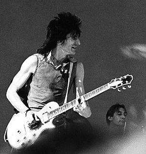
- Ronnie Wood, the guitarist for the famous rock bands The Rolling Stones and Faces, grew up in Whitethorn Avenue. He went to St Stephen's Infant School and St Matthew's Church of England Primary School.
- Art Wood (1937-2006), a singer in the 1960s rhythm and blues group The Artwoods, also grew up in Whitethorn Avenue.
- Ted Wood (1939-2003), a jazz singer and drummer, was born in Yiewsley and grew up on Whitehorn Avenue.
- Musician Kim Gardner (1948–2001), from bands like The Birds and The Creation, grew up in Yiewsley.
- Cinematographer Wally Gentleman (1926–2001), known for special effects in films like 2001: A Space Odyssey, was born in Yiewsley.
- George Thomas Moore Marriott (1885-1949), a well-known stage and screen actor, was born in Alpha Place, High Street, Yiewsley.
 | Emma Amos |
 | Edward Mitchell Bannister |
 | Larry D. Alexander |
 | Ernie Barnes |


