Smithville, Arkansas facts for kids
Quick facts for kids
Smithville, Arkansas
|
|
|---|---|

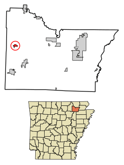
Location in Lawrence County, Arkansas
|
|
| Country | United States |
| State | Arkansas |
| County | Lawrence |
| Area | |
| • Total | 0.67 sq mi (1.73 km2) |
| • Land | 0.67 sq mi (1.73 km2) |
| • Water | 0.00 sq mi (0.00 km2) |
| Elevation | 351 ft (107 m) |
| Population
(2020)
|
|
| • Total | 87 |
| • Density | 130.63/sq mi (50.43/km2) |
| Time zone | UTC-6 (Central (CST)) |
| • Summer (DST) | UTC-5 (CDT) |
| ZIP code |
72466
|
| Area code(s) | 870 |
| FIPS code | 05-64910 |
| GNIS feature ID | 0058647 |
Smithville is a small town located in Lawrence County, Arkansas, in the United States. In 2020, about 87 people lived here. It's a quiet place with a rich history and interesting geography.
Contents
Smithville's History
Early Settlers and County Seat
People from Europe first settled in the Smithville area in 1808. This was a long time ago, even before Arkansas became a state!
Smithville became an important place in 1837. It was chosen as the county seat for Lawrence County. A county seat is like the main town where the county government is located.
However, after the Civil War, the county seat moved. In 1869, it was changed to Powhatan. This move happened partly because Powhatan was closer to the Black River. Being near the river was good for riverboat trade and business.
A Moment in Modern History
Smithville is also known for being close to a famous event in 1983. This was when a tax fugitive named Gordon Kahl had a final shootout with law enforcement. Sadly, the Lawrence County Sheriff, Harold Gene Matthews, was killed during this event. The actual shootout happened a few miles north of Smithville.
Geography of Smithville
Where is Smithville Located?
Smithville is in the western part of Lawrence County. Its exact location is 36°4′48″N 91°18′14″W / 36.08000°N 91.30389°W.
Several roads connect Smithville to other towns. Arkansas Highway 117 goes east for about 13 miles to Black Rock. It also goes south for 9 miles to Strawberry.
Highway 115 heads northeast for 12 miles to Imboden. From there, you can connect to US 412. Highway 115 also goes southwest towards Cave City in Sharp County, which is about 21 miles away.
Land and Landscape
The town of Smithville covers about 0.67 square miles (1.73 square kilometers) of land. There is no water area within the town limits.
Smithville is located in the Ozark Foothills. These are the lower parts of the Ozark Mountains. It sits on a flat area called the Salem Plateau, which is part of the larger Ozark Plateau.
The eastern part of Smithville is a low area. It can sometimes flood because of Machine Creek. The center of Smithville is on a small hill. If you travel west or north from Smithville, you will see rolling hills. West of town, there is a place called Peebles Bluff.
Water Management in the Area
Smithville is in the middle of the Cooper Creek Watershed Improvement District. This district has several reservoirs. These reservoirs are like large lakes built to help control flooding.
Local people have given names to these reservoirs:
- Site 1: West Cooper Creek Lake
- Site 2: East Cooper Creek Lake
- Site 3: Dogwood Lake
- Site 4: Machine Lake
- Site 5: Goff Lake
- Site 6: Ed's Lake
People in Smithville
| Historical population | |||
|---|---|---|---|
| Census | Pop. | %± | |
| 1970 | 89 | — | |
| 1980 | 113 | 27.0% | |
| 1990 | 86 | −23.9% | |
| 2000 | 73 | −15.1% | |
| 2010 | 78 | 6.8% | |
| 2020 | 87 | 11.5% | |
| U.S. Decennial Census | |||
Let's look at how the population of Smithville has changed over the years. In 1970, there were 89 people. The population grew to 113 in 1980, but then decreased to 73 by 2000. In 2020, the population was 87.
In 2000, there were 73 people living in Smithville. The town had 33 households and 22 families. The population density was about 121.5 people per square mile. Most of the people were White (97.26%). There were also small percentages of Black or African American and Native American residents.
About 30.3% of households had children under 18 living with them. More than half (54.5%) were married couples. The average household had 2.21 people, and the average family had 2.64 people.
The population included people of all ages. About 21.9% were under 18. About 30.1% were 65 years or older. The average age in Smithville was 43 years old.
Education in Smithville
Students in Smithville attend schools in the Hillcrest School District.
Before 2004, Smithville was part of the Lynn School District. On July 1, 2004, the Lynn School District joined with the Hillcrest district.
See also
 In Spanish: Smithville (Arkansas) para niños
 | Ernest Everett Just |
 | Mary Jackson |
 | Emmett Chappelle |
 | Marie Maynard Daly |

