Snyder, New York facts for kids
Quick facts for kids
Snyder
|
|
|---|---|
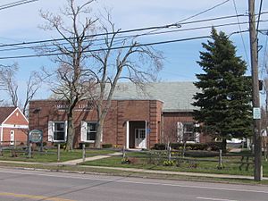
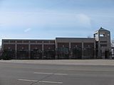
The Eggertsville-Snyder branch of the Buffalo & Erie County Public Library in the Snyder, New York "Business District"
|
|
| Country | United States |
| State | New York |
| County | Erie County |
| hamlet | 1837 |
| Elevation | 673 ft (205 m) |
| Population
(2000)
|
|
| • Total | 13,875 |
| Time zone | UTC-5 (EST) |
| • Summer (DST) | UTC-4 (EDT) |
| ZIP code |
14226 (and part of 14221 & 14225)
|
| Area code(s) | 716 |
| Average Household income | $87,700 |
| Average Household size | 2.49 |
Snyder (originally called Snyderville) is a small community, known as a hamlet, located within the town of Amherst in Erie County, New York. It is part of the larger Buffalo–Niagara Falls metropolitan area.
This hamlet was officially started in 1837. It got its name from Michael Snyder, who was its very first postmaster. Michael Snyder also ran a store at the busy corner of Harlem Road (which is also New York State Route 240) and Main Street (also known as New York State Route 5). Snyder grew quickly because of all the shops and businesses that popped up along Main Street. This road was a major travel route between Buffalo and places to the east during the 1800s and early 1900s.
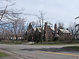
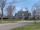
As of 2009, Snyder has several areas with businesses. This includes a main business district along Main Street, right where the original town center was at Main Street and Harlem Road. The hamlet is also home to many schools, both public and private, for students from kindergarten all the way through college. People living in Snyder generally have higher incomes and more education compared to the rest of the Buffalo area. Snyder also has two buildings listed on the National Register of Historic Places. These buildings show what the early homes in the hamlet looked like.
The traditional way to define Snyder is by the area served by its postal service, which is now part of the 14226 zip code. However, if you look at data from the United States Census Bureau, the modern Snyder area also includes parts of the nearby Eggertsville hamlet.
Contents
History of Snyder
The first person to settle in the area that would become Snyder was Timothy Hopkins in 1804. He and his wife, Nancy Kerr, moved into a log cabin on a farm. This farm was located where Amherst Central High School stands today at 4301 Main Street.
In 1821, the Schenck family moved to Amherst, settling at the corner of Main Street and Harlem Road. Abraham Snyder arrived from Pennsylvania in 1823. His son, Michael Snyder, became a very important person in the community. John Schenck, Michael Snyder's cousin, built the first house in the hamlet. He later built the first store in 1837, which is the year Snyder was officially established.
Early Transportation and Growth
In 1830, a stagecoach service began. This was the first regular public transportation between Buffalo and Batavia, and sometimes even Albany. It traveled along Buffalo Road, which later became Main Street. By the 1850s, farming was very important to Amherst's economy. Snyder also had a pottery and brick factory. Throughout the 1800s, Snyder grew into a small business community. It served the local farmers and the stagecoach line along Main Street.
In 1879, the hamlets of Amherst started getting newspaper service from the Amherst Bee. This newspaper is still published weekly today. A hotel was opened by L. F. Crout in 1883.
Modern Connections and Development
In 1892, an electric trolley line was built. It ran from Main Street and Bailey Avenue (U.S. Route 62) all the way to Williamsville. This trolley connected Amherst to Buffalo's streetcar system. This made Amherst's small communities easier to reach. Wealthy city residents wanted to expand their homes into the "country." This led to a lot of growth and development around the Main and Harlem area, which became the center for new suburbs.
In 1905, a big fire, known as the Snyderville Fire, destroyed 12 buildings in the Main Street/Harlem Road area. This included blacksmith shops, barns, and other important businesses. Livestock and stored grain were also lost. In the 1920s, the town of Amherst began to change. Farmland was turned into new neighborhoods, and Snyder residents started living closer together in these new areas.
Geography of Snyder
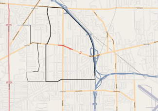
Snyder is located in the southern part of Amherst, which is in Erie County. Since it's a hamlet, it doesn't have official borders. However, it was first defined by the area its post office served. The traditional boundaries of Snyder are Getzville and Brantwood Road to the west. Sheridan Drive (New York State Route 324) is to the north. I-290, also called the Youngmann Expressway, and I-90, known as the New York State Thruway, are to the east. The town line of Cheektowaga is to the south, along Wehrle Drive east of Harlem Road and then Winspear Avenue.
When we look at Snyder using census data, its western boundary extends a bit further. This includes parts of the nearby hamlet of Eggertsville. Eggertsville grew around the Main Street and Eggert Road intersection. The center of Snyder, at Main Street and Harlem, is about 673 feet (205 m) above sea level.
Business Districts
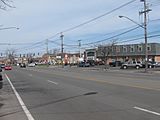
The main business district in Snyder is on Main Street. It stretches between Burroughs Drive to the east and Campus Drive to the west. In this area, you'll find the Snyder Fire Department and the Eggertsville-Snyder Branch of the Buffalo & Erie County Public Library (at 4622 Main Street). The Main Harlem Plaza is also here.
Harlem Road goes through the main business district. It connects three of Snyder's four commercial areas. The Sheridan Harlem Plaza and other businesses are at the north end of Harlem Road. Both Kensington Avenue and Wehrle Drive meet the southern part of Harlem Road in a business area that goes into Cheektowaga. This Harlem–Kensington business district is very old. The fourth business area is on the eastern edge of Snyder. It's at the intersection of Main Street and Kensington Avenue, close to the entrance of the Youngmann Expressway. The larger Snyder community also has more commercial areas along the busy Sheridan Drive and on Millersport Highway.
Transportation in Snyder
Snyder is bordered by I-290, a major interstate highway. It has two exits on its eastern side that are both less than 1 mile (1.6 km) from the center of town (Main and Harlem). These exits give direct access to I-90, which is also known as the New York State Thruway. If you continue south on Harlem Road through Cheektowaga, you can also reach New York State Route 33, which is a little over a mile from Snyder and also connects to I-90.
The community also has bus service from the Niagara Frontier Transportation Authority (NFTA). There are three bus routes (30, 48, and 49) that connect directly to the light rail Buffalo Metro Rail along Main Street to the west. All three of these routes also go to different parts of Williamsville to the east. They provide connections to Erie Community College (north campus), the Buffalo Niagara International Airport, and Transit Road (New York State Route 78). Another NFTA bus route, number 65, travels from downtown Buffalo along Kensington Avenue to Main Street. This service then continues to destinations in northeast Erie County.
Historically, Main Street has always been a busy route for transportation through Snyder. In 1836, Main Street became a Macadam toll road, meaning people had to pay to use it. On April 5, 1893, the trolley line started running. It went from Main Street and Bailey Avenue to the east end of Williamsville, about 4.5 miles (7.2 km) away. Later, it was extended another 3 miles to Transit Road.
Snyder Landmarks
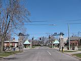
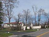
Snyder is home to two places listed on the National Register of Historic Places. These are the Entranceways at Main Street at Lamarck Drive and Smallwood Drive and the Entranceway at Main Street at Roycroft Boulevard. The first one was built in 1926, and the second in 1918. Both were added to the National Register of Historic Places on December 7, 2005.
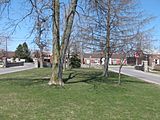
These landmarks are stone wall entrances to neighborhoods. You can see similar ones throughout Eggertsville and Snyder along Main Street. They were built to make new housing developments look like the grand estates that used to be common along Main Street in the area.
Willard Genrich built the Lord Amherst Motor Hotel on Main Street. It is near the I-290 interchange. He designed it to match the colonial style of architecture used by other businesses on Main Street.
Snyder's Economy
Snyder is known as a well-off and highly educated community within the Buffalo Metropolitan area. Most of the homes are large, single-family houses on their own plots of land. In the 2000 United States Census, the average household income in Snyder was $87,700. This was much higher than the Buffalo region's average of $57,400 at that time.
Between the 1990 United States Census and the 2000 United States Census, Snyder's population slightly decreased from 14,294 to 13,875. However, the number of households actually increased from 5,469 to 5,574. During that decade, the number of children aged 5–17 and adults aged 35–54 grew a lot. At the same time, the number of young adults aged 18–34 and adults over 55 decreased quite a bit. The total number of housing units grew from 5,662 to 5,739. In 1990, 82.5% of the housing was single-family homes. Snyder also has the busiest ATM in the entire Buffalo region.
As of January 2002, the traditional Snyder area of Main Street had 180 businesses. The town has two theaters: MusicalFare Theatre, which is a non-profit group on the Daemen College campus, and ComedySportz Buffalo.
Starting in the 1950s, local laws about building (called zoning laws) required all new buildings to be set back from the street. They also had to have their own private parking on site. The current zoning laws date back to 1976.
Education in Snyder
Amherst Central High School is the public high school for the town. It is located at 4301 Main Street, just west of the business district. This school started when the new Amherst school district was created in the late 1920s. Before that, students from Eggertsville and Snyder went to either Bennett High School in Buffalo or what is now called Williamsville South High School in Williamsville. Williamsville South High School is also listed on the National Register of Historic Places.
Daemen College is a college located across from the high school at 4380 Main Street. Amherst Middle School (which used to be Amherst Junior High School) is the town's public middle school. It is located two blocks south of the High School at 55 Kings Highway. Also, the Stenographic Institute-Western New York, which offers college degrees, is found in the business district at 4525 Main Street.
Other schools in the area include Smallwood Drive Elementary School (for grades K-5), Park School of Buffalo (for Pre-K through 12th grade), and Christ The King School (for Pre-K through 8th grade). Park School has been in Snyder since 1922. Smallwood is a public school, Park is a private school, and Christ The King is a Roman Catholic school.
 | Delilah Pierce |
 | Gordon Parks |
 | Augusta Savage |
 | Charles Ethan Porter |


