Soldotna, Alaska facts for kids
Quick facts for kids
Soldotna, Alaska
|
||
|---|---|---|
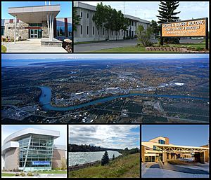
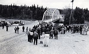
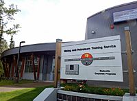
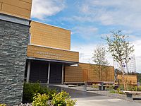
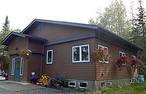
From top left: Joyce K. Carver Memorial Library, Kenai Peninsula Borough Building, aerial view of the City of Soldotna, Central Peninsula Hospital, Soldotna Creek Park, and the Kenai Peninsula College.
|
||
|
||
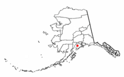
Location of Soldotna, Alaska
|
||
| Country | United States | |
| State | Alaska | |
| Borough | Kenai Peninsula | |
| Incorporated | July 1967 | |
| Area | ||
| • Total | 7.41 sq mi (19.19 km2) | |
| • Land | 6.96 sq mi (18.01 km2) | |
| • Water | 0.45 sq mi (1.18 km2) | |
| Elevation | 105 ft (32 m) | |
| Population
(2020)
|
||
| • Total | 4,342 | |
| • Density | 624.30/sq mi (241.05/km2) | |
| Time zone | UTC-9 (Alaska (AKST)) | |
| • Summer (DST) | UTC-8 (AKDT) | |
| ZIP code |
99669
|
|
| Area code | 907 (local exchange prefix: 260, 262) | |
| FIPS code | 02-71640 | |
| GNIS feature ID | 1414025 | |
Soldotna is a city in Alaska, located on the Kenai Peninsula. In 2020, about 4,342 people lived there. It is the main city for the Kenai Peninsula Borough.
Soldotna is in the south-central part of Alaska. It sits along the Kenai River, which flows into the Cook Inlet near the city of Kenai. The city is also next to the huge Kenai National Wildlife Refuge. This protected area is nearly 2 million acres. It is home to animals like bears, moose, and caribou. Many fish and bird species also live there.
The city is at a key meeting point of two major roads: the Sterling Highway and the Kenai Spur Highway. This location has helped Soldotna become a center for shopping and services. It serves people living on the Kenai Peninsula and travelers. The Central Peninsula Hospital provides medical care for locals and visitors. Kenai Peninsula College, part of the University of Alaska Anchorage, has a campus in Soldotna. The main offices for the Kenai National Wildlife Refuge and the Kenai Peninsula Borough are also in the city.
Contents
History of Soldotna
After World War II in 1947, the U.S. government opened up land near the Cook Inlet and Kenai River. This land was made available for people to settle under the Homestead Act. Veterans who served in the military got to choose land first. Also in 1947, the Sterling Highway was built. This road connected the Soldotna area to other places.
The Sterling Highway made it easier for people to move to Soldotna. More families built homes, and visitors came to fish. The Soldotna Post Office opened in 1949. More businesses soon followed.
In 1957, oil was found in the Swanson River area. This discovery brought new jobs and growth to Soldotna. In 1960, Soldotna officially became a city. It had a population of 332 people. Seven years later, in 1967, it became a "first class" city.
In 1964, the Kenai Peninsula College was created. The local government, the Kenai Peninsula Borough, also started around this time.
Soldotna grew quickly from the 1960s to the 1990s. This was because of its location on major highways and the oil industry. While growth has slowed, the city continues to be an important place on the Kenai Peninsula.
Geography and Climate
Soldotna is located on the banks of the Kenai River in Alaska. Its name comes from the nearby Soldotna Creek. There are different ideas about where the name "Soldotna" came from.
The city covers about 7.4 square miles. Most of this area is land, and a small part is water.
Soldotna's Weather
Soldotna has a moderate subarctic climate. This means it has cool summers. Winters are long and snowy but not extremely cold. The average temperature in January is about 13.4 degrees Fahrenheit.
Summers are cool because of the nearby ocean. Temperatures usually reach 70 degrees Fahrenheit about 12 days a year.
| Climate data for Soldotna 5SSW, Alaska, 1991-2020 normals, 2004-2023 extremes: 180ft (55m) | |||||||||||||
|---|---|---|---|---|---|---|---|---|---|---|---|---|---|
| Month | Jan | Feb | Mar | Apr | May | Jun | Jul | Aug | Sep | Oct | Nov | Dec | Year |
| Record high °F (°C) | 50 (10) |
46 (8) |
62 (17) |
71 (22) |
77 (25) |
86 (30) |
87 (31) |
84 (29) |
69 (21) |
60 (16) |
49 (9) |
44 (7) |
87 (31) |
| Mean maximum °F (°C) | 39.2 (4.0) |
40.7 (4.8) |
45.5 (7.5) |
57.3 (14.1) |
70.3 (21.3) |
73.3 (22.9) |
76.1 (24.5) |
72.6 (22.6) |
64.2 (17.9) |
54.3 (12.4) |
40.6 (4.8) |
38.7 (3.7) |
78.1 (25.6) |
| Mean daily maximum °F (°C) | 21.2 (−6.0) |
28.3 (−2.1) |
34.6 (1.4) |
45.9 (7.7) |
56.1 (13.4) |
62.3 (16.8) |
65.5 (18.6) |
63.7 (17.6) |
55.2 (12.9) |
42.4 (5.8) |
28.1 (−2.2) |
23.3 (−4.8) |
43.9 (6.6) |
| Daily mean °F (°C) | 13.0 (−10.6) |
18.8 (−7.3) |
23.1 (−4.9) |
35.2 (1.8) |
44.2 (6.8) |
51.3 (10.7) |
55.3 (12.9) |
53.2 (11.8) |
45.9 (7.7) |
34.0 (1.1) |
20.1 (−6.6) |
15.7 (−9.1) |
34.2 (1.2) |
| Mean daily minimum °F (°C) | 4.8 (−15.1) |
9.4 (−12.6) |
11.5 (−11.4) |
24.4 (−4.2) |
32.3 (0.2) |
40.3 (4.6) |
45.0 (7.2) |
42.6 (5.9) |
36.6 (2.6) |
25.5 (−3.6) |
12.0 (−11.1) |
8.1 (−13.3) |
24.4 (−4.2) |
| Mean minimum °F (°C) | −20.7 (−29.3) |
−16.2 (−26.8) |
−13.9 (−25.5) |
7.8 (−13.4) |
23.0 (−5.0) |
29.3 (−1.5) |
34.0 (1.1) |
30.3 (−0.9) |
21.7 (−5.7) |
7.7 (−13.5) |
−12.7 (−24.8) |
−16.9 (−27.2) |
−25.5 (−31.9) |
| Record low °F (°C) | −34 (−37) |
−31 (−35) |
−28 (−33) |
−7 (−22) |
19 (−7) |
26 (−3) |
29 (−2) |
27 (−3) |
14 (−10) |
−4 (−20) |
−22 (−30) |
−38 (−39) |
−38 (−39) |
| Average precipitation inches (mm) | 1.42 (36) |
1.30 (33) |
0.74 (19) |
0.83 (21) |
0.85 (22) |
1.32 (34) |
2.03 (52) |
2.99 (76) |
3.95 (100) |
2.74 (70) |
1.76 (45) |
1.65 (42) |
21.58 (550) |
| Average snowfall inches (cm) | 11.2 (28) |
14.1 (36) |
6.5 (17) |
1.2 (3.0) |
0.0 (0.0) |
0.0 (0.0) |
0.0 (0.0) |
0.0 (0.0) |
0.0 (0.0) |
2.2 (5.6) |
10.6 (27) |
15.5 (39) |
61.3 (155.6) |
| Average precipitation days (≥ 0.01 in) | 9.7 | 9.1 | 8.1 | 8.9 | 11.4 | 12.2 | 14.4 | 17.2 | 20.8 | 17.0 | 11.5 | 12.3 | 152.6 |
| Average snowy days (≥ 0.1 in) | 8 | 8 | 4 | 1 | 0 | 0 | 0 | 0 | 0 | 1 | 7 | 9 | 38 |
| Source 1: NOAA | |||||||||||||
| Source 2: XMACIS2 (records, monthly max/mins & 2004-2023 snowfall/days) | |||||||||||||
People of Soldotna
| Historical population | |||
|---|---|---|---|
| Census | Pop. | %± | |
| 1960 | 332 | — | |
| 1970 | 1,202 | 262.0% | |
| 1980 | 2,320 | 93.0% | |
| 1990 | 3,482 | 50.1% | |
| 2000 | 3,759 | 8.0% | |
| 2010 | 4,163 | 10.7% | |
| 2020 | 4,342 | 4.3% | |
| U.S. Decennial Census | |||
Soldotna first appeared in the U.S. Census in 1960. It officially became a city in 1967.
In 2010, there were 4,163 people living in Soldotna. About 86% of the people were White. About 4.3% were Native American. The rest were from other racial backgrounds. About 3.9% of the population was Hispanic or Latino.
About 26% of the people were under 18 years old. About 13% were 65 or older. The average age was 34.6 years.
Education in Soldotna
Colleges and Training
Soldotna is home to the Kenai Peninsula College (KPC). This college is part of the University of Alaska Anchorage. The campus is on 300 acres of wooded land. It has a library, labs, and student housing.
KPC offers many programs. Students can earn associate's and bachelor's degrees. They can also get special certificates for different jobs.
The Amundsen Educational Center is another school in Soldotna. It teaches skills like building construction and office work. Alaska Christian College also offers degrees in subjects like Christian Ministry.
Schools for Kids
Soldotna's public schools are managed by the Kenai Peninsula Borough School District (KPBSD). There are several elementary schools, including Soldotna Elementary.
Skyview Middle School serves students in grades 7 and 8. After middle school, students go to Soldotna High School for grades 9 through 12. There are also some private schools in the area.
Arts and Culture
The Soldotna Visitor Center is a great place to learn about local wildlife. It has displays of bears, moose, eagles, and even a world-record king salmon. Near the Visitor Center is the Homestead Museum. This museum shows old buildings and tools from early settlers. It also has items from Alaska Native cultures.
The Joyce K. Carver Memorial Library offers many books and media. It has computers for public use and free Wi-Fi.
Caring for Nature
The Kenai Watershed Forum (KWF) is a group that works to keep the Kenai Peninsula's rivers and lakes healthy. They have programs like Stream Watch, where volunteers help protect the rivers. KWF also runs a summer camp for kids aged 6-12. They work on projects to restore nature, like removing harmful plants.
The Kenai National Wildlife Refuge covers almost 2 million acres. It has many different natural areas, from glaciers to forests. This refuge is home to many animals. These include brown and black bears, moose, and caribou. The Chickaloon River Flats is a special area for many migrating birds. You can visit the Kenai National Wildlife Refuge Visitor's Center to learn more.
Getting Around Soldotna
Roads and Highways
The Sterling Highway runs through Soldotna. It connects the city to other areas. The "Soldotna Y" is a well-known spot where the Sterling Highway meets the Kenai Spur Highway. The Kenai Spur Highway connects parts of Soldotna to nearby towns like Kenai.
Kalifornsky Beach Road, or "K-Beach" Road, connects the western parts of Soldotna. It also leads to the Soldotna Sports Center. Funny River Road goes east from the Sterling Highway. It leads to the Soldotna Airport and the Kenai National Wildlife Refuge headquarters.
Most of Soldotna's shops and businesses are along these main roads. Smaller streets lead to homes and places like the hospital and high school.
Flying In and Out
Soldotna Airport (SXQ) is a public airport owned by the city. It is located in the southeastern part of Soldotna. You can reach the airport from Funny River Road.
Public Transportation
Soldotna has a public transit system called CARTS. This stands for Central Area Rural Transit System. CARTS is an on-demand shuttle service. It serves Soldotna and nearby communities. You need to call ahead to arrange a pickup. It does not have fixed routes or bus stops like a city bus.
Fun and Sports
The City of Soldotna has eleven parks for fun activities.
- Swiftwater Park and Centennial Park offer campsites. They also have river access and boat launches.
- Rotary Park provides access to the river.
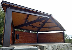
- Soldotna Creek Park has river access, a stage, and a playground. It's a great place for picnics.
- Farnsworth Park has a playground and picnic areas.
- Other neighborhood parks include Aspen Park and Pioneer Park.
- Karen Street Park has areas for skating and BMX bikes.
- Memorial Park is the city's cemetery.
Tsalteshi Trails are just south of Soldotna. They have over 15 miles of trails. In winter, they are groomed for cross-country skiing. When there's no snow, people can hike, run, or bike on them.
The Soldotna Regional Sports Complex is home to the Kenai River Brown Bears. This is a junior ice hockey team that plays in a major league.
Soldotna is famous for fishing. Les Anderson caught the world's largest king salmon here in 1985. It weighed 97 pounds, 4 ounces! You can see this record-setting fish at the Soldotna Visitor Center. The Kenai River is known for having all five types of Pacific salmon.
Economy of Soldotna
Healthcare Services
The Central Peninsula Hospital is the largest medical center on the Kenai Peninsula. It has 49 beds and an emergency room. It offers many types of medical care. These include family medicine, surgery, and a birthing center.
Many smaller healthcare businesses are located near the hospital. This makes it easy for people to get the care they need.
Tourism and Recreation
Tourism in Soldotna is mostly about outdoor activities. People come here for fishing, hunting, hiking, and camping. Soldotna has several parks along the Kenai River for public use. The river is famous for its salmon and trout fishing.
Soldotna is also close to the Kenai National Wildlife Refuge. The Kenai River was named one of the "World's 15 Best Rivers for Travelers" by CNN Travel. This is because of its great fishing and hunting.
Famous People from Soldotna
- Travis Hall (born 1972), an NFL football player. He was born in Soldotna.
- Chris Mabeus (born 1979), a Major League Baseball player. He grew up in Soldotna.
- Emily Johnson (born 1976), a dancer and choreographer. She was born in Soldotna.
See also
 In Spanish: Soldotna para niños


