Sonestown Covered Bridge facts for kids
Quick facts for kids Sonestown Covered Bridge |
|
|---|---|
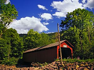
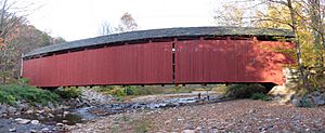
The Sonestown Covered Bridge over Muncy Creek (west portal and north side in 2008)
|
|
| Coordinates | 41°20′47″N 76°33′18″W / 41.34639°N 76.55500°W |
| Carries | TR 310 |
| Crosses | Muncy Creek |
| Locale | Sullivan County, Pennsylvania |
| Official name | Sonestown Covered Bridge |
| Other name(s) | Davidson Covered Bridge |
| Named for | Village of Sonestown |
| Maintained by | Sullivan County |
| NBI Number | 000000000032095 |
| Characteristics | |
| Design | National Register of Historic Places |
| Total length | 110 ft (34 m) |
| Width | 15.0 ft (4.6 m) |
| Height | 10.0 ft (3.0 m) |
| Load limit | 3 tons (2.7 t) |
| History | |
| Rebuilt | 1969, 1996, 2001, 2005, 2013 |
| MPS | Covered Bridges of Bradford, Sullivan and Lycoming Counties |
| NRHP reference No. | 80003640 |
| Added to NRHP | July 24, 1980 |
| Lua error in Module:Location_map at line 420: attempt to index field 'wikibase' (a nil value). | |
The Sonestown Covered Bridge is a historic wooden bridge in Sullivan County, Pennsylvania. It crosses Muncy Creek in Davidson Township. This bridge was built around 1850 and is about 110 ft (34 m) long.
It was added to the National Register of Historic Places (NRHP) in 1980. The bridge gets its name from the nearby village of Sonestown. It is also sometimes called the Davidson Covered Bridge. The bridge was first built to help people reach a grist mill, which was a factory that ground grain into flour.
Pennsylvania has a lot of covered bridges. They were built to protect the wooden parts of the bridge from bad weather. The Sonestown bridge uses a special design called a Burr arch truss. This design uses a strong arch with vertical posts to make the bridge very sturdy.
The Sonestown Covered Bridge has been repaired many times over the years, especially after floods. Even with repairs, its condition in 2016 was considered "basically intolerable," meaning it needed a lot of work. As of 2020, it is the shortest covered bridge in Sullivan County and is only open for people walking across it.
Contents
What is the Sonestown Covered Bridge?
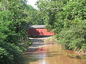
The Sonestown Covered Bridge is located in Davidson Township. It crosses Muncy Creek on Champion Hill Road (Township Road 310). The bridge is just east of U.S. Route 220.
The village of Sonestown is about 1 mile (1.6 km) north of the bridge. This is how the bridge got its name. The bridge is also about 1 mile (1.6 km) east of the village of Muncy Valley.
Sullivan County is in north-central Pennsylvania. It is about 123 miles (198 km) northwest of Philadelphia.
The area where Davidson Township is located was first settled in 1806. It became a township in 1833. George Sones built a sawmill here and started the village of Sonestown in 1843. Sullivan County was formed in 1847 from part of Lycoming County.
The bridge was built in 1850. In the late 1800s, Sonestown grew a lot because of the lumber industry. The village had factories that made parts for barrels and clothespins. By the 1930s, most of the industry was gone. In 1996, Sonestown had about 200 people. Many of them worked in nearby towns like Muncy and Williamsport.
History of the Bridge
Why Were Covered Bridges Built?
The first covered bridge in the United States was built in 1800 in Philadelphia. Pennsylvania was also where the first Burr arch truss bridges were built. At one time, Pennsylvania had over 1,500 covered bridges. It had the most covered bridges in the country between 1830 and 1875. In 2001, Pennsylvania still had more historic covered bridges than any other state.
Covered bridges were a step between stone bridges and metal bridges. In the 1800s, wood was easy to find for building bridges. However, wood would rot quickly when exposed to rain and sun. The roof and sides of covered bridges protected the wood. This allowed these bridges to last for a very long time.
A Burr arch truss design uses a strong arch combined with vertical posts. This makes the bridge much stronger and more stable. In 1890, Sullivan County had 30 covered bridges. By 1954, only five were left. As of 2020, only three remain: Forksville, Hillsgrove, and Sonestown.
Building the Sonestown Bridge
All three covered bridges in Sullivan County were built around 1850. The Sonestown bridge was the fifth covered bridge built in the county. It crossed Muncy Creek to give access to Johnny Hazen's gristmill. This mill was also built in 1850.
Many sources do not name the builder of the Sonestown bridge. However, some newspaper articles say that Sadler Rogers may have designed or built it. Rogers also built the Forksville and Hillsgrove bridges in 1850 when he was only 18 years old. After flood damage in 2011 was fixed, a plaque was put on the bridge. It says Rogers was the builder.
On July 24, 1980, the Sonestown bridge was added to the NRHP. It was part of a group of seven covered bridges from the area. The bridge is also listed on the 2016 Federal Highway Administration National Bridge Inventory (NBI). The NBI says the bridge is 110 ft (34 m) long. Its roadway is 13 feet 6 inches (4.11 m) wide. The maximum weight it can hold is 5.0 short tons (4.5 t). However, a sign at the bridge itself says the limit is only 3.0 short tons (2.7 t). The NRHP says the bridge's road is 15 feet (4.6 m) wide, which is only enough for one car at a time.
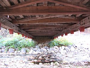
The Sonestown bridge is built lighter than similar bridges in southeastern Pennsylvania. It sits on stone and mortar supports called abutments. These supports have been made stronger with concrete. The ends of the bridge have wing walls. These walls help hold the soil of the road leading to the bridge.
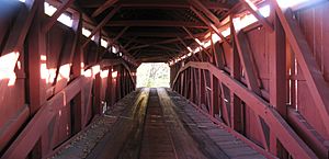
The bridge's floor is made of wide wooden boards. Two long wooden runners are placed on top of the floor. The Burr arches that support the bridge are not perfectly smooth curves. Instead, they are made of several straight pieces joined at an angle. The arch on the south side of the bridge is lower than the arch on the north side.
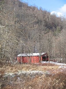
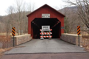
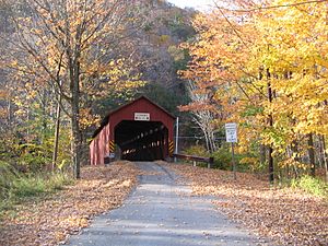
The sides and ends of the bridge are covered with vertical red boards. There are openings between the roof and the sides along both lengths of the bridge. Since 2013, the bridge also has a small window in the middle of each side. Before that, it had no windows. The roof is covered with wooden shake shingles. Signs at each end of the bridge say the height limit is 10 feet 0 inches (3.05 m). The bridge does not have any steel to make it stronger.
People's opinions about covered bridges in Sullivan County changed a lot in the late 1900s. Two of the five bridges left in 1954 were torn down by 1970. However, the Pennsylvania Department of Transportation decided to fix the Forksville bridge because it was historic and popular with tourists. The Hillsgrove Covered Bridge was added to the NRHP in 1973. The other two bridges, including Sonestown, were added in 1980. Now, the state needs to approve any repairs to NRHP bridges. They also do not allow these bridges to be destroyed.
Flooding and Repairs
In the 1800s, the Sonestown Covered Bridge survived big floods in 1865 and 1889. These floods destroyed other bridges in the area. The 1889 flood was caused by the same storm that led to the Johnstown Flood, which killed over 2,200 people. In 1885, a railroad line reached Sonestown, passing near the bridge. The railroad carried lumber, coal, and people until it closed in 1938.
The bridge was built to reach a gristmill. Maps from 1915 show a mill near the bridge. By 1941, the mill was no longer there. The NRHP form says the bridge was repaired in 1969. These repairs included replacing some side panels and strengthening the supports with concrete.
In January 1996, there was a huge flood in Pennsylvania. A big snowstorm was followed by warm rain. This caused a lot of snow to melt, leading to widespread flooding. Ice jams made the flooding even worse on many streams. In a nearby county, flooding killed six people and caused millions of dollars in damage.
The flood in 1996 pushed the center of the Sonestown Covered Bridge almost 1 foot (0.30 m) downstream. This severe damage closed the bridge from January to December 1996. It was one of 69 public bridges in Pennsylvania that were damaged or closed by the flood. Sullivan County owns the bridge and paid for its repair. The state required the repair because the bridge is on the NRHP. The repair cost $89,000 and took about two months. While the bridge was closed, people had to take a 5-mile (8 km) detour.
After the repairs, vehicles that were too heavy or large still could not use the bridge. So, a new "Veterans Memorial Bridge" was built in 2000. This new bridge is just downstream from the covered bridge. It allows all vehicles to cross Muncy Creek.
The covered bridge was also restored in 2001. In September 2004, Hurricane Ivan caused flooding. Then, heavy rains in April 2005 damaged one of the bridge's supports. Repairs took six weeks. In August 2005, large rocks were placed in the creek to protect the supports from erosion.
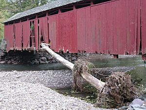
The bridge was damaged again in September 2011 by Tropical Storm Lee. Over 12 inches (300 mm) of rain caused Muncy Creek to flood. Debris hit the bridge, and a tree trunk got stuck in its side. The floodwaters reached the bridge's deck, and several cars were swept under it. In 2011, the Sonestown and Hillsgrove covered bridges were listed as "Pennsylvania At Risk" historic sites. The bridge remained closed until 2013, when it was "reconstructed."
In August 2018, Sonestown was evacuated due to flooding along Muncy Creek. The bridge was closed again because of flood damage. In July 2020, Sullivan County hired a company to repair the closed bridge for $116,559. This repair used money from FEMA.
In 1996, people had a tradition of decorating and lighting the Sonestown bridge for Christmas. In 2015, about 50 vehicles used the bridge each day. As of 2020, it is the only covered bridge left over Muncy Creek. Experts say that the Sullivan County bridges are some of the most beautiful in the state because of their surroundings.
Bridge Measurements
Different sources have slightly different measurements for the Sonestown Covered Bridge. This is because they use different ways to measure. For example, the National Bridge Inventory (NBI) measures the length between the "backwalls of abutments." It defines the width as the narrowest space for cars.
The National Register of Historic Places (NRHP) form was made by the Pennsylvania Historical and Museum Commission. They gathered information from engineers and historical groups. The Evans book (2001) measured each bridge from portal to portal for length and at the portal for width. The Zacher book (1994) used data from a 1991 survey.
Here is a table comparing some of these measurements:
| Length feet (m) |
Width feet (m) |
Load short tons (MT) |
Name used |
Source (Year) |
|---|---|---|---|---|
| 110 ft (34 m) | 13 feet 6 inches (4.11 m) | 5.0 short tons (4.5 t) | Sonestown | NBI (2012) |
| 99 feet (30 m) | 15 feet (4.6 m) | 3.0 short tons (2.7 t) | Sonestown | NRHP (1980) |
| 118 feet 9 inches (36.2 m) | 14 feet 6 inches (4.42 m) | NA | Sonestown | Evans (2001) |
| 102 feet (31 m) | 15 feet (4.6 m) | NA | Sonestown | Zacher (1994) |
 | Janet Taylor Pickett |
 | Synthia Saint James |
 | Howardena Pindell |
 | Faith Ringgold |


