South Nation River facts for kids
Quick facts for kids South Nation River |
|
|---|---|

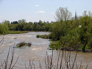
South Nation River at Plantagenet
|
|
|
Location of the mouth of the South Nation River in eastern Ontario
|
|
| Country | Canada |
| Province | Ontario |
| Region | Eastern Ontario |
| Physical characteristics | |
| Main source | Near Fairfield East, Leeds and Grenville County 44°40′30″N 75°42′00″W / 44.67500°N 75.70000°W |
| River mouth | Ottawa River 2 km east of Wendover, Prescott and Russell County 45 m (148 ft) 45°34′23″N 75°06′00″W / 45.57306°N 75.10000°W |
| Length | 175 km (109 mi) |
| Basin features | |
| Progression | Ottawa River→ Saint Lawrence River→ Gulf of Saint Lawrence |
| River system | Ottawa River drainage basin |
| Basin size | 3,900 km2 (1,500 sq mi) |
The South Nation River is a river found in Eastern Ontario, Canada. It starts in forests and wet marshy areas north of Brockville. The river then flows about 175 kilometers (109 miles) northeast. It finally empties into the big Ottawa River near Plantagenet. The land area that drains water into this river is about 3,900 square kilometers (1,500 square miles).
Contents
What's in a Name?
The South Nation River gets its name to help tell it apart from another river. There is a river in Quebec called the Petite-Nation River. Both names come from a French word for the native people of this area. These people are known as the Weskarini.
The River's Surroundings
Long ago, the area around the river was covered with tall white pine trees. Today, much of this land is used for farming. The river flows across a very flat plain. Because it is so flat, the river does not flow very fast. This means it can easily flood when there is a lot of rain or melting snow.
To help stop floods, people have built dams and other controls. These structures help manage the water levels in the river. They reduce the impact of seasonal flooding on nearby farms and towns.
Unstable Ground and Landslides
In some places, the river flows through a special type of soil called Leda clay. This clay can be very unstable, meaning it can easily move or slide. Over the last 100 years, there have been several landslides along the river.
One big landslide happened on June 20, 1993. It was near a former town called Lemieux. About 3 million cubic meters (106 million cubic feet) of mud and clay slid into the river valley. This huge slide blocked the river's flow for three days.
Fun on the River
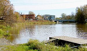
If you enjoy being outdoors, you can go canoeing on the South Nation River. About four kilometers (2.5 miles) of the river south of Spencerville is great for canoeing. You can usually canoe there in most water conditions. There is also a public place to launch your boat at the old mill.
Rivers Joining the South Nation
Many smaller rivers and creeks flow into the South Nation River. These are called tributaries. They add water to the main river as it flows downstream.
- North Branch South Nation River
- Sandy Creek
- Payne River
- Various branches of the Castor River
- Moose Creek
- Bear Brook
- Scotch River
- Caledonia Creek
Towns Along the River
Several communities are located along the South Nation River. They are listed here in the order you would find them as you travel downstream.
- Spencerville
- South Mountain
- Chesterville
- Crysler
- St. Albert
- Casselman
- Plantagenet
 | Mary Eliza Mahoney |
 | Susie King Taylor |
 | Ida Gray |
 | Eliza Ann Grier |


