St Clement Danes (parish) facts for kids
| St Clement Danes | |
 |
|
| Geography | |
| Status | Civil parish |
| 1881 area | 53 acres (0.21 km2) |
| 1901/1921 area | 57 acres (0.23 km2) |
| HQ | Vestry Hall, Strand |
| History | |
| Origin | Ancient parish |
| Created | before 1190 |
| Abolished | 1922 |
| Succeeded by | City of Westminster (parish) |
Quick facts for kids Demography |
|
|---|---|
| 1881 population - 1881 density |
10,280 194/acre |
| 1901 population - 1901 density |
6,090 107/acre |
| 1921 population - 1921 density |
1,905 33/acre |
| Politics | |
| Governance | St Clement Danes Vestry (16th century–1855) |
St Clement Danes was a historic area in London, England. It was known as a civil parish, which is like a local district. Today, the church of St Clement Danes still stands. This church is part of the Anglican faith.
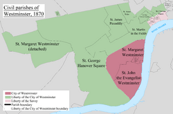
The area of St Clement Danes was split into two parts. One part was in the Liberty of Westminster. The other part was in the Liberty of the Duchy of Lancaster. This area is now part of the City of Westminster. It includes places like Aldwych and Adelphi, which are near the famous Strand street. You can find hotels, restaurants, and important buildings like the Indian and Australian High Commissions here. The London School of Economics is also in this area. To the west, you'll find Charing Cross station and Trafalgar Square.
Contents
What's in a Name?

The name "St Clement Danes" comes from its church, St Clement Danes. Records from the early 1100s call it 'the parish of St Clement's church of the Danes'. This name suggests that Danes (people from Denmark) lived in this part of London, just west of the main city.
How the Area Was Governed
St Clement Danes was first mentioned in 1190. This makes it a very old parish. About half of it was in the Liberty of Westminster. The other half was in a part of Middlesex called Ossulstone. Over time, new parishes were created, and parts of St Clement Danes were absorbed into them.
In medieval times, the parish was partly in Westminster and partly in the soke of Leicester. The Ossulstone part was also known as the Liberty of the Duchy of Lancaster. From 1604, the parish was included in the Bills of mortality, which recorded deaths.
In 1826, the old wooden stocks that belonged to the parish were removed and destroyed. They were in Portugal Street. People thought they were the last stocks left in London.
In 1855, St Clement Danes became part of the Strand District. This meant it was looked after by the Metropolitan Board of Works. In 1889, the parish became part of the new County of London. Then, in 1900, it joined the Metropolitan Borough of Westminster. St Clement Danes stopped being a civil parish in 1922.
King's College Hospital

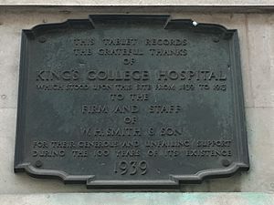
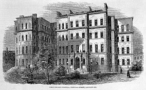
King's College Hospital first opened in 1840. It was in the old St Clement Danes parish workhouse on Portugal Street. The hospital was a place where medical students from King's College London could learn and practice. They got lessons from the college's professors.
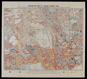
A map made by Booth in 1889 showed that many streets in the parish were very poor. There were many overcrowded homes, and people suffered from poverty and disease. In the 1840s, the hospital treated 1,290 patients each year. It had 120 beds, and sometimes two patients had to share a bed. The hospital later moved to its current location in Denmark Hill.
Where Was St Clement Danes?
The parish of St Clement Danes had two main parts. Both parts stretched down to the north side of the Thames.
The main part was in the east of Westminster. This area used to be mostly gardens and countryside until later in medieval times. It was next to the Liberty of the Rolls and the Temple area of the City of London. To its west, it had a straight border with two other parishes: the large St Martin in the Fields and the very small St Mary le Strand. To the north, it bordered St Giles in the Fields.
There was also a very small, separate part of the parish. This tiny piece was located between a section of St Martin in the Fields near the river and the small Precinct of the Savoy.
Population Changes Over Time
| Year | Population | Initial acreage and changes |
|---|---|---|
| 1801 | 13,001 | not known |
| 1811 | 13,706 | not known |
| 1821 | 14,763 | not known |
| 1831 | 15,442 | 52 acres (0.21 km2) |
| 1841 | 15,602 | unchanged |
| 1851 | 15,662 | |
| 1881 | 10,280 | |
| 1891 | 8,492 | |
| 1901 | 6,090 | |
| 1911 | 3,152 | unchanged |
| 1921 | 1,905 | unchanged |
Modern Church Boundaries
Today, the boundaries for the Church of England are almost the same as the final civil parish. The parish of St Mary le Strand is now combined with it. This area also includes a third place of worship, King's College Chapel, London. The two main churches, St Clement Danes and St Mary le Strand, are often called the "island churches" because they stand in the middle of busy roads.
 | DeHart Hubbard |
 | Wilma Rudolph |
 | Jesse Owens |
 | Jackie Joyner-Kersee |
 | Major Taylor |


