St Ives Bay facts for kids
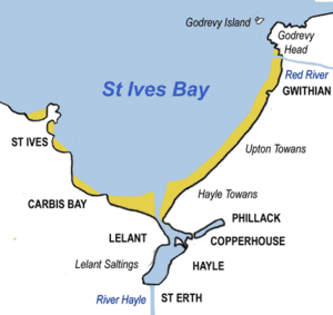
St Ives Bay (called Cammas an Tewyn in Cornish, which means 'bay of the sand dunes') is a beautiful bay on the Atlantic Ocean coast of north-west Cornwall, England. It's shaped like a gentle curve, about 6 kilometers (4 miles) wide. You'll find it between the town of St Ives in the west and Godrevy Head in the east.
At the very bottom of St Ives Bay, the River Hayle flows into the sea. It travels through sandy areas called sand dunes and across the beach. Behind these dunes, the river forms a wide, tidal area known as the Hayle Estuary. This estuary has a special area of salt marsh and a port that isn't used much anymore. The estuary is a fantastic spot for birdwatching, and the RSPB (a bird protection group) has a special nature reserve there.
The eastern side of the bay has a long, sandy beach that stretches for about 5 kilometers (3 miles). Behind this beach is a big system of coastal dunes called The Towans. This sandy stretch goes from Porth Kidney Sands in the west to Godrevy Head in the east. This part of the beach is very popular for surfing, especially near Gwithian.
The western side of the bay is higher up and has more towns and villages. These include Lelant, Carbis Bay, and St Ives. This western coast is rockier, with several small beaches separated by rocky points called headlands.
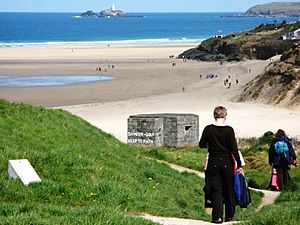
About 1.5 kilometers (one mile) north-west of Godrevy Head is a rocky area called The Stones reef. This reef can be dangerous for boats. The lighthouse on Godrevy Island shines a light to warn sailors about this danger. Closer to shore, there are also strong water currents around Godrevy Island and at the mouth of the River Hayle.
Contents
Getting Around St Ives Bay
By Train
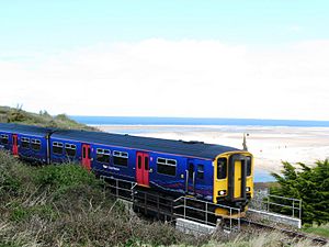
The main railway line from Penzance to Plymouth passes south of the bay. You can find stations at St Erth and Hayle. A special branch line, called the St Ives Bay Line, runs from St Erth right into St Ives. It's a very scenic journey!
By Road
The B3301 coast road runs from Godrevy to Hayle, just behind the sand dunes. There are many places along this road where you can easily get to the coast. The main A30 road also passes south of Hayle.
On Foot
The South West Coast Path is a famous walking trail that follows the coast around St Ives Bay. It does make a small detour inland around the Hayle estuary, but it's a great way to explore the area on foot.
Places to Explore Around St Ives Bay
Here are some of the towns, villages, and natural features you can find around St Ives Bay:
Towns and Villages
- Carbis Bay
- Connor Downs
- Gwithian
- Hayle
- Lelant
- Phillack
- St Erth
- St Ives
Rivers
Other Interesting Features
- Hayle Towans (the large sand dune system)
- Godrevy Head (the headland at the eastern end of the bay)
- Godrevy Lighthouse (the lighthouse on Godrevy Island)
- Hayle estuary Site of Special Scientific Interest (a protected area for nature)
 | Emma Amos |
 | Edward Mitchell Bannister |
 | Larry D. Alexander |
 | Ernie Barnes |


