Staten Island Greenbelt facts for kids
Quick facts for kids Staten Island Greenbelt |
|
|---|---|

At Manor Road
|
|
| Type | Urban park |
| Location | Staten Island, New York City, United States |
| Area | 1,778 acres (7.20 km2) |
| Created | 1984 |
| Owned by | NYC Parks |
| Operated by | Greenbelt Conservancy |
| Status | Open all year |
The Staten Island Greenbelt is a huge system of connected public parks and natural areas. You can find it in the central hills of Staten Island, a borough of New York City. It's the second-largest park area owned by the city government.
The Greenbelt is looked after by the NYC Parks Department and the Greenbelt Conservancy. The Conservancy is a non-profit group that works with NYC Parks to care for the Greenbelt. They also raise money for its upkeep and fun programs. Some of the well-known parks inside the Greenbelt include High Rock Park, LaTourette Park, William T. Davis Wildlife Refuge, and Willowbrook Park.
Contents
What is the Greenbelt?
The main office for the Greenbelt and Greenbelt Conservancy is at the entrance to High Rock Park. This is one of the many parks within the Greenbelt system. In 2004, a second building, called the Greenbelt Nature Center, opened nearby. The Greenbelt Conservancy offers nature-themed events all year for both kids and adults.
A group called the Protectors of Pine Oak Woods has been working since the 1970s to protect Staten Island's natural areas. They organize people who care about the island's wild spaces. They also lead nature hikes and speak up for conservation.
You can find old documents about the Greenbelt's history and nature at the library of the College of Staten Island.
Greenbelt's Amazing Geology
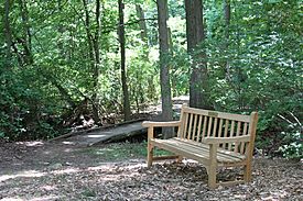
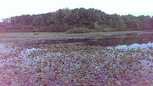
The Greenbelt has many connected trails and covers about 2,800 acres. Its forested hills stretch across the middle of Staten Island. You'll also find wetlands and ponds in the lower areas.
Todt Hill is 410 feet above sea level. It's the highest point south of Maine on the East Coast of the United States! These hills and other features were shaped by glaciers during the Ice Age. The rocks under the ground, like schist and serpentine, were formed much earlier by Earth's moving plates and volcanoes.
Wildlife in the Greenbelt
The Greenbelt is one of the most diverse places for nature in New York City. It's home to many different animals!
You can find several types of amphibians here, like the eastern redback salamander, green frog, and grey tree frog. Reptiles include the eastern garter snake, eastern box turtle, and the common snapping turtle, which is New York's state reptile. Sometimes, northern black racer snakes and eastern milksnakes are also seen. These snakes are rare in other parts of Staten Island because their homes have been destroyed.
The Greenbelt is a year-round home for mammals like the eastern gray squirrel, eastern chipmunk, eastern cottontail rabbit, and white-tailed deer. Many birds live here all the time, such as the blue jay, northern cardinal, and downy woodpecker. Other birds, like northern flickers, stop here during their seasonal migrations. You might also spot birds of prey like Cooper's hawks, redtail hawks, and great horned owls.
The waterways are full of fish! You can find largemouth bass, bluegill, brown bullhead, yellow perch, and other fish species here.
Early History of the Land
Centuries ago, the native Lenni-Lenape people lived on Staten Island. They may have called it "the place of bad woods." This might have been because of the spirits they believed lived there. Back then, just like today, the hills were covered with many kinds of trees. These included oak, hickory, maple, and beech. Smaller plants like dogwood, blackberry, and wild grape also grew there.
Arrowheads have been found in the rich soil, showing that the Lenape people lived and hunted here. The island's forests were very appealing to Dutch and British settlers in the 1600s and 1700s. The hills were perfect for getting timber for ships and iron ore for cannonballs. They were also a good place for British troops during the American War for Independence.
In the 1800s, after Europeans had settled and farmed much of Staten Island, famous people started visiting. Henry David Thoreau, a famous writer, lived here for a year in 1843. Later, Frederick Law Olmsted, who designed many city parks (like Central Park!), lived on an experimental farm overlooking the water.
Ideas for a Park
In 1871, Frederick Law Olmsted suggested a plan for Staten Island. He thought it would be a good idea to create a park about four miles long. He said it would use a lot of land that wasn't good for building roads. This land was perfect for a park.
Other people also wanted to save the wild areas of Staten Island. William T. Davis, a naturalist from the island, believed that "The best park is certainly a piece of woodland left as Nature arranged it, with a few path cut through it." He and local historian Charles W. Leng wrote in 1896 that the island's forests were its "crowning glory." They hoped these areas would become parklands.
In 1897, Staten Island resident Erastus Wiman said that the land was "a wilderness of such beauty pervaded this region that no expenditure could improve upon."
The Parkway Plan and How It Was Stopped
In the early 1900s, there were plans for parks and parkways (scenic roads) on Staten Island. In the 1960s, a powerful city planner named Robert Moses proposed a highway called the "Richmond Parkway." This highway would have cut right through the middle of Staten Island, including many of the natural areas that are now part of the Greenbelt.
The proposed highway route was about 4.8 miles long. But people fought against it, and the plan was stopped. Today, the parkway ends at the Greenbelt's southwestern edge.
People Fight Back!
Conservation activists, people who wanted to protect nature, strongly opposed these highway plans. They were inspired by leaders like President John F. Kennedy's Secretary of the Interior, Stewart Udall.
First, they saved High Rock Girl Scout Camp. This land was originally part of a Boy Scout camp. In 1964, the Girl Scout Council secretly decided to sell the camp to a developer. But the New York City Parks Department and the State of New York, with help from a foundation, raised money to buy the land back. This created High Rock Park!
Then, in 1965, a group called the Staten Island Citizens Planning Committee (SICPC) started fighting the highway. They suggested a different plan for the parkway that would save the natural areas. A landscape architect named Bradford Greene, one of the group's founders, came up with the name "Staten Island Greenbelt."
Many "off-islanders"—young professionals who had moved to Staten Island because of its beautiful open spaces—led the SICPC. They included lawyers, a graphic designer, a museum director, and a writer for The New York Times. They used their skills to speak out in the news, to public officials, and even in court.
A year later, another group formed: the Staten Island Greenbelt Natural Areas League (SIGNAL). This group, led by journalist John G. Mitchell, helped gather community support against the highway. From 1966 to the early 1970s, SIGNAL organized thousands of people, including elected officials, to take part in annual winter walks through the forests. They walked the path where the highway was supposed to go.
These two citizen groups used lobbying, public relations, and community organizing to challenge Robert Moses. He had only been stopped by community efforts twice before. In 1956, mothers saved Central Park from a parking lot expansion. Two years later, a group led by Jane Jacobs stopped him from building a highway through Washington Square Park.
The Work Continues
Even with all the opposition, road work began in 1965 on a section of the highway. The city then hired a firm to find other routes. These new routes were discussed and debated by state and city officials.
A landscape architect named Ian McHarg, who believed engineers often damaged the land, led a study. He created a new way to show how social values, like history, homes, recreation, and nature, would be affected by road building. He used maps and overlays to show that a route to the west of what is now the Greenbelt would cause the "least social cost."
Developers wanted to build homes near the highway. So, Mayor John Lindsay and Governor Nelson Rockefeller supported a compromise route. But the two citizen groups, SICPC and SIGNAL, were determined to save the "fine patch of wild." They sued both the Mayor and the Governor in court. The court sided with the citizens!
The area was then marked as a special natural area in New York City. Between 1972 and 1974, an architect named Peter Verity prepared documents to support this special protection.
What's Left of the Plan
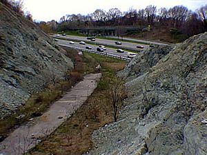
When the road work was stopped, the dirt from the excavations was used to build what is now called "Moses Mountain." This is a hill near the Manor Road and Rockland Avenue intersection. You can also see other signs of the old construction from the Staten Island Expressway. These are sometimes called the "abandoned bridges." They were removed as part of a big upgrade to the Expressway.
Growing the Greenbelt in the 1980s
In 1982, 25 acres of city-owned land were added to the Greenbelt. This land was once part of the New York City Farm Colony. It's located on the north side of Rockland Avenue.
Finally, in 1984, the Staten Island Greenbelt was officially recognized by the city. It became one of the largest natural areas in New York City and the second-largest park in the city, after Pelham Bay Park.
 | Delilah Pierce |
 | Gordon Parks |
 | Augusta Savage |
 | Charles Ethan Porter |


