Stevens Square, Minneapolis facts for kids
Quick facts for kids
Stevens Square-Loring Heights
|
|
|---|---|
|
Neighborhoods of Minneapolis
|
|
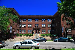
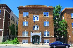
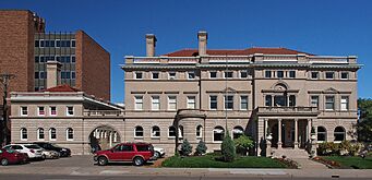
Stevens Court, the oldest contributing building in the Stevens Square Historic District, built in 1913.
|
|
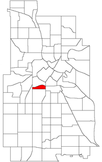
Location of Stevens Square/Loring Heights within the U.S. city of Minneapolis
|
|
| Country | United States |
| State | Minnesota |
| County | Hennepin |
| City | Minneapolis |
| Community | Central |
| City Council Wards | 6, 7 |
| Area | |
| • Total | 0.187 sq mi (0.48 km2) |
| Elevation | 863 ft (263 m) |
| Population
(2020)
|
|
| • Total | 4,137 |
| • Density | 22,120/sq mi (8,542/km2) |
| Time zone | UTC-6 (CST) |
| • Summer (DST) | UTC-5 (CDT) |
| ZIP code |
55403, 55404, 55405
|
| Area code(s) | 612 |
|
Stevens Square Historic District
|
|
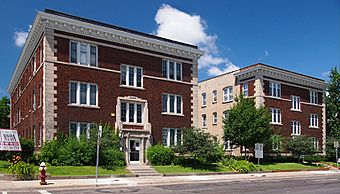
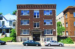
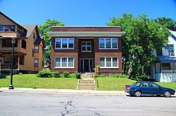
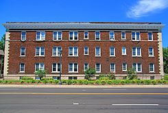
Two 1915 apartment buildings typical of Stevens Square
|
|
| Lua error in Module:Location_map at line 420: attempt to index field 'wikibase' (a nil value). | |
| Location | Minneapolis, Minnesota |
|---|---|
| Built | 1912 |
| Architect | Multiple |
| Architectural style | Late 19th and 20th Century Revivals, Renaissance, Gothic Revival |
| NRHP reference No. | 93000594 |
| Added to NRHP | July 1, 1993 |
| Historical population | |||
|---|---|---|---|
| Census | Pop. | %± | |
| 1980 | 3,827 | — | |
| 1990 | 4,433 | 15.8% | |
| 2000 | 3,948 | −10.9% | |
| 2010 | 3,833 | −2.9% | |
| 2020 | 4,137 | 7.9% | |
Stevens Square (also known as Stevens Square-Loring Heights) is a neighborhood in Minneapolis, Minnesota. It's located in the southern part of the city's Central community. The neighborhood is bordered by Lyndale Avenue to the west, Franklin Avenue to the south, and Interstates 94 and 35W to the north and east. The area west of Nicollet Avenue is often called Loring Heights, while the eastern part is Stevens Square.
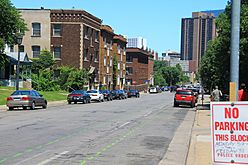
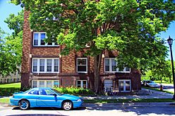
Even though it's a small area, Stevens Square-Loring Heights is one of the most populated neighborhoods in Minneapolis. It used to have large mansions, but now it's mostly filled with old apartment buildings. Many of these used to be mansions that were divided into smaller apartments. This makes the neighborhood very dense, meaning lots of people live in a small space. It's about a mile long but only three blocks wide. A big part of the neighborhood is recognized as a National Historic District. In 1993, five of its apartment buildings were even added to the National Register of Historic Places.
Like many older city neighborhoods, Stevens Square faced some challenges in the past. However, in recent years, it has become much safer, and the average income of its residents has gone up. This improvement is thanks to a successful neighborhood improvement program. Also, some apartment buildings have been turned into condominiums or co-ops, which means people can own their apartments or share ownership.
Contents
Exploring Stevens Square's Past
Early Days and Growth
Before European settlers arrived, the Dakota Sioux lived in this area. The land was officially mapped out in 1856, but it stayed mostly empty for many years. A man named Richard Mendenhall bought most of the land. He built a few large houses and huge greenhouses for his flower business.
However, the neighborhood's central spot and Minneapolis's fast growth in the 1890s made it a great place for new buildings. Horse-drawn and later electric streetcars passed through the area, making it easy to get around.
Creating Stevens Square Park
In 1907, property owners and a big developer asked the Park Board to buy the land for Stevens Square Park. The land was uneven, making it hard to build on. The Park Board agreed quickly, buying the land for $41,820. Local landowners helped pay for it. The park was named after Col. John H. Stevens, who was the first authorized settler on the west side of what became Minneapolis.
Building Boom and Changes
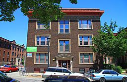
Construction on the Abbott Hospital began in 1910. This building is now apartments. Soon after, many apartment buildings were constructed, often in the Renaissance Revival style, like Stevens Court. Most buildings were built as tall and wide as fire safety rules allowed, to fit as many people as possible.
Most of the older buildings in the neighborhood were finished by the mid-1920s. After that, building slowed down because there wasn't much land left, and the housing market wasn't doing well. At first, middle-class office workers and single women lived here. But by the middle of the century, more people had cars and moved to the suburbs. This led to a decline in the neighborhood, and incomes dropped.
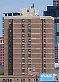
Even though Interstate 35W was originally planned to go right through the neighborhood, it was built around it instead. However, these new interstates made it harder to get to downtown Minneapolis, except by a few bridges. In the 1960s, some large public housing buildings were built. This made the neighborhood seem less safe and lower-income to some people.
Neighborhood Revival Efforts
Starting in the 1970s, a dedicated neighborhood group and landowners began working to improve the area. They fixed up many buildings and worked on making the neighborhood a better place to live. A successful neighborhood watch program was started. In 1994, the Emily Peake Memorial Garden was created at Third Avenue and 19th Street. This garden helped improve a spot that had been known for problems. In recent years, crime has gone down a lot, though some small issues still remain.
Getting Around Stevens Square
Major Roads and Highways
Several important streets run through the neighborhood. These include Nicollet Avenue, which is famous for its "Eat Street" restaurants, First Avenue, and Franklin Avenue. The neighborhood also has easy access to nearby interstate highways. Downtown Minneapolis is less than a mile to the north, making it easy to reach.
Public Transportation Options
The neighborhood is well-served by public transportation.
- The high-frequency 18 bus runs on Nicollet Avenue.
- Other bus lines include the 2 (on Franklin Ave), the 11 (on 3rd Ave S), and the 17 (also on Nicollet Ave).
- While the neighborhood was considered for the METRO Green Line extension light rail, a different route was chosen.
- The planned Nicollet-Central Streetcar would pass directly through the neighborhood in the future.
Bike Sharing
There is a Nice Ride station at the corner of Franklin and Nicollet. This makes it easy for residents to use the city's bike sharing system.
Discovering Landmarks and Attractions
Several buildings in Stevens Square are listed on the National Register of Historic Places because of their historical importance.
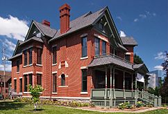
- The historic Amos B. Coe House on Third Avenue is now home to the Minnesota African American History Museum and Cultural Center.
- The Abbott Hospital, now apartments, shows how medical buildings changed over time.
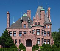
- The George W. and Nancy B. Van Dusen House is a beautiful Richardsonian Romanesque mansion that is now used for events.
The bells of the historic Plymouth Congregational Church, located in the center of the neighborhood, can be heard far and wide. There are several restaurants and coffee shops in the neighborhood, along with four small grocery stores. Residents can also easily walk to the many restaurants on Eat Street in Whittier and those in Loring Park.
Gallery
 | Percy Lavon Julian |
 | Katherine Johnson |
 | George Washington Carver |
 | Annie Easley |


