Stockport, New York facts for kids
Quick facts for kids
Stockport, New York
|
|
|---|---|

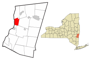
Location of Stockport, New York
|
|
| Country | United States |
| State | New York |
| County | Columbia |
| Government | |
| • Type | Town Council |
| Area | |
| • Total | 13.15 sq mi (34.07 km2) |
| • Land | 11.65 sq mi (30.17 km2) |
| • Water | 1.50 sq mi (3.90 km2) |
| Elevation | 131 ft (40 m) |
| Population
(2020)
|
|
| • Total | 2,670 |
| • Density | 203.0/sq mi (78.37/km2) |
| Time zone | UTC-5 (Eastern (EST)) |
| • Summer (DST) | UTC-4 (EDT) |
| FIPS code | 36-021-71443 |
| GNIS feature ID | 0979529 |
Stockport is a town located in Columbia County, New York, in the United States. It is found in the northwestern part of the county, right along the Hudson River.
In 2020, about 2,670 people lived in Stockport. This number was a little lower than the 2,815 people who lived there in 2010.
Contents
History of Stockport
Early Settlement and Town Creation
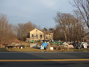
The area where Stockport is located was first settled a very long time ago, around 1657. One of the oldest buildings, the Staats House, was built during this early period.
The town of Stockport was officially created in 1833. It was formed by combining parts of nearby towns like Ghent and Stuyvesant, and also a piece of the city of Hudson. A historic building, the Church of St. John the Evangelist, was recognized for its importance in 1972. It was added to the National Register of Historic Places.
Geography and Natural Features
Land and Water Area
Stockport covers a total area of about 13.15 square miles (34.1 square kilometers). Most of this area is land, which is about 11.65 square miles (30.2 square kilometers). The rest is water, making up about 1.50 square miles (3.9 square kilometers).
Rivers and Creeks
The western edge of Stockport is marked by the middle of the Hudson River. This river also forms the border with Greene County. A special waterway called Stockport Creek flows into the Hudson River. This creek is formed when two other creeks, Kinderhook Creek and Claverack Creek, join together near the center of the town.
Population Information
How Many People Live Here?
| Historical population | |||
|---|---|---|---|
| Census | Pop. | %± | |
| 1840 | 1,815 | — | |
| 1850 | 1,655 | −8.8% | |
| 1860 | 1,445 | −12.7% | |
| 1870 | 1,438 | −0.5% | |
| 1880 | 1,980 | 37.7% | |
| 1890 | 2,345 | 18.4% | |
| 1900 | 2,719 | 15.9% | |
| 1910 | 2,506 | −7.8% | |
| 1920 | 1,909 | −23.8% | |
| 1930 | 2,422 | 26.9% | |
| 1940 | 2,229 | −8.0% | |
| 1950 | 2,054 | −7.9% | |
| 1960 | 2,025 | −1.4% | |
| 1970 | 2,324 | 14.8% | |
| 1980 | 2,847 | 22.5% | |
| 1990 | 3,085 | 8.4% | |
| 2000 | 2,933 | −4.9% | |
| 2010 | 2,815 | −4.0% | |
| 2020 | 2,670 | −5.2% | |
| U.S. Decennial Census 2020 | |||
According to the census taken in 2000, there were 2,933 people living in Stockport. These people lived in 1,116 households, and 805 of these were families. The population density was about 251.9 people per square mile (97.3 people per square kilometer).
Households and Families
Out of the 1,116 households, about 34.4% had children under 18 living with them. More than half, 55.6%, were married couples living together. About 11.4% had a female head of the household without a husband present. Roughly 22.2% of all households were made up of people living alone. About 7.9% of households had someone aged 65 or older living by themselves.
The average number of people in a household was 2.62. For families, the average size was 3.04 people.
Age Distribution
The population in Stockport was spread out across different age groups. About 26.2% of the people were under 18 years old. Those aged 18 to 24 made up 7.0% of the population. The largest group, 30.2%, was between 25 and 44 years old. People aged 45 to 64 made up 25.4%, and 11.2% were 65 years old or older. The average age in the town was 37 years.
Communities and Services
Places to Know in Stockport
Stockport has several smaller communities within its borders:
- Columbiaville – This is a small village located near the center of the town. It is north of Stockport Creek and can be found along U.S. Route 9.
- Rossman – Another small village, Rossman is northeast of Columbiaville, close to Kinderhook Creek.
- Stockport – This is the main village of Stockport, located south of Stockport Creek on Route 9.
- Stottville – This village is near the southern border of the town. Part of Stottville also extends into Greenport.
Local Services
The town of Stockport is protected by two volunteer fire companies. These are the Stockport Volunteer Fire Co. No. 1 and the Stottville Volunteer Fire Co. No. 2. They are made up of volunteers who help keep the community safe.
Notable Person
- Jasper Holmes (1900–1986) – He was an important US Navy Intelligence Analyst.
See also
 In Spanish: Stockport (Nueva York) para niños
 | Bayard Rustin |
 | Jeannette Carter |
 | Jeremiah A. Brown |


