Stoutland, Missouri facts for kids
Quick facts for kids
Stoutland, Missouri
|
|
|---|---|

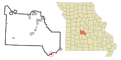
Location of Stoutland, Missouri
|
|
| Country | United States |
| State | Missouri |
| Counties | Camden, Laclede |
| Area | |
| • Total | 0.60 sq mi (1.57 km2) |
| • Land | 0.60 sq mi (1.57 km2) |
| • Water | 0.00 sq mi (0.00 km2) |
| Elevation | 1,171 ft (357 m) |
| Population
(2020)
|
|
| • Total | 209 |
| • Density | 346.03/sq mi (133.53/km2) |
| Time zone | UTC-6 (Central (CST)) |
| • Summer (DST) | UTC-5 (CDT) |
| ZIP code |
65567
|
| Area code(s) | 417 |
| FIPS code | 29-71008 |
| GNIS feature ID | 2395979 |
Stoutland is a small city in the state of Missouri, in the United States. It is located across two different areas called Camden County and Laclede County. In 2010, about 192 people lived there. By 2020, the population had grown slightly to 209 people.
Contents
History of Stoutland
The first people to settle in the area that is now Stoutland arrived in 1869. A year later, in 1870, a post office was opened. A post office is a place where you can send and receive mail. The village was named after a person known as Captain Stout. He was an important official who worked for the railroad.
Where is Stoutland?
Stoutland is located right on the border between Camden and Laclede counties. You can find it where two roads, Missouri Route T and Missouri Route F, meet.
Nearby towns include Richland, which is about 6.5 miles (10.5 km) to the northeast. Sleeper is about 5.5 miles (8.9 km) to the southwest. A stream called Bear Creek flows about two miles (3.2 km) southeast of the city. The larger Gasconade River is just one mile (1.6 km) further south.
According to the United States Census Bureau, Stoutland covers a total area of about 0.60 square miles (1.57 square kilometers). All of this area is land, with no large bodies of water inside the city limits.
Stoutland's Population
| Historical population | |||
|---|---|---|---|
| Census | Pop. | %± | |
| 1920 | 300 | — | |
| 1930 | 214 | −28.7% | |
| 1940 | 244 | 14.0% | |
| 1950 | 192 | −21.3% | |
| 1960 | 172 | −10.4% | |
| 1970 | 205 | 19.2% | |
| 1980 | 286 | 39.5% | |
| 1990 | 207 | −27.6% | |
| 2000 | 177 | −14.5% | |
| 2010 | 192 | 8.5% | |
| 2020 | 209 | 8.9% | |
| U.S. Decennial Census | |||
What the 2010 Census Showed
In 2010, there were 192 people living in Stoutland. These people lived in 93 different homes, and 50 of these were families. The city had about 320 people per square mile (123.6 people per square kilometer). There were 104 housing units, which are places where people can live.
Most of the people living in Stoutland were White (99.0%). A small number (1.0%) were from other racial backgrounds. About 5.7% of the population identified as Hispanic or Latino.
Out of the 93 homes, about 21.5% had children under 18 living there. Many homes (37.6%) were married couples living together. Some homes had a single parent, and nearly half (46.2%) were not families. About 38.7% of all homes had only one person living in them. And 23.7% of homes had someone aged 65 or older living alone. On average, there were about 2 people per household.
The average age of people in Stoutland was 46.4 years old. About 16.1% of residents were under 18. About 6.8% were between 18 and 24 years old. People aged 25 to 44 made up 24% of the population. Those aged 45 to 64 were 30.1%. And 22.9% of the people were 65 years old or older. The city had slightly more females (51.6%) than males (48.4%).
Schools and Learning
The Stoutland R-II School District runs two schools for the children in the area. These include one elementary school and Stoutland High School.
Stoutland also has a public library. It is part of the Camden County Library District, which means it serves the whole county.
See also
 In Spanish: Stoutland (Misuri) para niños
 | Jewel Prestage |
 | Ella Baker |
 | Fannie Lou Hamer |

