Sugarloaf Mountain (South Carolina) facts for kids
Quick facts for kids Sugarloaf Mountain |
|
|---|---|

Sugarloaf Mountain, SC
|
|
| Highest point | |
| Elevation | 467.8 feet (142.6 m) |
| Prominence | 100+ ft |
| Geography | |
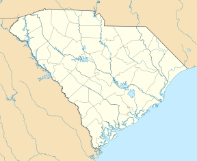
| Location | Chesterfield County, South Carolina |
| Parent range | Sandhills (Carolina) |
| Geology | |
| Age of rock | Late Cretaceous |
| Mountain type | Sandstone |
| Climbing | |
| Easiest route | Stairway and trail to summit |
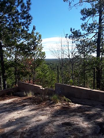
Sugarloaf Mountain is a special hill located near the town of Patrick in Chesterfield County, South Carolina. People in the area often call it "The Mountain" because it stands out, rising about 100 feet (30 meters) above the land around it. This unique spot is found inside the Sand Hills State Forest, right off US Highway 1. It's part of the Carolina Sandhills region, which is a flat area along the U.S. Atlantic coast.
Contents
What is Sugarloaf Mountain Made Of?
Sugarloaf Mountain is mostly made of a type of rock and soil called the Middendorf Formation. This formation includes different kinds of sand, silt, and clay, along with some pebbly sandstone. Scientists believe these materials were laid down by ancient rivers during the Cretaceous Period, which was a very long time ago when dinosaurs roamed the Earth!
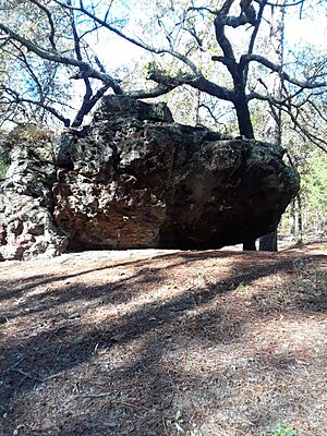
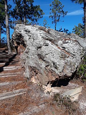
Much of the mountain is soft, made of loose sand, silt, and clay. But you can also find harder rocks, like iron-cemented sandstone, both on the mountain and nearby. These rocks are held together by iron, which likely came from groundwater.
Amazing Animals and Plants
Sugarloaf Mountain is home to lots of different animals and plants! You might spot whitetail deer, turkeys, and quail. In the water, there are fish, and in the trees, you could see black squirrels and flying squirrels.
The area also has special plants like rhododendron, moss, lichen, and ferns. Some of these plants are quite rare for this part of South Carolina. A very special bird, the Red-cockaded woodpecker, lives here. You might even be lucky enough to see a Pine Barrens Tree Frog!
Because this area is also a Wildlife Management Area of South Carolina, hunting is allowed in certain spots to help manage the animal populations.
Reptiles to Watch For
During the warmer months, from spring to fall, you might see some snakes. These include the Timber Rattlesnake, the Black Racer, and the Water Moccasin. It's always a good idea to be aware of your surroundings when exploring nature!
Camping Adventures
If you love camping, Sugarloaf Mountain has 16 basic camping spots. You need to book these ahead of time by calling (843) 498-6478. Sheltered sites cost $15 a night, and non-sheltered sites are $10. There's no electricity or running water, but there are two small outhouses at Site 1 and Site 6.
Each campsite has plenty of space for multiple tents. Make sure to keep your campfires inside the fire pits provided. It's very important not to start fires outside the pits because the area has lots of pine trees and dry straw, which can catch fire very quickly. There's also lots of room to play games like football, baseball, frisbee golf, or cornhole!
Hiking Trails
There are several marked hiking trails around Sugarloaf Mountain. The woods are open with not much thick brush, and the sandy ground makes for easy walking. Remember to bring plenty of water and drinks, especially on longer hikes, and always be alert for wildlife.
To reach the main mountain's base, stop just past campsite number 6; you'll see a parking area on your left. There's also a smaller hill called "Little Sugarloaf" directly across from the main mountain. It's a bit harder to find, so look for a small sign to guide you up. The view from Little Sugarloaf isn't quite as good as from the main mountain.
| Length: 1.7 miles to about 2.1 |
|---|
| Type: Loop |
| Surface: Natural, Sand |
| Difficulty: Moderate |
| Seasons and best times to go |
|---|
| Summer Avg: 92° / 69° |
| Fall Avg: 85° / 63° |
| Winter Avg: 59° / 33° |
| Spring: 76° / 49° |
Horseback Riding
Imagine riding your horse through trails of red clay and white sand, surrounded by a mix of old and new trees like dogwoods, pines, and hardwoods. As you ride, you might see deer, fox squirrels, turkeys, and maybe even the rare red-cockaded woodpecker! Every trail offers something special.
The Pine Barrens Wagon Trail is also available, though it's not used very often. This trail was made specifically for horse-drawn wagons and buggies. You'll find occasional creeks along the trails where your horse can drink. Even though there are facilities at the start of the trails, it's a good idea to carry water for yourself because the trails can be long.
Horses don't need to be shod (have special metal shoes) to ride here. During warm months, it's also a good idea to use insect repellent to keep mosquitoes and other bugs away.
Fishing Fun
Nearby, there's a large pond where you can go fishing! Swimming isn't allowed, but canoes and kayaks are welcome (no motorboats). You can catch different kinds of fish like bream, redbreast, and crappie. Sometimes, you might even catch a small catfish!
 | Bessie Coleman |
 | Spann Watson |
 | Jill E. Brown |
 | Sherman W. White |


