
Sullivan, New York facts for kids
Quick facts for kids
Sullivan, New York
|
|
|---|---|

Sullivan Free Library
|
|

Sullivan, New York
Location in New York
|
|
| Country | United States |
| State | New York |
| County | Madison |
| Government | |
| • Type | Town Council |
| Area | |
| • Total | 73.35 sq mi (189.96 km2) |
| • Land | 73.15 sq mi (189.45 km2) |
| • Water | 0.20 sq mi (0.52 km2) |
| Elevation | 410 ft (120 m) |
| Population
(2010)
|
|
| • Total | 15,339 |
| • Estimate
(2018)
|
15,149 |
| • Density | 208.14/sq mi (80.36/km2) |
| Time zone | UTC-5 (Eastern (EST)) |
| • Summer (DST) | UTC-4 (EDT) |
| ZIP code |
13030, 13037 , 13082
|
| Area code(s) | 315 |
| FIPS code | 36-053-71993 |
| GNIS feature ID | 0979535 |
| Website | Town of Sullivan government site |
Sullivan is a town located in Madison County, New York, United States. In 2010, about 15,339 people lived there. The town is named after General John Sullivan, a famous general.
The Town of Sullivan is in the northwestern part of Madison County.
Contents
History of Sullivan
When Was Sullivan Founded?
People started settling in the area around 1790. The town of Sullivan was officially created in 1803. It was formed from a part of the Town of Cazenovia. Later, in 1809, a section of Sullivan was used to create the Town of Lenox.
Important Historical Sites
The Chittenango Landing Dry Dock Complex is a special historical site in Sullivan. It was added to the National Register of Historic Places in 1992. This means it's an important place that helps us understand the past.
Geography of Sullivan
What is the Area of Sullivan?
The town of Sullivan covers a total area of about 73.6 square miles (190.6 square kilometers). Most of this area, about 73.4 square miles (189.9 square kilometers), is land. Only a small part, about 0.2 square miles (0.52 square kilometers), is water.
Natural Borders and Landmarks
The northern edge of the town touches Oneida Lake, which is a large lake. The western border of Sullivan is formed by the Chittenango Creek. This is a natural stream that flows through the area.
Major Roads in Sullivan
The New York State Thruway, also known as Interstate 90, goes right through the town. This is a major highway that connects different parts of New York State.
Population and People of Sullivan
| Historical population | |||
|---|---|---|---|
| Census | Pop. | %± | |
| 1820 | 2,932 | — | |
| 1830 | 4,077 | 39.1% | |
| 1840 | 4,390 | 7.7% | |
| 1850 | 4,764 | 8.5% | |
| 1860 | 5,233 | 9.8% | |
| 1870 | 4,921 | −6.0% | |
| 1880 | 4,803 | −2.4% | |
| 1890 | 4,046 | −15.8% | |
| 1900 | 3,778 | −6.6% | |
| 1910 | 3,367 | −10.9% | |
| 1920 | 3,002 | −10.8% | |
| 1930 | 3,383 | 12.7% | |
| 1940 | 3,775 | 11.6% | |
| 1950 | 4,905 | 29.9% | |
| 1960 | 9,369 | 91.0% | |
| 1970 | 11,969 | 27.8% | |
| 1980 | 13,371 | 11.7% | |
| 1990 | 14,622 | 9.4% | |
| 2000 | 14,991 | 2.5% | |
| 2010 | 15,339 | 2.3% | |
| 2018 (est.) | 15,149 | −1.2% | |
| U.S. Census Bureau | |||
How Many People Live in Sullivan?
In 2010, the town of Sullivan had 15,339 residents. There were 6,114 households and 4,325 families living in the town. The population density was about 209.7 people per square mile.
Who Lives in Sullivan?
Most people in Sullivan are White (97.2%). There are also smaller groups of African American, Native American, and Asian residents. About 1.2% of the population is Hispanic or Latino.
Age and Gender in Sullivan
The median age in Sullivan is 43.5 years old. This means half the people are younger than 43.5 and half are older. About 24.6% of the population is under 19 years old. The population is almost evenly split between males (49.2%) and females (50.8%).
Income in Sullivan
In 2010, the average income for a household was $56,596. For families, the average income was $64,101. The average income per person in 2018 was $32,971. About 8.6% of the people in Sullivan lived below the poverty line.
Communities and Locations in Sullivan
The town of Sullivan includes several smaller communities and places:
- Blakeslea – A small community in the southeastern part of the town.
- Bolivar – A community located northeast of Chittenango village.
- Bridgeport – A community in the northwest, near the town line on NY-31.
- Chittenango – This is a village in the southern part of the town. The town government is located here.
- Chittenango Creek – A stream that forms the northwestern border of the town.
- Chittenango Springs – A community south of Chittenango village on Route 13.
- East Boston – A place near the eastern border of the town.
- Eaton Corners – A location south of Lakeport.
- Fyler Settlement – A community in the northwestern part of the town.
- Gees Corner – A location in the northeastern part of the town.
- Lake Oneida Beach West – A community right on the shore of Oneida Lake.
- Lakeport – A community located on Oneida Lake and Route 31.
- Messenger Bay – A lakeside community in the northeastern corner of the town.
- North Chittenango – A community south of the Thruway on Lakeport Road.
- Oneida Lake Beach West – Another lakeside community in the northern part of the town. The Oneida Lake Congregational Church is here and is a historic site.
- Peck Corner – A location in the northwestern part of the town where County Routes 1 and 4 meet.
- Sullivan – A community east of Chittenango village on Route 5 and 13.
- Weaver Corner – A location near Chittenango Creek in the northwestern part of the town.
Transportation in Sullivan
Airports in Sullivan
Luther Airport is a small airport located about one nautical mile (1.85 kilometers) east of the main part of Chittenango.
Notable People from Sullivan
Some well-known people have come from Sullivan:
- Augustus and John Allen – These brothers were important because they founded the city of Houston, Texas.
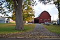
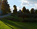
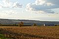
Images for kids
-
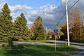
A view of a road in Sullivan.
-
A quiet street in Sullivan.
-
A building in Sullivan.
-
Another view of a street in Sullivan.
-
A rural scene in Sullivan.
.jpg)
.jpg)
.jpg)
.jpg)
.jpg)
See also
 In Spanish: Sullivan (Nueva York) para niños
