Sundial (Olympic Mountains) facts for kids
Quick facts for kids Sundial |
|
|---|---|

East aspect, from Royal Basin
|
|
| Highest point | |
| Elevation | 7,200 ft (2,200 m) |
| Prominence | 80 ft (24 m) |
| Isolation | 0.27 mi (0.43 km) |
| Parent peak | Mount Clark (7,528 ft) |
| Geography | |
| Location | Olympic National Park Jefferson County, Washington, US |
| Parent range | Olympic Mountains |
| Topo map | USGS Mount Deception |
| Geology | |
| Age of rock | Eocene |
| Type of rock | basalt |
| Climbing | |
| First ascent | 1944 by Adel Degenhardt, William Degenhardt |
| Easiest route | class 3 scrambling East Face |
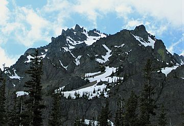
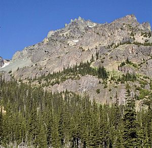
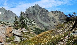
Sundial is a mountain peak located in Olympic National Park, in Jefferson County of Washington state. It stands about 7,200 feet (2,195 meters) tall. Sundial is part of a group of peaks called The Needles, which are part of the larger Olympic Mountains.
Its closest taller neighbor is Mount Clark, located about 0.27 miles (0.43 km) to the northwest. Mount Johnson is also nearby, about 0.45 miles (0.72 km) to the west.
Climbing routes on Sundial start with easy scrambling on the East Face. More difficult routes can be found on the South Side Face. The first people to climb this mountain were Adel and William Degenhardt in 1944.
The mountain gets its name because it can act like a sundial. If you are in Royal Basin in the morning, you can watch the sun's rays move down the east side of the mountain. This helps you guess the time of day. Water from the mountain flows into Royal Creek. This creek then joins the Dungeness River.
Climate Around Sundial
The area around Sundial has a marine west coast climate. This means it has cool, wet winters and mild, drier summers. Most of the weather systems come from the Pacific Ocean. They travel northeast towards the Olympic Mountains.
When these weather systems hit the tall Olympic peaks, they are forced to rise. As the air rises, it cools down and drops its moisture. This causes a lot of rain or snow, especially in winter. This process is called Orographic lift.
Because of this, the Olympic Mountains get a lot of precipitation. Winters are usually cloudy. However, in summer, high pressure systems over the Pacific Ocean often bring clear skies. The best time to visit Sundial for climbing or viewing is usually from July through September.
How Sundial Was Formed
The Olympic Mountains are made of different kinds of rock. These rocks include Eocene sandstone, turbidite (rock formed from underwater landslides), and basalt (a type of volcanic rock). These rocks were pushed up from the ocean floor a long time ago.
Over millions of years, during the Pleistocene era, glaciers and erosion shaped these mountains. Glaciers are like giant rivers of ice. They moved across the land many times, carving out valleys and peaks. This is how the mountains got their current rugged shape.
 | Claudette Colvin |
 | Myrlie Evers-Williams |
 | Alberta Odell Jones |


