Sunrise River facts for kids
Quick facts for kids Sunrise River |
|
|---|---|

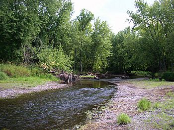
The Sunrise River in Wild River State Park
|
|
| Country | United States |
| Physical characteristics | |
| River mouth | St. Croix River 45°33′59″N 92°51′45″W / 45.56639°N 92.86250°W |
| Length | 39.1 miles (62.9 km) |
The Sunrise River is a river located in east-central Minnesota, United States. It is about 39.1 miles (62.9 km) long. The river flows into the St. Croix River, which is a larger river that forms part of the border between Minnesota and Wisconsin.
The Sunrise River's Journey
The Sunrise River starts its journey in Washington County. It begins at the outlet of Forest Lake, near the city of Forest Lake.
Where the River Flows
As the river flows north, it meets other smaller streams that add to its water. One of these is the South Branch, which joins the main river near the city of Wyoming. The river then continues north into a place called Mud Lake.
Another stream, the West Branch, also joins the Sunrise River near the city of Stacy. This branch starts in Isanti County and briefly flows through Anoka County.
From Stacy, the Sunrise River generally flows north-northwest through Chisago County. It eventually meets the St. Croix River inside Wild River State Park. This park is located near the communities of Sunrise and Almelund.
Just before it reaches the St. Croix River, the Sunrise River collects water from its North Branch. This branch begins in Isanti County and flows through the city of North Branch.
What's in a Name?
The name "Sunrise River" is an English translation. It comes from the original Ojibwe-language name for the river. The Ojibwe people are a Native American group who have lived in this region for a very long time.
 | Lonnie Johnson |
 | Granville Woods |
 | Lewis Howard Latimer |
 | James West |

