Tail of the Bank facts for kids
Quick facts for kids Tail of the Bank |
|
|---|---|
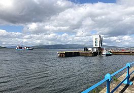
Tail of the Bank, from Princes Pier
|
|
| Location | Firth of Clyde, Scotland |
| Coordinates | 55°58′12″N 4°45′11″W / 55.97°N 4.753°W |
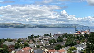
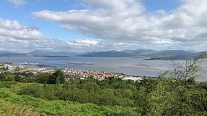
The Tail of the Bank is a special area in the upper Firth of Clyde in Scotland. It is a popular spot where ships can drop anchor. This area is located just north of Greenock, between Inverclyde and Argyll and Bute. It gets its name because it's a deep part of the water right next to a large sandbank. This sandbank marks the start of the main channel that ships use to travel up the Estuary of the River Clyde.
Contents
Where is the Tail of the Bank Located?
The River Clyde is a mix of fresh and salt water from the Glasgow Green Tidal Weir all the way west. As the river flows past Dumbarton, a large sandbank starts to appear. This sandbank takes up most of the river's width. It stretches for about 8 kilometers (5 miles) towards Ardmore.
Understanding the River's Depth and Channels
Some parts of the sandbank, like the Pillar Bank and Cockle Bank, even dry out when the tide is low. Near Port Glasgow, the main flow of the river stays close to the south shore. The Greenock Bank then extends past the waterfront.
Right off Ocean Terminal, the "Tail of the Bank" suddenly drops very deep. The water here is more than 9 meters (30 feet) deep. This deep area continues towards Ardmore. About halfway across the firth, between Ocean Terminal and Craigendoran, lies the wreck of the "sugar boat" Captayannis. It sank in this deep water about 2.6 kilometers (1.6 miles) north of Greenock.
To the west of Helensburgh, a deep channel leads into the Gare Loch. The Rosneath Peninsula forms the northern shore of the firth. In the middle, the Rosneath Patch reef splits the Clyde into two deep channels. This reef marks the western edge of the main anchorage area.
Ships coming up the Firth of Clyde can choose one of two paths. They can use the Ardmore Channel, which runs along the south side of the Rosneath Peninsula. This channel allows them to turn north into the Gare Loch. Or, they can take the main Firth of Clyde Channel. This channel follows the Greenock shore east towards Ocean Terminal.
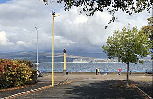
The entrance to the main shipping channel of the River Clyde is clearly marked. It's between a green light buoy and a red light buoy. The red buoy marks the Tail of the Bank, about 420 meters (1,380 feet) from Princes Pier. This channel then continues for about 27 kilometers (17 miles) to the center of Glasgow.
The water depth in the anchorage area usually ranges from 18 to 27 meters (60 to 90 feet). Ships typically anchor to the east of a line marked by two red lights in Greenock. This line points towards "The Hole," an even deeper area. "The Hole" can be up to 68 meters (222 feet) deep.
A Look Back at the Tail of the Bank's Past
The Tail of the Bank has a rich history. In 1828, a mapmaker named John Wood described Greenock. He noted that the sandbank narrowed the river near the town. However, he also mentioned that "at the tail of this bank there is deep water and anchorage for the largest vessels."
A Gateway for Travelers
This area was a very important starting point for many travelers. Many people, especially those moving to Canada and the United States, began their journeys here. Large steamships, like those from the Cunard Line, would often stop at the Tail of the Bank. They would pick up more passengers on their way from Liverpool to New York City.
The Tail of the Bank During World War II
In the past, this area was sometimes filled with many ships. This was especially true during the Second World War. After HMS Royal Oak was sunk, the Home Fleet warships of the Royal Navy moved here. They used the Tail of the Bank as a temporary base.
In September 1940, the Clyde Anchorages Emergency Port (CAEP) was set up here. This was done by companies that had to leave London due to bombing. Hundreds of merchant ships from the Atlantic convoys gathered here. Ships from the Free French Navy also used this area.
An anti-submarine boom protected the upper Firth of Clyde at that time. It stretched from Cloch point across to Dunoon. A monument shaped like a Cross of Lorraine combined with an anchor stands on Lyle Hill. It overlooks the Tail of the Bank. This monument honors the Free French Naval Forces. It also reminds people of the French destroyer Maillé Brézé. This ship exploded off Greenock on April 30, 1940, with many lives lost. By 1944, the CAEP became a main arrival point for US troops coming to Britain.
Modern Use of the Tail of the Bank
In 1974, the "sugar boat" Captayannis was anchored at the Tail of the Bank. A storm pushed it north, and it turned on its side on a sandbank. This shipwreck is still visible in the middle of the Firth today.
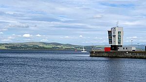
While the sugar trade has decreased, Greenock's Ocean Terminal is still very busy. It now handles large container ships and regular cruise liners. The Royal Navy has bases at Gare Loch and Loch Long. These bases are connected by this part of the Clyde. Greenock's Great Harbour is also one of the main ports that supports the Navy. So, you will often see "Admiralty boats" in the area, sometimes guiding large Navy ships.
 | Leon Lynch |
 | Milton P. Webster |
 | Ferdinand Smith |


