New Taipei City facts for kids
Quick facts for kids
New Taipei City
新北市
|
|||
|---|---|---|---|
|
Special municipality
|
|||
|
Clockwise from top:
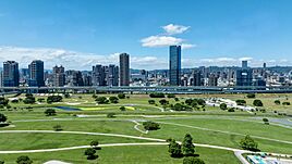
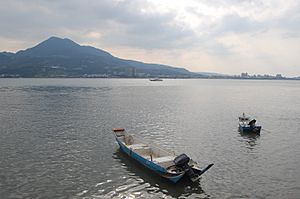
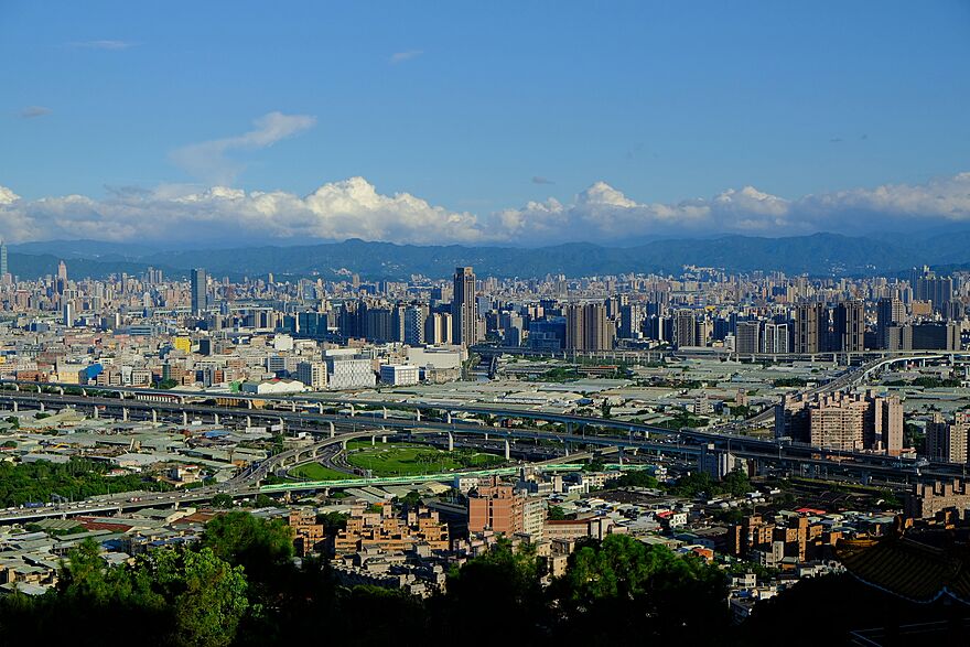
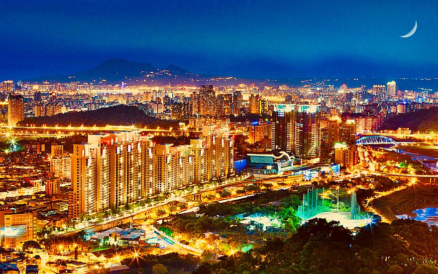
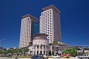
Panoramic view of the skyline of New Taipei City, Shifen Waterfall, TRA Pingxi Line, Bitan Suspension Bridge, Sunset of Tamsui, Jiufen Old Street at night and New Taipei City Government |
|||
|
|||
| Etymology: Chinese: 新北; literally "New north" | |||
 |
|||
| Country | |||
| Part of Taihoku Prefecture | 17 April 1895 | ||
| Taipei County | 7 January 1946 | ||
| Special municipality status | 25 December 2010 | ||
| Seat | Banqiao District | ||
| Districts |
29
Banqiao
Sanchong Zhonghe Yonghe Xinzhuang Xindian Shulin Yingge Sanxia Tamsui Xizhi Ruifang Tucheng Luzhou Wugu Taishan Linkou Shenkeng Shiding Pinglin Sanzhi Shimen Bali Pingxi Shuangxi Gongliao Jinshan Wanli Wulai |
||
| Government | |||
| • Body |
|
||
| Area | |||
| • Special municipality | 2,052.57 km2 (792.50 sq mi) | ||
| • Urban | 1,140 km2 (440 sq mi) | ||
| Area rank | 9 out of 22 | ||
| Population
(January 2023)
|
|||
| • Special municipality | 4,004,367 | ||
| • Rank | 1 out of 22 | ||
| • Density | 1,950.904/km2 (5,052.818/sq mi) | ||
| • Urban | 8,535,000 | ||
| • Urban density | 7,490/km2 (19,390/sq mi) | ||
| Time zone | UTC+8 (National Standard Time) | ||
| Postal code |
207, 208, 220 – 224, 226 – 228, 231 – 239, 241 – 244, 247 – 249, 251 – 253
|
||
| Area code(s) | (0)2 | ||
| ISO 3166 code | TW-NWT | ||
| New Taipei City | |||||||||||||||||||||||||||||||||
|---|---|---|---|---|---|---|---|---|---|---|---|---|---|---|---|---|---|---|---|---|---|---|---|---|---|---|---|---|---|---|---|---|---|
| Chinese | 新北市 | ||||||||||||||||||||||||||||||||
| Literal meaning | New North City | ||||||||||||||||||||||||||||||||
|
|||||||||||||||||||||||||||||||||
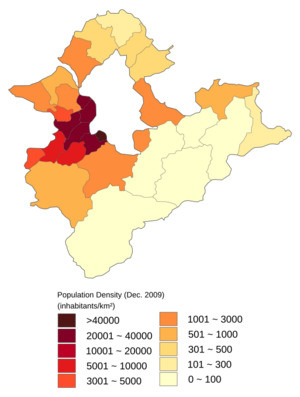
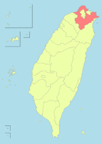
New Taipei City is a special city in northern Taiwan. It is the most populated city in Taiwan, with about 4 million people as of January 2023. It is also the second largest special city by land area. New Taipei City completely surrounds the capital city of Taipei. The main government office and biggest business area are in Banqiao District.
Before the Spanish and Dutch arrived in Taiwan in 1626, the area of New Taipei City was mostly home to Taiwanese indigenous peoples, like the Ketagalan people. Later, the port of Tamsui became a busy trading hub. During the time when Japan ruled Taiwan, New Taipei City was part of the Taihoku Prefecture. After 1945, it became Taipei County. On December 25, 2010, it was officially renamed "New Taipei City" and became a special municipality.
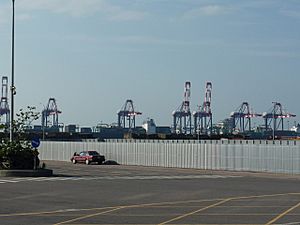
New Taipei City is a large urban area made up of many towns and business districts. It forms most of the Taipei-Keelung metropolitan area with Taipei and Keelung cities. This area stretches from the northern coast to the Xueshan Range mountains. The city has great public transport, including Metro services, high-speed rail, and a train line to Taoyuan International Airport. The Port of Taipei, a big international seaport, is located in Bali District on the northwestern coast.
Contents
What's in a Name?
New Taipei City was called Taipei County until 2010. That's when it became a special municipality. The Chinese name means "New Northern City." At first, its English name was "Xinbei City." But people wanted it to be called "New Taipei City." So, on December 31, 2010, "New Taipei City" became its official English name.
A Look Back in Time
Early Days
Archaeologists have found signs that people lived in New Taipei City a very long time ago. Tools and items found in Bali District show people were there as early as 7000 to 4700 BC. The area was first home to the Ketagalan people. The Atayal people lived in Wulai District. People from mainland China started moving here around 1620. Over time, many of the native people blended into the larger population.
Qing Dynasty Rule
During the Qing Dynasty, more Chinese people settled in the New Taipei City area starting in 1694. By the 1850s, Tamsui became a major international trading port. British offices and shops opened, which helped the local tea business grow. A lot of tea was sent to Europe. In 1887, the area became part of the Taipeh Prefecture.
Japanese Rule
In 1895, Japan took control of Taiwan. During Japanese rule, New Taipei City was part of the Taihoku Prefecture. This prefecture also included modern-day Taipei, Keelung, and Yilan County. Gold and other minerals were found near Keelung Mountain. This led to a mining boom. The Japanese government divided the mining area into two parts: Jinguashi and Jiufen. These are now in Ruifang District. Japanese companies were given the mining rights.
Republic of China Era
After Japan handed Taiwan back to the Republic of China in October 1945, the area became Taipei County. This happened on December 25, 1945, with Banqiao City as its main town. Over the years, parts of Taipei County were separated. For example, Yilan County became its own county in 1950. Taipei City also became a special municipality in 1967, taking some areas from Taipei County.
On December 25, 2010, Taipei County was upgraded to a special municipality. It was renamed New Taipei City. It now has 29 districts, with Banqiao District as its main government center.
City Geography
New Taipei City is at the northern tip of Taiwan Island. It has many different types of land, including mountains, hills, plains, and basins. The northern part has about 120 kilometers (75 miles) of beautiful coastline and beaches. The Tamsui River is the main river flowing through the city. Other big rivers include the Xindian, Keelung, and Dahan rivers. These rivers have parks along their banks. The tallest mountain in the city is Mount Zhuzi, which is 1,094 meters (3,589 feet) high. It is in Sanzhi District.
City Climate
New Taipei City has a humid subtropical climate. This means it has wet seasons and plenty of rain all year. Temperatures usually range from warm to hot. However, in winter, cold fronts can make temperatures drop below 10°C (50°F). January is usually the coolest month, and July is the warmest.
| Climate data for Tamsui District, New Taipei City (1991–2020 normals, extremes 1942–present) | |||||||||||||
|---|---|---|---|---|---|---|---|---|---|---|---|---|---|
| Month | Jan | Feb | Mar | Apr | May | Jun | Jul | Aug | Sep | Oct | Nov | Dec | Year |
| Record high °C (°F) | 28.4 (83.1) |
29.0 (84.2) |
31.9 (89.4) |
33.6 (92.5) |
35.8 (96.4) |
37.3 (99.1) |
38.8 (101.8) |
38.5 (101.3) |
37.4 (99.3) |
35.8 (96.4) |
32.8 (91.0) |
30.5 (86.9) |
38.8 (101.8) |
| Mean daily maximum °C (°F) | 18.8 (65.8) |
19.3 (66.7) |
21.6 (70.9) |
25.4 (77.7) |
28.8 (83.8) |
31.3 (88.3) |
33.3 (91.9) |
33.1 (91.6) |
30.9 (87.6) |
27.1 (80.8) |
24.4 (75.9) |
20.6 (69.1) |
26.2 (79.2) |
| Daily mean °C (°F) | 15.4 (59.7) |
15.7 (60.3) |
17.7 (63.9) |
21.4 (70.5) |
24.7 (76.5) |
27.3 (81.1) |
29.0 (84.2) |
28.7 (83.7) |
26.9 (80.4) |
24.6 (76.3) |
21.0 (69.8) |
17.3 (63.1) |
22.5 (72.5) |
| Mean daily minimum °C (°F) | 12.7 (54.9) |
13.0 (55.4) |
14.7 (58.5) |
18.3 (64.9) |
21.6 (70.9) |
24.2 (75.6) |
25.7 (78.3) |
25.5 (77.9) |
23.8 (74.8) |
20.9 (69.6) |
18.3 (64.9) |
14.6 (58.3) |
19.4 (67.0) |
| Record low °C (°F) | 2.3 (36.1) |
3.2 (37.8) |
3.1 (37.6) |
6.7 (44.1) |
13.4 (56.1) |
15.4 (59.7) |
20.4 (68.7) |
19.6 (67.3) |
15.5 (59.9) |
10.6 (51.1) |
7.6 (45.7) |
4.2 (39.6) |
2.3 (36.1) |
| Average precipitation mm (inches) | 105.9 (4.17) |
178.0 (7.01) |
153.4 (6.04) |
157.6 (6.20) |
239.8 (9.44) |
257.4 (10.13) |
119.8 (4.72) |
218.3 (8.59) |
290.1 (11.42) |
165.8 (6.53) |
104.2 (4.10) |
112.4 (4.43) |
2,102.7 (82.78) |
| Average rainy days (≥ 0.1 mm) | 13.9 | 13.8 | 15.2 | 13.6 | 12.6 | 12.2 | 8.3 | 10.9 | 11.8 | 12.3 | 12.4 | 12.5 | 149.5 |
| Average relative humidity (%) | 80.8 | 82.4 | 81.9 | 79.9 | 79.2 | 79.9 | 75.9 | 76.0 | 76.1 | 77.8 | 78.5 | 79.0 | 79.0 |
| Mean monthly sunshine hours | 83.1 | 70.4 | 92.7 | 105.9 | 135.6 | 155.9 | 226.9 | 208.6 | 171.7 | 127.5 | 101.9 | 84.1 | 1,564.3 |
| Source: Central Weather Bureau | |||||||||||||
City Views
People and Culture
Population Numbers
| Historical population | ||
|---|---|---|
| Year | Pop. | ±% |
| 1960 | 829,012 | — |
| 1966 | 1,123,354 | +35.5% |
| 1970 | 1,240,576 | +10.4% |
| 1975 | 1,629,105 | +31.3% |
| 1980 | 2,258,757 | +38.7% |
| 1985 | 2,663,683 | +17.9% |
| 1990 | 3,048,034 | +14.4% |
| 1995 | 3,305,615 | +8.5% |
| 2000 | 3,567,896 | +7.9% |
| 2005 | 3,767,095 | +5.6% |
| 2010 | 3,897,367 | +3.5% |
| 2015 | 3,970,644 | +1.9% |
| 2020 | 4,030,954 | +1.5% |
| Source: | ||
New Taipei City has about 4 million people. More than 80% of its residents live in 10 districts that used to be cities. These districts include Banqiao, Luzhou, and Sanchong. About 70% of the people in New Taipei City moved there from other parts of Taiwan. Many foreigners also live in the city, making it the third largest city in Taiwan for foreign residents.
Religion in the City
The city has many places of worship. There are 952 registered temples and 120 churches. This includes 160 Buddhist-Taoist temples and over 3,000 Taoist shrines. There are also five major Buddhist monasteries. These include Dharma Drum Mountain in Jinshan District. On average, there are two worship places for every square kilometer in the city. The Museum of World Religions is located in Yonghe District.
Sports Scene
New Taipei City is home to professional sports teams. The Fubon Guardians are a professional baseball team. The city also has two professional basketball teams: the New Taipei CTBC DEA and the New Taipei Kings.
The city has hosted several major sports events:
- 2010 BWF Super Series Finals (badminton)
- 2013 World Baseball Classic – Qualifier 4
- 2016 International Children's Games
- 2017 Asian Baseball Championship (with Taipei)
- 2018 AFC Futsal Championship (with Taipei)
- 2025 Summer World Masters Games (with Taipei)
Regular sports events held here include:
- New Taipei City Wan Jin Shi Marathon
- Mercuries Taiwan Masters (golf)
- William Jones Cup (basketball)
The city has important sports venues like the Banqiao Stadium and Xinzhuang Baseball Stadium.
City Economy
New Taipei City is a major business hub, second only to Taipei. It has over 250,000 private companies and 20,000 factories. These factories are in five industrial parks. The city's main industries are information technology (IT), telecommunications, and biotechnology. New Taipei City is a global leader in IT products. It produces over 50% of the world's motherboards, notebooks, and LCD monitors.
Creative Industries
The city is also known for its creative industries. These include pottery in Yingge District and glass art in Tamsui District. There's also a drum industry in Xinzhuang District and a dye industry in Sanxia District. The Taiwan Film Culture Center is planned for Xinzhuang District. This will help Taiwan's film industry grow.
Logistics and Shipping
The Port of Taipei in Bali District is a large international port. It can handle huge container ships. The Tamsui Fisherman's Wharf in Tamsui District is a port for fishing boats. It's also a popular spot for sightseeing and relaxing.
Manufacturing Powerhouses
Foxconn, a major electronics company, is based in New Taipei City. They produce iPhones for Apple. New Taipei is also the home of Giant Bicycles, a famous bicycle maker. Another company, Fairly Cycle, produces many bikes daily for various brands.
Learning and Education
The Education Department of the New Taipei City Government manages education here. Many people in the city have a higher education. Over 38% of residents have attended college or university.
Universities and Colleges
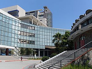
There are 24 colleges and universities in New Taipei City. Fu Jen Catholic University is a very important university in the city. It is known for its talent, academics, and medical care.
Other universities include Aletheia University, Asia Eastern University of Science and Technology, and Mackay Medical College.
Public Libraries
The National Taiwan Library is in Zhonghe District. It was founded in 1914 and is the oldest public library in Taiwan.
Education Centers
The Sustainable Development Education Center opened in January 2008 in Bali District. It focuses on teaching about wetland conservation.
Energy in New Taipei
Power Plants
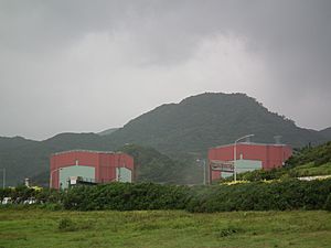
New Taipei City has one of Taiwan's active nuclear power plants, the Kuosheng Nuclear Power Plant in Wanli District. The Linkou Coal-Fired Power Plant and Feitsui Hydroelectric Power Plant also generate power for the city.
Green Energy Efforts
New Taipei City is working to become a "Green Future City." It helps homes and businesses save energy. The city also helps industries become more environmentally friendly. The city government promotes green energy and electric vehicles. In 2016, New Taipei City was the best in Taiwan at saving electricity.
Places to Visit
New Taipei City has many interesting places for tourists. These include historical sites, natural wonders, and cultural spots. The Tourism and Travel Department of the New Taipei City Government manages tourism.
Historical Sites
You can visit historical places like Fort Santo Domingo and Hobe Fort. There are also old mining towns like Jiufen, Jinguashi, and Jingtong. Sanxia Old Street is another historic area.
Temples to See
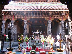
Some famous temples include the Changfu Temple in Sanxia District and Gongbei Temple in Xizhi District. The main office of Dharma Drum Mountain, a major Buddhist group, is in Jinshan District.
Museums and Galleries
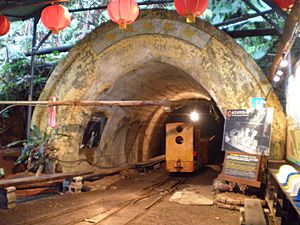
The city has many museums and galleries. You can visit the New Taipei City Gold Museum, the Museum of World Religions, or the New Taipei City Yingge Ceramics Museum. Other interesting places include the Taiwan Coal Mine Museum and the Wulai Atayal Museum.
Natural Wonders
New Taipei City offers beautiful natural attractions. You can see waterfalls like Shifen Waterfall and Wulai Waterfall. There's also Bitan lake and the Wulai Hot Spring. The unique rock formations at Yehliu seacoast are also popular. You can go hiking in places like Mount Guanyin. Tamsui Fisherman's Wharf is great for relaxing by the water. Popular beaches include Fulong and Baisha Bay.
Fun Parks and Resorts
For fun, you can visit Yehliu Ocean World or Yun Hsien Resort.
Night Markets
Don't miss the lively night markets! Famous ones include Lehua Night Market and Nanya Night Market.
Festivals and Events
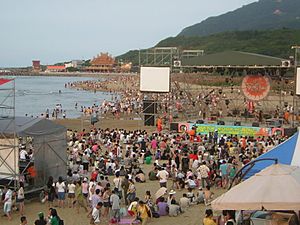
New Taipei City hosts about 5,000 art, music, and cultural festivals each year. The Hohaiyan Rock Festival in Gongliao District is very popular. The Lantern Festival is a special event in Pingxi District. Here, you can buy sky lanterns, write your wishes on them, and release them into the sky.
Other festivals include the Cherry Blossom Season, Mazu Cultural Festival, and the Shimen International Kite Festival.
Getting Around
Train Travel
You can travel by Taiwan High Speed Rail from Banqiao Station. This station connects to the Taiwan Railways Administration (TRA) and Taipei Metro.
The TRA's Yilan Line goes through Gongliao and Ruifang. The Western Line passes through Banqiao and Yingge. The Pingxi Line connects Pingxi to Ruifang.
Wulai District also has a special Wulai Scenic Train.
Metro System
The Taipei Metro serves New Taipei City with four lines. These lines help you get to the city's northern, southern, and western parts.
The city's own New Taipei Metro also has a line:
- Add→ Circular line
The Taoyuan Metro also has a line that serves the area:
Light Rail
The New Taipei Metro operates a light rail line:
- Add→ Danhai light rail
Roads and Bridges
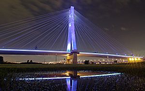
The Taipei Bridge is a famous bridge connecting New Taipei City with Taipei over the Tamsui River. The New Taipei Bridge is another well-known bridge.
Airports
For air travel, people use Taoyuan International Airport in nearby Taoyuan City. They also use Songshan Airport in Taipei.
 |
East China Sea |
 |
||
| Taiwan Strait | East China Sea | |||
See also
 In Spanish: Nueva Taipéi para niños


