Taiya River facts for kids
Quick facts for kids Taiya River |
|
|---|---|

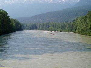
The Taiya River a few miles from the mouth
|
|
|
Location of the mouth of the Taiya River in Alaska
|
|
| Country | United States |
| State | Alaska |
| Physical characteristics | |
| Main source | 59°41′52″N 135°15′51″W / 59.69778°N 135.26417°W |
| River mouth | Taiya Inlet 59°28′48″N 135°20′52″W / 59.48000°N 135.34778°W |
| Length | 27 km (17 mi) |
The Taiya River is a river in Alaska, a state in the United States. It is about 17 miles (27 km) long. The river starts near the border with British Columbia, Canada. It flows into the Taiya Inlet, which is part of the larger Lynn Canal. The river is also sometimes called the Dyea River.
Contents
Exploring the Taiya River's Environment
The Taiya River is special because it flows through many different natural areas. These areas are called ecosystems. It goes from cold, high-up alpine tundra to warm, wet temperate rainforests. This means many different plants and animals live in the Taiya River valley.
Taiya River Valley and Watershed
The Taiya River valley is a narrow, steep-sided valley. It was shaped by glaciers long ago. Because of this, the land is slowly rising, a process called post-glacial rebound. The river gets its water from small glaciers and icefields in the nearby mountains. Even though it's a small area, it has a lot of water flowing through it.
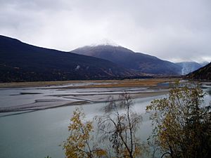
The river forms a wide area of land at its end called a delta. This delta makes the water in the nearby Taiya Inlet very shallow.
The Taiya River's Past
The name "Taiya" comes from the Tlingit people. They are a Native American group who lived in the area. The name was first written down in 1868.
Taiya River and the Klondike Gold Rush
The Taiya River played a big part in the Klondike Gold Rush. This was a time when many people rushed to find gold. The river ends at the Taiya Inlet, which was once home to a busy gold rush town called Dyea. Dyea was the starting point for the famous Chilkoot Trail.
The river's sediment, which is like fine dirt and sand, made the Taiya Inlet shallow. This meant that large ships could not easily dock in Dyea. This was one reason why a different route was chosen for a railway. The White Pass and Yukon Route railway was built from Skagway over the White Pass. This made the Chilkoot Trail and Dyea less important.
Winter Travel on the Taiya River
During the gold rush, the Taiya River was also important for travel. In winter, the river would freeze solid. This made it much easier to move supplies. People could use sleds and pack animals on the frozen river. This was especially helpful where the overland trail was difficult, like in the canyon between Canyon City and Pleasant Camp.
Taiya River Today
Today, the Taiya River is a key part of the Klondike Gold Rush National Historical Park. This park helps protect the Chilkoot Trail and the history of the gold rush.
Recreation and Conservation
The Taiya River is a popular spot for fun activities. People enjoy taking rafting tours on the river, often starting from Skagway. It is also a great place for fishing. Many fish that swim from the ocean to fresh water to lay eggs, called anadromous fish, live here.
There is a group called the Taiya Inlet Watershed Council. This group works to protect the river and its surrounding area. They also help make sure people can enjoy the river safely for recreation.
 | Janet Taylor Pickett |
 | Synthia Saint James |
 | Howardena Pindell |
 | Faith Ringgold |


