White Pass facts for kids
Quick facts for kids White Pass |
|
|---|---|
 |
|
| Elevation | 873 m (2,864 ft) |
| Location | Atlin District, Canada / Municipality of Skagway Borough, Alaska, United States |
| Range | Boundary Ranges |
| Coordinates | 59°37′29″N 135°08′17″W / 59.62472°N 135.13806°W |
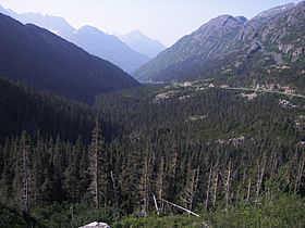
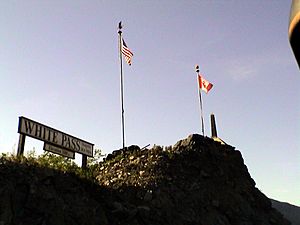
The White Pass, also known as the Dead Horse Trail, is a mountain pass. It is located in the Boundary Ranges of the Coast Mountains. This pass sits right on the border between Alaska in the United States and British Columbia in Canada.
The White Pass is about 873 meters (2,864 feet) high. It connects Skagway, Alaska, to a series of lakes. These lakes, like Crater Lake, Lake Lindeman, and Bennett Lake, are the starting points for the Yukon River. The pass itself is about 45 miles long.
White Pass History
For a long time, the White Pass was controlled by the Chilkoot Indigenous people. People from outside the area did not know about it until 1887. That year, a man named William Ogilvie heard about a lower pass near the headwaters of the Lewes River (which is part of the Yukon River). Ogilvie's team was in the Yukon to map the international border.
In June 1887, Ogilvie's group was surveying the Chilkoot Pass. Another man, William Moore, who was good at building roads in mountains, wanted to find an easier route. The Chilkoot Pass was too steep for a wagon road. They had heard rumors about another lower pass that the Chilkoot people kept secret.
Ogilvie asked around and learned that such a pass did exist. An Indigenous man named Jim was convinced to show them the way. Moore and his guide went over this new, lower pass. Ogilvie and his team continued over the Chilkoot Pass. Among the many Chilkoot people hired to carry supplies was Skookum Jim Mason. He and his family later found a lot of gold in the Klondike area.
Moore made a quick map of the new pass. He was happy because he had found a route for his wagon road. William Ogilvie named the White Pass after Thomas White, who was a Canadian government leader at the time.
William Moore and his son later returned to the area. They claimed land in a place then called Skagua. They built a cabin and a dock, and they planned a town they named Mooresville. In 1894, the North-West Mounted Police (Canada's police force) arrived at Dyea and Mooresville. They were on their way to Canada's Yukon Territory. The first gold seekers used Moore's rough trail over the White Pass.
Once the gold rush started, many people came, and the Moores' plans were quickly changed. Mooresville was re-mapped and renamed Skaguay. The rough trail was turned into a toll road by George A. Brackett. The North-West Mounted Police guarded the passes and even had a small post in Skaguay for a short time, as Canada claimed the area.
The Gold Rush Years
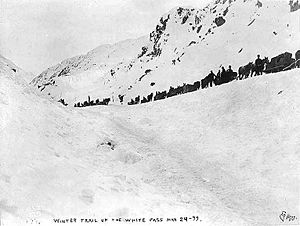
The White Pass trail was one of the two main routes used by gold seekers during the famous Klondike Gold Rush. It was an easier path to Lake Bennett than the Chilkoot Trail, which was just a few kilometers to the west. However, the White Pass trail had problems with dishonest people who tried to trick newcomers. These tricksters were thought to be part of the Soapy Smith gang from Skagway, Alaska.
In 1898, a famous shootout happened, and Soapy Smith was killed. His gang then left Skagway and the White Pass area. So many horses died on the trail during the gold rush that it became known as the "Dead Horse Trail." The trail ended at Lake Bennett. From there, gold seekers built or bought boats to float down the Yukon River to the gold fields near Dawson City.

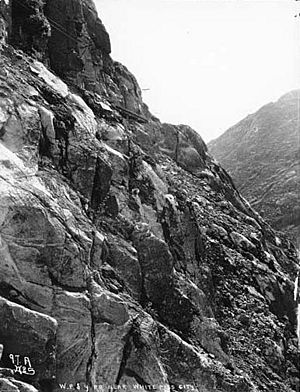
The White Pass and Yukon Route (W.P. & Y.R.) is a narrow-gauge railroad. It was built through the White Pass between 1898 and 1900. Today, the southern part of the Klondike Highway also uses the White Pass and runs next to the railway.
The Skagway Historic District and White Pass is a special place in the U.S. that is recognized as a National Historic Landmark.
Traveling on both the Chilkoot Trail and the White Pass was extremely difficult. The weather was harsh, conditions were grueling, and the journey was long. Travelers often faced very tough conditions and sometimes didn't have enough food. The journey was incredibly tough, and some people found it very hard to cope mentally.
 | Jewel Prestage |
 | Ella Baker |
 | Fannie Lou Hamer |


