Takeley facts for kids
Quick facts for kids Takeley |
|
|---|---|
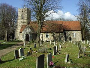
 Holy Trinity Church, Takeley |
|
| Population | 7,192 (2021) |
| OS grid reference | TL561212 |
| • London | 25 mi (40 km) SW |
| Civil parish |
|
| District |
|
| Shire county | |
| Region | |
| Country | England |
| Sovereign state | United Kingdom |
| Post town | Bishop's Stortford |
| Postcode district | CM22 |
| Dialling code | 01279 |
| Police | Essex |
| Fire | Essex |
| Ambulance | East of England |
| EU Parliament | East of England |
| UK Parliament |
|
Takeley is a village in Essex, England. It is located in the Uttlesford area. A village like Takeley is also a "civil parish," which means it has its own local council that helps manage things like parks and local services.
The Story of Takeley: How the Village Grew
Have you ever wondered how a village gets its name? For Takeley, there are a few cool ideas! One thought is that its name came from "Teg-Ley," which means a place where sheep were cleared. Another idea is that it was named after a Saxon lord called Taecca, who owned land here a long, long time ago. A third theory suggests "Takeley" means "settlement next to an open forest."
When the Normans first wrote about Takeley in 1086, the village was quite large. It stretched for about 13 kilometers (8 miles) and covered an area of 12 square kilometers (3,000 acres). However, over time, especially with the growth of Stansted Airport, Takeley has become smaller. It has lost almost a third of its original land.
A part of Takeley called Cooper's End used to be where the airport's cargo area is now. This old part of the village was taken down to make space for the airport. A big roundabout, also called Cooper's End, was built nearby to help people get to and from the airport.
The main church in Takeley is called Holy Trinity Church. It is very old, built in the 12th century, which means it's over 800 years old! It's so important that it was given a special "Grade I listed" status in 1967, meaning it's a building of great historical interest.
Where is Takeley?
Takeley is located about halfway between two other towns, Bishop's Stortford and Great Dunmow. It sits right on an ancient Roman road called Stane Street, which once connected the Roman towns of Braughing and Colchester. The A120 road and Stansted Airport are just to the north of the village.
Takeley isn't just one big area; it's made up of several smaller parts, often called 'Ends' or 'Greens'. These include Brewer's End, The Street, Smith's Green, Bamber's Green, Molehill Green, and Mill End. Each of these smaller areas has its own history and charm.
How Takeley is Governed
Takeley is part of a larger area called the Takeley and the Canfields electoral ward. An "electoral ward" is like a local district where people vote for their representatives. In 2021, about 7,192 people lived in this ward.
Sports in Takeley
Takeley has its own football team called Takeley Football Club. They play their games at a place called Station Road. The team joined the Essex Senior League in 2008. If you're a fan of cricket, Takeley also has a cricket team that started around 1880!
See also
 In Spanish: Takeley para niños
 | Valerie Thomas |
 | Frederick McKinley Jones |
 | George Edward Alcorn Jr. |
 | Thomas Mensah |


