
Tanbar, Queensland facts for kids
Quick facts for kids TanbarQueensland |
|||||||||||||||
|---|---|---|---|---|---|---|---|---|---|---|---|---|---|---|---|

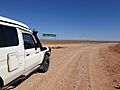
Turn-off from Arrabury Road to Haddon Corner, 2019
|
|||||||||||||||

Tanbar
Location in Queensland
|
|||||||||||||||
| Population | 0 (2021 census) | ||||||||||||||
| • Density | 0/km2 (0/sq mi) | ||||||||||||||
| Postcode(s) | 4481 | ||||||||||||||
| Area | 11,465.6 km2 (4,426.9 sq mi) | ||||||||||||||
| Time zone | AEST (UTC+10:00) | ||||||||||||||
| Location |
|
||||||||||||||
| LGA(s) | Shire of Barcoo | ||||||||||||||
| State electorate(s) | Gregory | ||||||||||||||
| Federal Division(s) | Maranoa | ||||||||||||||
|
|||||||||||||||
Tanbar is a very remote area in the outback of Queensland, Australia. It's a special type of place called a "locality," which is like a small district. Tanbar is right on the edge of Queensland, where it meets the state of South Australia. In 2021, very few people lived in Tanbar, or perhaps no one at all.
Contents
What is Tanbar Like?
Tanbar is a huge area, covering about 11,465 square kilometers. That's bigger than many countries! It's mostly flat land used for grazing animals.
Haddon Corner: Where Borders Meet
In the southwest part of Tanbar, you'll find a special spot called Haddon Corner. This is where the borders of Queensland and South Australia meet. It's marked by a survey marker, which is like a special sign.
Lake Yamma Yamma: A Giant Lake That Disappears
Right in the middle of Tanbar is Lake Yamma Yamma, also known as Lake Mackillop. This lake is huge, about 736 square kilometers! But here's the cool part: it's an ephemeral lake. This means it only fills up with water when the Cooper Creek floods. This doesn't happen very often, maybe only every 25 to 30 years. When it does fill, it becomes Queensland's biggest temporary lake!
Roads in the Outback
The Birdsville Developmental Road runs through the northern part of Tanbar. It connects Tanbar to places like Farrars Creek and Birdsville. Another road, Arrabury Road, branches off and goes south towards Durham. These roads are important for getting around this remote area.
A Look Back: Tanbar's History
The name Haddon Corner comes from a nearby property in South Australia called Haddon Downs. This property was started way back in 1877 by two people named William and John Howie.
Who Lives in Tanbar?
Because Tanbar is so remote, not many people live there. In 2016, only 3 people were recorded as living in Tanbar. By 2021, the population was listed as "no people or a very low population," meaning it's almost empty.
Special Places: Heritage Sites

One important historical site in Tanbar is Haddon Corner. It's considered a heritage-listed site because of the special survey marker that shows where the state borders meet.
Working in Tanbar
The main activity in Tanbar is pastoralism, which means raising animals like cattle or sheep on large properties. There are several large farms, called homesteads or outstations, in the area:
- Arrabury
- Curalle Tin Shed
- Gilpeppee Outstation
- Nulla Outstation
- Planet Downs Outstation (which is part of Arrabury)
- Tanbar Station
Learning in the Outback
There are no schools in Tanbar itself, or even very close by. So, kids who live here usually learn through distance education, which means they study from home using special programs. Another option is to go to a boarding school in a bigger town.
Getting Around: Transport
Since Tanbar is so spread out, small planes are a common way to travel. There are several airstrips (small airports) located near the homesteads:
- Arrabury airstrip
- Planet Downs Outstation airstrip
- Tanbar airstrip
Images for kids
-
Turn-off from Arrabury Road to Haddon Corner, 2019
