Tarryall Creek facts for kids
Quick facts for kids Tarryall Creek |
|
|---|---|

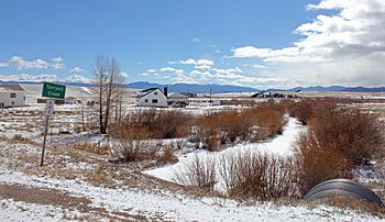
The creek as seen from the southeast side of U.S. Route 285 in Park County in late March, 2014.
|
|
| Physical characteristics | |
| Main source | Park County, Colorado 39°20′33″N 106°00′33″W / 39.34250°N 106.00917°W |
| River mouth | Confluence with South Platte River 7,224 ft (2,202 m) 39°05′49″N 105°20′23″W / 39.09694°N 105.33972°W |
| Basin features | |
| Progression | South Platte—Platte Missouri—Mississippi |
Tarryall Creek is a river in central Colorado, United States. It flows for about 68.5 miles (110 kilometers). This creek is a branch of the South Platte River.
The creek is located in Park County. It helps drain a large, open grassland area called South Park. This area is nestled within the Rocky Mountains, southwest of Denver.
About Tarryall Creek
Tarryall Creek begins high up in the Rocky Mountains. Its source is near the Continental Divide, which separates rivers flowing to the Atlantic from those flowing to the Pacific. This area is part of the Pike National Forest.
The creek flows southwest through a short canyon. It then enters the wide-open South Park area near Como, Colorado. It crosses U.S. Highway 285 east of Red Hill Pass. Finally, it winds its way southeast. Tarryall Creek joins the South Platte River in the southeastern part of South Park.
Gold Rush History
Tarryall Creek was a very important place during the Colorado Gold Rush in 1859. Many people came here hoping to find gold. This area was known as the "Tarryall diggings."
Thousands of gold prospectors traveled over mountain passes like Ute Pass and Kenosha Pass to reach this spot. Soon, two towns grew up along the creek: Tarryall and Hamilton. Today, these towns have completely disappeared. There are no towns on the upper part of the creek anymore.
 | May Edward Chinn |
 | Rebecca Cole |
 | Alexa Canady |
 | Dorothy Lavinia Brown |

