Templin, Queensland facts for kids
Quick facts for kids TemplinQueensland |
|||||||||||||||
|---|---|---|---|---|---|---|---|---|---|---|---|---|---|---|---|

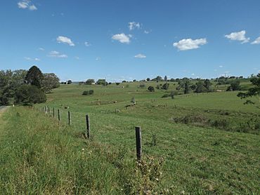
Paddocks along Kents Pocket Road, 2016
|
|||||||||||||||
| Population | 89 (2021 census) | ||||||||||||||
| • Density | 7.30/km2 (18.9/sq mi) | ||||||||||||||
| Postcode(s) | 4310 | ||||||||||||||
| Area | 12.2 km2 (4.7 sq mi) | ||||||||||||||
| Time zone | AEST (UTC+10:00) | ||||||||||||||
| Location |
|
||||||||||||||
| LGA(s) | Scenic Rim Region | ||||||||||||||
| State electorate(s) | Scenic Rim | ||||||||||||||
| Federal Division(s) | Wright | ||||||||||||||
|
|||||||||||||||
Templin is a small rural area, also known as a locality, located in the Scenic Rim Region of Queensland, Australia. It's a quiet place with a population of 89 people, according to the 2021 census. Templin is known for its historical village, which helps preserve the history of the local area.
Contents
Exploring Templin's Location
Templin is a rural area, meaning it has lots of open land and farms. The main road that goes through Templin is called the Boonah–Fassifern Road. This road enters Templin from the south-east, coming from a place called Kents Pocket, and then leaves towards the west, heading into the Fassifern Valley.
Templin's Past: A Look at History
How Templin Got Its Name
Templin was likely named by early German settlers. Two men, William Gerner Zerner and Wilhelm F. Hohenhaus, came from a town called Templin in Brandenburg, which was part of Prussia back then. They probably named this new place after their hometown.
The Old Templin School
The Templin State School first opened its doors on 18 January 1892. The land for the school was kindly given by Wilhelm Zerne in 1890. The school taught local children for many years before it closed on 31 December 1974.
Templin Historical Village: A Step Back in Time
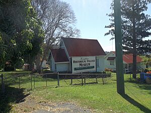
After the school closed, a group called the Fassifern District Historical Society took over the site in 1975. They wanted to create the Templin Historical Village. Today, you can still see the original school building and the teacher's house on the site.
In 1976, another old building was moved to the village. This was the former St John's Anglican Church, which was originally built in 1911 in a place called Cannon Creek. Moving old buildings like this helps keep history alive!
The Templin Historical Village is located at 397 Boonah-Fassifern Road. It's a museum run by the Fassifern Historical Society, where you can learn about the history of the area.
Learning Opportunities Near Templin
There are no schools directly inside Templin itself. However, students living in Templin have good options nearby.
Primary Schools for Younger Students
The closest government primary schools are Kalbar State School, which is in the nearby town of Kalbar to the north-west, and Boonah State School, located in Boonah to the south-west.
High Schools for Older Students
For older students, the nearest government secondary school is Boonah State High School, which is also in Boonah.
 | Aurelia Browder |
 | Nannie Helen Burroughs |
 | Michelle Alexander |


