
Corral Hollow facts for kids
Quick facts for kids Corral Hollow |
|
|---|---|
| El Arroyo de los Buenos Ayres | |

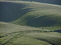
A location in Corral Hollow
|
|

Corral Hollow
Location in California
|
|
| Floor elevation | 121 m (397 ft) |
| Geography | |
| Location | Alameda and San Joaquin counties, California |
| Traversed by | Corral Hollow Creek |
| Reference #: | 755 |
Corral Hollow is a long, narrow valley in California. It was carved out by Corral Hollow Creek. You can find it partly in Alameda County and partly in San Joaquin County. It's about 6.5 miles (10.5 km) southwest of Tracy, California.
Corral Hollow Creek used to be called El Arroyo de los Buenos Ayres. This means "The Creek of the Good Winds." The creek starts near Mount Boardman. It flows north, then west, then east, and finally northeast. It ends up in the Delta-Mendota Canal in the San Joaquin Valley.
Long ago, Native Americans lived here. It was part of the lands of both the Yokuts and Ohlone tribes. An old Spanish trail, El Camino Viejo, went through the valley. Spanish and Mexican cattle drivers used it. Later, gold miners traveled this path during the Gold Rush.
Much later, the valley was home to two mining towns: Tesla and Carnegie. Tesla mined coal, and Carnegie mined clay. Sadly, both towns were destroyed by a big flood in 1911. Around 2001, the California government bought land near Tesla. They planned to use it for off-road vehicles. But many environmental groups protested this idea. In 2022, a new law was passed. It stopped the land from being used for off-road vehicles.
Contents
What's in a Name?
The valley's first name was El Arroyo de los Buenos Ayres. Later, it was changed to Corral Hollow. For a while, some people thought the name came from an early settler, Edward Carrell. But this idea was proven wrong. The name "Corral Hollow" actually came from a corral. This was a pen used to hold wild mustangs in the 1850s. It was located downstream from the Tesla area.
Nature and Rocks
Corral Hollow sits where the San Joaquin Valley meets the California Coast Ranges. It's the northernmost of several valleys that run from the Diablo Range into the San Joaquin Valley. This valley is special because it's the northern limit for many desert plants and animals. These include glossy snakes, black-headed snakes, and spadefoot toads.
About 8,000 to 5,000 years ago, some desert species moved here. Because the valley is a bit hidden, these desert plants and animals live alongside species usually found in the Bay Area. This mix of habitats is rare. So, scientists have studied Corral Hollow a lot. It's also an important path for wildlife. Animals use it to travel from the Diablo Range to the San Joaquin Plain.
The trees on the valley's slopes include ghost pine, bigberry manzanita, and blue oak. It's interesting that the pines grow lower than the oaks here. This is different from most of California. It might be because the pines do well in the rocky soil. The rocks are made of quartz-rich sandstone. On the valley floor, you'll find sycamores and fremont cottonwoods. These trees are common along streams in this area.
History of Corral Hollow
Early People
Long ago, Native Americans lived in Corral Hollow. The area was part of the traditional lands of the Yokuts and Ohlone peoples. There are important old sites here. They show that the Tesla area was a sacred place for these tribes. The creek has many bedrock mortars. These were used by Native Americans to grind acorns and other seeds into flour.
European Arrivals
The first European to likely pass through Corral Hollow was Juan Bautista de Anza. He explored the valley during a trip from San Francisco to Monterey. He was joined by Joaquin Murrietta and Tiburcio Vasquez.
An old Spanish trail called El Camino Viejo went right through the canyon. Spanish and Mexican vaqueros (cowboys) often used this trail. They drove large herds of cattle through the valley. Later, during the California Gold Rush, it became a route for miners heading to the southern gold fields.
One of the first non-Native settlers in the canyon was Edward B. Carrell. He arrived in 1850. Carrell and three friends built a tavern called the "Zink House." It was on the edge of El Camino Viejo. This tavern served travelers for several years. Carrell's home, located near the tavern, is now a California Historical Landmark.
Mining Towns: Carnegie and Tesla


Coal was found in Corral Hollow in 1856. This led to the start of the Pacific Coal Mining Company. Edward Carrell was one of its owners. The company changed hands and names many times. After Carrell died in 1880, John and James Treadwell bought it. They renamed it the Tesla Mine, honoring Nikola Tesla.
In the 1890s, the Tesla Mine produced about 500 tons of coal every day. From 1896 to 1905, it was California's biggest coal mine. The town of Tesla grew around the mine. It eventually had 200 buildings and 1,500 people.
Around the 1890s, the Treadwells also built a large brick and pottery factory. It was about four miles from Tesla. This factory was called the Carnegie Brick and Pottery Company. It used clay from Tesla to make bricks and pottery. A town called Carnegie grew around this factory, with about 2,000 residents.
Both towns were abandoned in the early 1900s. The Treadwells faced many problems. The 1906 earthquake and a bank failure hurt them financially. Then, repeated floods and boiler explosions damaged their operations. The towns were completely abandoned after a final flood in 1911. This flood destroyed the railroad and mining equipment. The company could not afford to rebuild.
Protecting Tesla Land
Around 2001, the California Off-Highway Motor Vehicle Recreation Division (OHMVR) bought a large area of land near Tesla. They planned to add it to the nearby Carnegie State Vehicular Recreation Area (CSVRA). This would have allowed off-road vehicles on the land.
However, many groups protested this plan. They were worried about the environment. These groups included the Sierra Club, the California Native Plant Society (CNPS), the Greenbelt Alliance, Save Mount Diablo, and the Friends of Tesla Park. The Friends of Tesla Park was a group of local ranchers and residents.
The fight ended in 2022. The state of California passed a law that stopped the area from becoming an off-road vehicle park. Now, groups like the Friends of Tesla Park, the Sierra Club, and the CNPS want the state to make Tesla a natural or cultural reserve. This would mean protecting the land is the main goal.
Images for kids
-
A location in Corral Hollow
