
The Plains, Virginia facts for kids
Quick facts for kids
The Plains, Virginia
|
||
|---|---|---|
_at_Virginia_State_Route_55_(Main_Street)_in_The_Plains,_Fauquier_County,_Virginia.jpg)
The center of town
|
||
|
||

Location of The Plains in Virginia
|
||
| Country | United States | |
| State | Virginia | |
| County | Fauquier | |
| Founded | 1910 | |
| Area | ||
| • Total | 0.28 sq mi (0.71 km2) | |
| • Land | 0.28 sq mi (0.71 km2) | |
| • Water | 0.00 sq mi (0.00 km2) | |
| Elevation | 610 ft (190 m) | |
| Population
(2020)
|
||
| • Total | 245 | |
| • Estimate
(2022)
|
239 | |
| • Density | 875/sq mi (345.1/km2) | |
| Time zone | UTC-5 (Eastern (EST)) | |
| • Summer (DST) | UTC-4 (EDT) | |
| ZIP Code |
20198
|
|
| Area code(s) | 540 | |
| FIPS code | 51-78192 | |
| GNIS feature ID | 1496309 | |

The Plains is a small town located in Fauquier County, Virginia, in the United States. About 245 people lived here in 2020. It's found where two main roads meet: Virginia State Route 55 (John Marshall Highway) and Virginia State Route 245 (Old Tavern Road). I-66 is also nearby. As of 2022, Lori Sisson is the current mayor of The Plains.
Contents
History of The Plains
In the 1700s, the Colony of Virginia started to grow westward. This allowed European settlers to build new communities in the area. Before and during the Civil War, maps showed this area as "White Plains." A Post Office named "The Plains" opened in 1831. A two-story building with a blacksmith shop was built in 1852. During the Civil War, a group called Mosby's Raiders, led by John S. Mosby, used The Plains as part of their raiding territory. The Plains officially became a town in 1910.
Geography and Climate
The Plains is located in the northeastern part of Fauquier County. You can find it at these coordinates: 38°51′46″N 77°46′32″W / 38.86278°N 77.77556°W.
How to Get Around The Plains
VA 55 goes southeast about 10 miles (16 km) to Gainesville. It also goes west about 4.5 miles (7.2 km) to Marshall. VA 245 goes southwest about 1 mile (1.6 km) to I-66 at Exit 31. From I-66, you can travel east about 45 miles (72 km) to Washington, D.C., or west about 24 miles (39 km) to Front Royal.
The town covers a total area of about 0.7 square kilometers (0.28 square miles). All of this area is land.
Weather in The Plains
The weather in The Plains has hot, humid summers. Winters are usually mild to cool. This type of weather is called a humid subtropical climate. On climate maps, it's often shown as "Cfa."
Population and People
| Historical population | |||
|---|---|---|---|
| Census | Pop. | %± | |
| 1920 | 275 | — | |
| 1930 | 414 | 50.5% | |
| 1940 | 372 | −10.1% | |
| 1950 | 405 | 8.9% | |
| 1960 | 484 | 19.5% | |
| 1970 | 418 | −13.6% | |
| 1980 | 382 | −8.6% | |
| 1990 | 219 | −42.7% | |
| 2000 | 266 | 21.5% | |
| 2010 | 217 | −18.4% | |
| 2020 | 245 | 12.9% | |
| 2022 (est.) | 239 | 10.1% | |
| U.S. Decennial Census | |||
In 2000, there were 266 people living in The Plains. There were 110 households and 70 families. The town had about 1,035 people per square mile. Most of the people living there were White (about 90%). About 10% were African American.
About 25% of households had children under 18. Many households (about 44%) were married couples. The average household had about 2.4 people. The average family had about 3 people.
The median age of people in the town was 42 years old. This means half the people were older than 42 and half were younger. About 21% of the population was under 18. About 15% were 65 or older.
Fun Things to Do and See
The Plains has several interesting places to visit and events to enjoy.
Great Meadow Events
The Plains is home to Great Meadow. This is a large outdoor area that hosts many big events each year.
- The Virginia Gold Cup steeplechase horse race happens here. Over 50,000 people come to watch this race on the first Saturday of May.
- The Team America Rocketry Challenge is also held here in May. This is a competition where students build and launch rockets.
Local Markets and Museums
- The Archwood Green Barns Farmer's Market offers fresh, homemade, and local products. It's open on Sundays from late April to mid-November. They also have a "Christmas on the Farm" show in December.
- You can visit a museum exhibit called "Footprint to Change." It's located at 4243 Loudoun Avenue, near the train tracks. This building also holds the offices and library of the Afro-American Historical Association of Fauquier County.
Nearby Landmarks and Schools
- Long Branch Baptist Church was established in 1786. It is the third oldest Baptist church in Virginia. It's about 4 miles (6.4 km) north of The Plains in an area called Halfway.
- Wakefield School is an independent school for students from pre-school through 12th grade. It is located just south of the town.
Famous Connections
- Actor Robert Duvall used to own a restaurant in The Plains called "The Rail Stop." It was named after the Norfolk Southern train tracks that run through town. He still lives north of town on his 360-acre (1.5 km²) Byrnley Farm.
- The town also has a seasonal corn maze that a family from Charlottesville owns and runs.
Other Notable Places
- The National Association of Rocketry held their NARAM-50 event here in the summer of 2008.
- The Cochran Lodge No. 271, a Masonic lodge, held its first meeting near the current post office in 1898.
- Beverley Mill was added to the National Register of Historic Places in 1972. Most of the town was also listed as The Plains Historic District in 2014.
Transportation in The Plains
The main roads that go through The Plains are Virginia State Route 55 and Virginia State Route 245. VA 55 runs east and west and helps people get to nearby I-66. VA 245 is the most direct way to reach I-66 from The Plains.
Images for kids
-
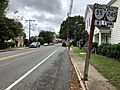
View east along SR 55 approaching SR 245
-
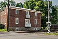
Carter Hotel next to Norfolk Southern RR tracks
-
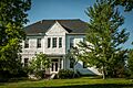
Old High School at west end of town
-
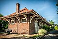
Train depot - brick
-
Train depot - frame
-
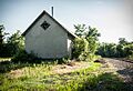
Former jail
_between_Stuart_Street_and_Bragg_Street_in_The_Plains,_Fauquier_County,_Virginia.jpg)


See also
 In Spanish: The Plains (Virginia) para niños
