
The Pulpit (Washington) facts for kids
Quick facts for kids The Pulpit |
|
|---|---|

The Pulpit
|
|
| Highest point | |
| Elevation | 4,523 ft (1,379 m) |
| Prominence | 483 ft (147 m) |
| Geography | |

The Pulpit
Location in Washington (state)

The Pulpit
Location in the United States
|
|
| Parent range | Cascade Range |
| Topo map | USGS Lake Philippa |
| Climbing | |
| Easiest route | Scrambling class 4 |
The Pulpit is a mountain in King County, Washington state. It stands about 4,523 feet (1,379 meters) tall. You can find it on the western side of the Cascade Range. This area is part of the Mount Baker-Snoqualmie National Forest.
The Pulpit is special because it rises very steeply from the land around it. It's not the tallest mountain, but its shape makes it stand out. The closest taller mountain is Preacher Mountain, which is about 1.3 miles (2.1 kilometers) to the southeast. Rain and snow that fall on The Pulpit flow into small streams. These streams eventually join the Snoqualmie River.
The Pulpit's Climate
The Pulpit is in a place with a special kind of weather. It's called a "marine west coast climate." This means it's near the Pacific Ocean in western North America. The ocean greatly affects the weather here.
Most weather systems start over the Pacific Ocean. They then travel northeast towards the Cascade Mountains. When these weather systems hit the tall mountains, they are forced to rise. As the air goes up, it cools down and drops its moisture. This creates a lot of rain or snow on the western side of the Cascades. This process is called orographic lift.
Because of this, the west side of the Cascades gets a lot of rain and snow. This is especially true during the winter months. Winters are usually cloudy. However, in summer, high-pressure systems over the Pacific Ocean often bring clear skies. The ocean's influence also means the snow tends to be wet and heavy. This can make avalanches more likely.
How The Pulpit Was Formed
The Cascade Mountains were formed over millions of years. This process started during the late Eocene Epoch. Later, during the Pleistocene period, huge sheets of ice called glaciers moved across the land. These glaciers advanced and then melted away many times. As they moved, they carved out the landscape. They also left behind piles of rock and dirt.
The last time glaciers melted in this area was about 14,000 years ago. By 10,000 years ago, they had moved north of the Canada–US border. The river valleys you see today have a U-shape. This shape was created by these powerful glaciers.
The tall peaks and deep valleys of the Cascade Range were formed by two main things. One was the land pushing up, called uplift. The other was cracks in the Earth's crust, called faulting. These processes, combined with the action of glaciers, created the amazing mountains we see today.
Images for kids
-
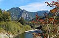
The Pulpit (left) with Preacher Mountain

