Tiruchirappalli district facts for kids
Quick facts for kids
Tiruchirappalli District
Trichy District
|
|
|---|---|
|
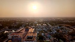
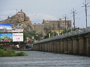
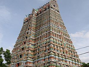
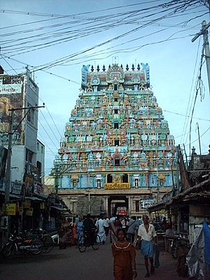
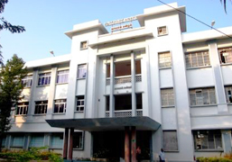
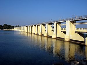
Clockwise from top-left: Ranganathaswamy Temple in Srirangam, Upper Anaicut, Kaveri in Musiri, view of Tiruchirappalli from Rockfort, ponds in Mutharasanallur
|
|
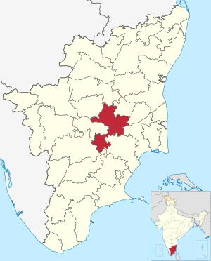
Location in Tamil Nadu
|
|
| Country | |
| State | |
| Municipal corporations | Tiruchirappalli |
| Municipalities | Thuraiyur, Manapparai, Thuvakudi, Lalgudi, Musiri |
| Town panchayats | Balakrishnampatti, Kallakudi, Kattuputhur, Koothappar, Manachanallur, Mettupalayam, Ponnampatti, Poovalur, Pullambadi, South Kannanur, Sirugamani, Thathaiyangarpet, Thottiyam, Uppiliapuram |
| divisions | Tiruchirappalli division, Lalgudi division, Musiri division, Srirangam division |
| Headquarters | Tiruchirapalli |
| Talukas | Lalgudi taluk, Manachanallur taluk, Manapparai taluk, Marungapuri taluk, Musiri taluk, Srirangam taluk, Thiruverumbur taluk, Thottiyam taluk, Thuraiyur taluk, Tiruchirappalli West taluk, Tiruchirappalli East taluk |
| Area | |
| • Total | 4,403.83 km2 (1,700.33 sq mi) |
| Area rank | 10th |
| Elevation | 88 m (289 ft) |
| Population
(2011)
|
|
| • Total | 2,722,290 |
| • Rank | 6th |
| • Density | 618.1642/km2 (1,601.038/sq mi) |
| Languages | |
| • Official | Tamil |
| Time zone | UTC+5:30 (IST) |
| PIN |
620 xxx and 621 xxx
|
| Telephone code | 0431 |
| ISO 3166 code | IN |
| Vehicle registration | TN-45, TN-48, TN-81 |
| Central location: | 10°47′N 78°41′E / 10.783°N 78.683°E |
Tiruchirappalli District, often called Trichy District, is a special place in Tamil Nadu, India. It's one of the 38 districts in the state and is located right next to the important Kaveri River. The main city and headquarters of this district is Tiruchirappalli.
Long ago, when India was under British rule, this area was known as Trichinopoly. After India became independent in 1947, it was renamed Tiruchirappalli. The district covers a large area of about 4,404 square kilometers. In 2011, about 2,722,290 people lived here.
Contents
Exploring Tiruchirappalli's Geography
Tiruchirappalli district is located almost exactly in the center of Tamil Nadu. It covers an area of 4,404 square kilometers. Many other districts surround it. To the north is Salem district, and to the northwest is Namakkal district. Perambalur District is to the northeast, while Ariyalur district and Thanjavur District are to the east.
To the southeast, you'll find Pudukkottai district and Sivagangai district. Madurai district is to the south, Dindigul district to the southwest, and Karur district to the west. This means Tiruchirappalli district shares its borders with 10 other districts, which is more than any other district in Tamil Nadu!
The Kaveri river flows right through the district. It is the main source of water for farming and for people to drink. The Kolli Hills are on the border with Namakkal district. The Pachaimalai Hills are on the border with Salem and Perambalur districts.
The northern and southern parts of the district have hills. The central part is a flat plain because of the Kaveri River. The river makes Trichy district greener than many nearby areas.
People and Languages of Tiruchirappalli
| Historical population | |||||||||||||||||||||||||||||||||||||||||||||||
|---|---|---|---|---|---|---|---|---|---|---|---|---|---|---|---|---|---|---|---|---|---|---|---|---|---|---|---|---|---|---|---|---|---|---|---|---|---|---|---|---|---|---|---|---|---|---|---|
|
|
|
|||||||||||||||||||||||||||||||||||||||||||||
| source: | |||||||||||||||||||||||||||||||||||||||||||||||
| Religions in Tiruchirappalli district (2011) | ||||
|---|---|---|---|---|
| Religion | Percent | |||
| Hinduism | 83.73% | |||
| Christianity | 9.04% | |||
| Islam | 7.01% | |||
| Other or not stated | 0.22% | |||
In 2011, the population of Tiruchirappalli district was 2,722,290 people. There were slightly more females than males, with 1,013 females for every 1,000 males. Almost half of the people (49.15%) lived in cities.
About 272,456 children were under the age of six. The average literacy rate, which means how many people can read and write, was 74.9%. This is higher than India's national average.
Most people in the district speak Tamil as their first language (95.67%). Smaller groups speak Telugu (2.08%) and Urdu (1.10%).
Administrative Divisions: Taluks
In 2013, Tiruchirappalli district added two new taluks, making a total of eleven. A taluk is like a smaller administrative area within a district.
- Thuraiyur taluk
- Manapparai taluk
- Marungapuri taluk
- Srirangam taluk
- Tiruchirappalli West taluk
- Tiruchirappalli East taluk
- Thiruverumbur taluk
- Lalgudi taluk
- Manachanallur taluk
- Musiri taluk
- Thottiyam taluk
Major Urban Centers
Tiruchirappalli District has several important towns and cities. These are places where many people live and work.
- Trichy City
- Thuraiyur town
- Manapparai town
- Thuvakudi town
- Lalgudi town panchayat
- Manachanallur town panchayat
- Musiri town panchayat
- Thottiyam town panchayat
- Uppiliapuram Town panchayat
Key Industries and Economy
Tiruchirappalli district is home to several important industries. These industries provide many jobs for the people living here.
- Bharat Heavy Electricals Limited (BHEL)
- High Energy Projectile Factory (HEPF)
- Golden Rock Railway Workshop
- Ordnance Factory Tiruchirappalli
- Light and heavy engineering (making machines and parts)
- Leather Tanneries (places where animal hides are processed into leather)
- Food Processing (preparing food products)
- Sugar Mills (making sugar)
- Traditional Cigar Making (in villages)
- Hosiery and garments (making clothes, but on a smaller scale)
- IT/BPO (Information Technology and Business Process Outsourcing)
- Manufacturing of Synthetic Stones for Jewelry
Natural Resources and Water Bodies
The most important rivers in the district are the River Kaveri and the River Kollidam. These rivers are vital for the district's water supply.
Other important rivers that flow through the city area include Koraiyar, Uyyakondan, and Kudamuruti rivers.
Agriculture and Farming
Farming is a very important activity in Tiruchirappalli district. Many people work in agriculture, especially in smaller villages like Kalpalayathanpatti. The district has a large number of cattle and poultry.
The Kaveri and Kollidam rivers branch out to form the Kaveri delta. This delta helps water a huge amount of farmland in the district.
The main crops grown here are:
- Rice (in very large areas)
- Sugarcane (in large areas)
- Banana/plantain
- Coconut
- Cotton (in smaller areas)
- Betel
- Maize
- Groundnut
Tiruchirappalli district is especially famous for growing many different types of Banana. There is even a special Banana research center at the Agricultural University in Tiruchirappalli. In the Pachaimalai Hills of the district, farmers also grow hill jackfruit, Cassava, and other mountain crops.
Famous Temples: Divya Desams
Tiruchirappalli district is home to the first five Divya Desam temples. These are very important and sacred temples for followers of a certain religion.
- Srirangam Ranganathaswamy Temple (This is considered the 1st Divya Desam)
- Azhagiya Manavala Perumal Temple (The 2nd Divya Desam)
- Uthamar Kovil (The 3rd Divya Desam)
- Pundarikakshan Perumal Temple (The 4th Divya Desam)
- Sundararaja Perumal temple (The 5th Divya Desam)
See also
In Spanish: Distrito de Tiruchirappalli para niños
 | William L. Dawson |
 | W. E. B. Du Bois |
 | Harry Belafonte |


