Tremor Mountain facts for kids
Quick facts for kids Tremor Mountain |
|
|---|---|

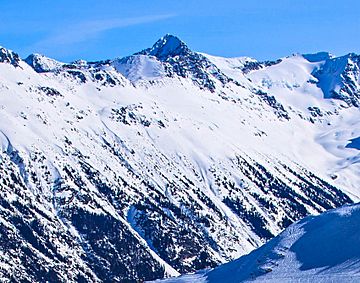
Tremor Mountain as seen from the Whistler Mountain ski area
|
|
| Highest point | |
| Elevation | 2,691 m (8,829 ft) |
| Prominence | 1,261 m (4,137 ft) |
| Parent peak | Wedge Mountain |
| Geography | |
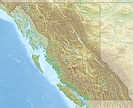
| Location | Garibaldi Provincial Park British Columbia, Canada |
| Parent range | Spearhead Range Garibaldi Ranges Coast Ranges |
| Topo map | NTS 92J2 |
| Climbing | |
| First ascent | 1928 |
| Easiest route | East ridge |
Tremor Mountain is a very tall mountain in Garibaldi Provincial Park, located in British Columbia, Canada. It stands 2,691-metre (8,829-foot) high. This mountain is part of the larger Coast Mountains range. It is also the highest point in a smaller group of mountains called the Spearhead Range.
Tremor Mountain is about 13 km (8 mi) southeast of Whistler. It is also 8.7 km (5 mi) south of Wedge Mountain, which is a slightly taller peak nearby. Water from the melting ice on Tremor Mountain flows into different creeks and rivers. For example, water from the Platform Glacier goes into Fitzsimmons Creek, which then joins the Cheakamus River. Water from the Tremor Glacier flows into Wedge Creek. Also, water from the Shudder Glacier goes into Billygoat Creek, which joins the Lillooet River.
Many climbers enjoy a famous route called the Spearhead Traverse, which includes Tremor Mountain. The first people to climb this mountain reached the top in 1928. They were part of a survey team led by A.J. Campbell. The mountain got its name because the climbers felt unexplained earth tremors when they were on the summit. The name "Tremor Mountain" became official on September 6, 1951. This was decided by the Geographical Names Board of Canada.
Mountain Weather
Tremor Mountain has a type of weather called a marine west coast climate. This means it gets a lot of rain and snow. Most weather systems start over the Pacific Ocean. They then travel east towards the Coast Mountains. When these weather systems hit the mountains, they are forced to rise. This process is called Orographic lift. As the air rises, it cools down and drops its moisture as rain or snow.
Because of this, the Coast Mountains get a lot of precipitation. This is especially true during the winter months, when most of it falls as snow. Temperatures on the mountain can get very cold, sometimes dropping below −20 °C. With the wind, it can feel even colder, below −30 °C. The best time to climb Tremor Mountain is usually from July through September. During these months, the weather is more favorable for climbing.
Climbing Paths
There are several known paths that climbers use to reach the top of Tremor Mountain:
- East Ridge
- West Face
- North Face
- West Ridge
 | Emma Amos |
 | Edward Mitchell Bannister |
 | Larry D. Alexander |
 | Ernie Barnes |


