Tucannon River facts for kids
Quick facts for kids Tucannon River |
|
|---|---|
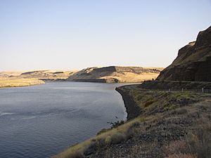
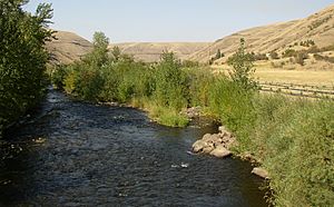
Confluence of the Tucannon with the Snake River
|
|
|
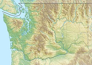
Location of the mouth of Tucannon River in Washington
|
|
| Country | United States |
| State | Washington |
| County | Columbia County, Garfield County |
| Physical characteristics | |
| Main source | near Diamond Peak Blue Mountains, Umatilla National Forest, Garfield County 6,189 ft (1,886 m) 46°07′11″N 117°30′41″W / 46.11972°N 117.51139°W |
| River mouth | Snake River near Starbuck, Columbia County 541 ft (165 m) 46°33′28″N 118°10′35″W / 46.55778°N 118.17639°W |
| Length | 62.3 mi (100.3 km) |
| Basin features | |
| Basin size | 502 sq mi (1,300 km2) |
The Tucannon River is a river in Washington, USA. It flows into the Snake River. The river starts in the Blue Mountains in southeastern Washington. It then flows generally northwest for about 62 miles (100 km). Part of the upper river goes through the Wenaha–Tucannon Wilderness.
Contents
What is the Tucannon River Watershed?
The Tucannon River area, called its watershed, covers about 502 square miles (1,300 km2). The land here ranges from about 540 feet (165 m) high at the river's end to about 6,400 feet (1,950 m) high in the Blue Mountains.
The amount of water in the Tucannon River depends on rain, snow, and underground water. In the early 1990s, studies showed there wasn't enough water for everyone who needed it. Farmers needed water for their crops, and fish needed water to survive. To help manage this, the Washington Department of Ecology called the Tucannon area a special "Watershed Resource Inventory Area." In 1995, they started meetings to decide how to share the water fairly.
A Look Back: History of the Tucannon River
Who lived near the Tucannon River?
The lower Snake River area was home to several Native American groups. These included the Palouse and other groups who spoke the Sahaptin language. Among them were the Nez Perce, Yakama, Walla Walla, Umatilla, and Wanapum.
The Blue Mountains were part of a huge 17,000,000-acre (69,000 km2) area important to the Nimi'ipuu people. They were later called Nez Perce by Lewis and Clark in 1805. Horses were very important to both the Palouse and Nez Perce people.
A path called the Nez Perce Trail followed parts of the Touchet and Tucannon rivers. It stretched east from Wallula.
When did Lewis and Clark visit the Tucannon River?
On October 12, 1805, the famous explorers Lewis and Clark passed by the mouth of the Tucannon River. Lewis wrote that they called it "Kimooenim creek." They did not stop but continued down the Snake River in their dugout boats.
On their way back home on May 2, 1806, Lewis and Clark followed the Nez Perce Trail. They crossed over from Patit Creek to reach the Tucannon River. Lewis described the creek as "only twelve yards wide" but carrying "a considerable body of water." They camped on Pataha Creek, a smaller stream that flows into the Tucannon. Here, they found plenty of firewood, which was hard to find in other places.
How did the fur trade affect the area?
The fur trade was a big business in this region. The Tucannon River was a good place to trap beavers and otters, which were plentiful. A book from 1906 said that the British Hudson's Bay Company (HBC) had been the main fur-trading company here since 1829.
One HBC group was led by John Work. In September 1831, Work and 56 people followed the Nez Perce Trail to the Upper Snake River country.
When did Americans start settling here?
In 1834, Captain Benjamin Bonneville crossed the Tucannon River. He was surveying the Northwest for the United States government.
Wagon roads were built through the area in the 1860s. One road connected Walla Walla, Washington, and Lewiston, Idaho, in 1862. People slowly started moving into the Tucannon River area in the 1860s. By the early 1870s, many more settlers arrived.
What happened during the Cayuse War?
In 1848, during the Cayuse War, a group of soldiers fought the Cayuse people on the Tucannon River. The soldiers were trying to get back livestock that had been taken. The Cayuse tried to trick the soldiers with a white flag, but then attacked. The soldiers, outnumbered, fought while retreating in a square shape. They had to fight hard to cross the Touchet River and escape.
What happened during the Coeur d'Alene War?
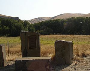
During the Coeur d'Alene War in 1858, Captain Erasmus D. Keyes built a supply base called Fort Taylor at the mouth of the Tucannon River. This fort was named after Captain Oliver H. P. Taylor, who had died earlier that year.
On August 25, Colonel George Wright led 570 men across the Snake River at this spot. It took them several days to find a way up from the Snake valley. This journey eventually led them to the Battle of Four Lakes on September 5.
What happened later in the Tucannon River Valley?
The town of Starbuck was built on the Tucannon River in the 1880s. It was an important stop on the main railroad line. At one time, up to 24 trains passed through Starbuck every day.
Little Goose Dam started working in 1975 near Starbuck. This brought many construction workers and their families to the town, making the population grow.
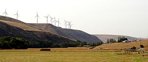
In 2005, the Hopkins Ridge Wind Farm was built in Columbia County. This wind farm uses wind turbines to create electricity. It can produce 150 megawatts of power.
Fun Things to Do at the Tucannon River
Some parts of the Tucannon River and all its smaller streams are closed to fishing. This is to protect four types of fish that are threatened or endangered. These include chinook salmon, bull trout, and steelhead. The closed areas protect where these fish lay their eggs.
You can still catch steelhead and bull trout in some areas, but you must follow special rules. The open areas of the Tucannon River are popular for fishing. The river flows through national forests, state lands, and private lands. Some of these areas are open for fishing.
The Washington Department of Fish and Wildlife has created eight fishing ponds that are open to the public. These ponds are regularly stocked with trout. The ponds are named Rainbow, Deer, Blue, Spring, Curl, Beaver, Watson, and Big Four Lake (which is only for fly fishing). You can also fish near the Tucannon Fish Hatchery, where the river is next to state or national forest land.
The Tucannon Campground is run by the U.S. Forest Service. It is one of 15 campgrounds in the Pomeroy Ranger District.
Washington State Parks also runs Camp Wooten Retreat Center on the upper Tucannon River. This center is near Pomeroy. It has cabins, dining halls, and meeting rooms for large groups. You can go hiking, canoeing on Donnie Lake, swimming in an indoor pool, archery, softball, tennis, and basketball.
 | Jessica Watkins |
 | Robert Henry Lawrence Jr. |
 | Mae Jemison |
 | Sian Proctor |
 | Guion Bluford |


